TopoQuest Logo
Do you find TopoQuest useful?
Help keep TopoQuest running and adding new maps/features by donating!
Bitcoin:  19c7KJd3qBynnjoSw5npx9KScwjBe4ifkT
Litecoin:  LXs6TkuXGGXo1vDsWCkWVdjQX94eUKd6ui
Home View Maps Find Maps Find Places Resources & Links


Maple Park, Illinois Topographic Map

USGS Map Title: Maple Park, IL
USGS Map MRC: 41088H5
DRG (GeoTIFF) Download: o41088h5.tif


Neighboring USGS Topographic Map Quads:


  Genoa, IL  
42088A6
 

  Hampshire, IL  
42088A5
 

  Pingree Grove, IL  
42088A4
 

  Sycamore, IL  
41088H6
 

  Maple Park, IL  
41088H5
 

  Elburn, IL  
41088H4
 

  Hinckley, IL  
41088G6
 

  Big Rock, IL  
41088G5
 

  Sugar Grove, IL  
41088G4


Map MRC Location:

N42°
W89°
N42°
W88°
H8 H7 H6 H5 H4 H3 H2 H1
G8 G7 G6 G5 G4 G3 G2 G1
F8 F7 F6 F5 F4 F3 F2 F1
E8 E7 E6 E5 E4 E3 E2 E1
D8 D7 D6 D5 D4 D3 D2 D1
C8 C7 C6 C5 C4 C3 C2 C1
B8 B7 B6 B5 B4 B3 B2 B1
A8 A7 A6 A5 A4 A3 A2 A1
N41°
W89°
N41°
W88°

Maple Park, IL USGS 1:24K Topographic Map Preview:
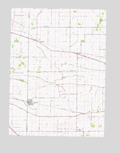
Maple Park, IL USGS Topographic Map
Click on map above to begin viewing in our Map Viewer.

This topographic map contains these locations and features:
Feature Name Type Latitude Longitude GNIS ID View Map
Barron CemeteryCemeteryN41.9856°W88.6201°1958788View Map
Gardner CemeteryCemeteryN41.8939°W88.5751°408886View Map
Gardner School (historical)SchoolN41.8945°W88.5712°1719077View Map
Grace United Methodist ChurchChurchN41.9056°W88.5979°2038330View Map
Hoyt School (historical)SchoolN41.8759°W88.5279°1719078View Map
Kaneland Elementary SchoolSchoolN41.8845°W88.5351°1816319View Map
Kaneland EstatesPopulated PlaceN41.8784°W88.5531°2025875View Map
Kaneland Middle SchoolSchoolN41.8814°W88.5334°411297View Map
Kaneland Senior High SchoolSchoolN41.8814°W88.5334°1816320View Map
Kennedy School (historical)SchoolN41.8800°W88.5762°1719079View Map
Kenyon School (historical)SchoolN41.9522°W88.5795°1719075View Map
Kuipers Family FarmLocaleN41.8836°W88.5583°2516512View Map
Lyons School (historical)SchoolN41.8806°W88.5009°1719080View Map
Maple ParkPopulated PlaceN41.9075°W88.5992°412961View Map
Maple Park and Countryside Fire Protection DistrictBuildingN41.9060°W88.6022°2682024View Map
Maple Park Post OfficePost OfficeN41.9076°W88.5989°2788450View Map
McMahan School (historical)SchoolN41.9250°W88.5129°1719082View Map
MeredithPopulated PlaceN41.8995°W88.5404°422973View Map
Miller/Maple Park Farm Airport (historical)AirportN41.8986°W88.5876°427506View Map
North Virgil School (historical)SchoolN41.9820°W88.5123°1719083View Map
Ohio Grove (historical)WoodsN41.9520°W88.6209°1808576View Map
Ohio Grove School (historical)SchoolN41.9517°W88.6212°1719073View Map
Old Saint Mary's CemeteryCemeteryN41.8795°W88.5612°415052View Map
Pine ViewPopulated PlaceN41.8823°W88.5515°2025895View Map
RichardsonPopulated PlaceN41.9664°W88.5856°423113View Map
Saint Mary Catholic ChurchChurchN41.9078°W88.6023°2038326View Map
Saint Marys CemeteryCemeteryN41.8903°W88.6020°422046View Map
Saints Peter and Paul ChurchChurchN41.9528°W88.5370°2038331View Map
Saints Peter and Paul SchoolSchoolN41.9522°W88.5367°417851View Map
Saints Peter and Paul's Catholic CemeteryCemeteryN41.9342°W88.5367°417850View Map
South Burlington CemeteryCemeteryN41.9825°W88.5765°418732View Map
South Burlington School (historical)SchoolN41.9834°W88.5768°1719074View Map
Thatcher CemeteryCemeteryN41.9189°W88.5598°419620View Map
Thatcher School (historical)SchoolN41.9250°W88.5617°1719076View Map
The Meadows of VirgilPopulated PlaceN41.9517°W88.5245°2025909View Map
Township of VirgilCivilN41.9383°W88.5450°429876View Map
Union Ditch Number 2CanalN41.9089°W88.6067°425584View Map
Union Ditch Number 3CanalN41.9328°W88.5934°425585View Map
Village of Maple ParkCivilN41.8992°W88.6111°2399247View Map
Village of VirgilCivilN41.9555°W88.5292°2400074View Map
VirgilPopulated PlaceN41.9559°W88.5373°420329View Map
Virgil Ditch Number 1CanalN41.9072°W88.5476°425603View Map
Virgil Ditch Number 2CanalN41.9639°W88.5170°425604View Map
Virgil Ditch Number 3CanalN41.9561°W88.5570°425605View Map

Note: Coordinates in the location and feature list above are referenced to NAD83 datum.


Copyright (C) 2008-2024 Ryan Niemi / Sunset Dynamics ... All Rights Reserved