TopoQuest Logo
Do you find TopoQuest useful?
Help keep TopoQuest running and adding new maps/features by donating!
Bitcoin:  19c7KJd3qBynnjoSw5npx9KScwjBe4ifkT
Litecoin:  LXs6TkuXGGXo1vDsWCkWVdjQX94eUKd6ui
Home View Maps Find Maps Find Places Resources & Links


Big Rock, Illinois Topographic Map

USGS Map Title: Big Rock, IL
USGS Map MRC: 41088G5
DRG (GeoTIFF) Download: o41088g5.tif


Neighboring USGS Topographic Map Quads:


  Sycamore, IL  
41088H6
 

  Maple Park, IL  
41088H5
 

  Elburn, IL  
41088H4
 

  Hinckley, IL  
41088G6
 

  Big Rock, IL  
41088G5
 

  Sugar Grove, IL  
41088G4
 

  Somonauk, IL  
41088F6
 

  Plano, IL  
41088F5
 

  Yorkville, IL  
41088F4


Map MRC Location:

N42°
W89°
N42°
W88°
H8 H7 H6 H5 H4 H3 H2 H1
G8 G7 G6 G5 G4 G3 G2 G1
F8 F7 F6 F5 F4 F3 F2 F1
E8 E7 E6 E5 E4 E3 E2 E1
D8 D7 D6 D5 D4 D3 D2 D1
C8 C7 C6 C5 C4 C3 C2 C1
B8 B7 B6 B5 B4 B3 B2 B1
A8 A7 A6 A5 A4 A3 A2 A1
N41°
W89°
N41°
W88°

Big Rock, IL USGS 1:24K Topographic Map Preview:
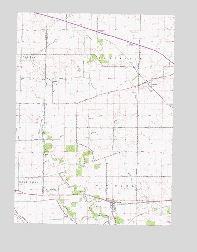
Big Rock, IL USGS Topographic Map
Click on map above to begin viewing in our Map Viewer.

This topographic map contains these locations and features:
Feature Name Type Latitude Longitude GNIS ID View Map
Bell School (historical)SchoolN41.8211°W88.6223°1719061View Map
Big RockPopulated PlaceN41.7639°W88.5470°404432View Map
Big Rock Elementary SchoolSchoolN41.7648°W88.5462°1816215View Map
Big Rock Fire Protection DistrictBuildingN41.7615°W88.5438°2681983View Map
Big Rock Post OfficePost OfficeN41.7635°W88.5467°1998735View Map
Community Methodist CemeteryCemeteryN41.8361°W88.6209°1807795View Map
Duffin Drain WestStreamN41.7865°W88.5075°2424839View Map
East Branch Big Rock CreekStreamN41.7542°W88.5620°407604View Map
English Congregational United ChurchChurchN41.7614°W88.5476°1998732View Map
Evans School (historical)SchoolN41.7881°W88.6223°1719062View Map
Excelsior School (historical)SchoolN41.8503°W88.6220°1719060View Map
First Baptist ChurchChurchN41.7620°W88.5490°1998733View Map
J Maddock AirportAirportN41.7665°W88.5289°427069View Map
KanevillePopulated PlaceN41.8353°W88.5220°411298View Map
Kaneville CemeteryCemeteryN41.8372°W88.5176°1957349View Map
Kaneville Fire Protection DistrictBuildingN41.8349°W88.5191°2681722View Map
Kaneville Post OfficePost OfficeN41.8354°W88.5218°2788385View Map
Kaneville United Methodist ChurchChurchN41.8348°W88.5237°1998734View Map
Lone Grove School (historical)SchoolN41.8511°W88.5720°1719059View Map
Long Grove Forest PreserveParkN41.8489°W88.5637°2025886View Map
Malgren DrainStreamN41.7697°W88.5693°2424844View Map
Oakfield RLA AirportAirportN41.8504°W88.5700°2770500View Map
Pierce Community ChurchChurchN41.8359°W88.6201°421999View Map
Plowmens ParkParkN41.7648°W88.5592°415947View Map
Swan DrainStreamN41.8019°W88.5661°2424837View Map
Township of Big RockCivilN41.7639°W88.5456°428673View Map
Township of KanevilleCivilN41.8512°W88.5454°422241View Map
TroxelPopulated PlaceN41.8342°W88.5965°419897View Map
Village of Big RockCivilN41.7668°W88.5265°2398118View Map
Village of KanevilleCivilN41.8336°W88.5217°2398325View Map
West Big Rock CemeteryCemeteryN41.7703°W88.5904°420783View Map
West Branch Big Rock CreekStreamN41.7542°W88.5620°422144View Map
White School (historical)SchoolN41.8081°W88.5279°1719063View Map

Note: Coordinates in the location and feature list above are referenced to NAD83 datum.


Copyright (C) 2008-2024 Ryan Niemi / Sunset Dynamics ... All Rights Reserved