TopoQuest Logo
Do you find TopoQuest useful?
Help keep TopoQuest running and adding new maps/features by donating!
Bitcoin:  19c7KJd3qBynnjoSw5npx9KScwjBe4ifkT
Litecoin:  LXs6TkuXGGXo1vDsWCkWVdjQX94eUKd6ui
Home View Maps Find Maps Find Places Resources & Links


Marmaton, Kansas Topographic Map

USGS Map Title: Marmaton, KS
USGS Map MRC: 37094G7
DRG (GeoTIFF) Download: o37094g7.tif


Neighboring USGS Topographic Map Quads:


  Xenia, KS  
37094H8
 

  Devon, KS  
37094H7
 

  Hammond, KS  
37094H6
 

  Uniontown, KS  
37094G8
 

  Marmaton, KS  
37094G7
 

  Fort Scott, KS  
37094G6
 

  Hepler, KS  
37094F8
 

  Hiattville, KS  
37094F7
 

  Cato, KS  
37094F6


Map MRC Location:

N38°
W95°
N38°
W94°
H8 H7 H6 H5 H4 H3 H2 H1
G8 G7 G6 G5 G4 G3 G2 G1
F8 F7 F6 F5 F4 F3 F2 F1
E8 E7 E6 E5 E4 E3 E2 E1
D8 D7 D6 D5 D4 D3 D2 D1
C8 C7 C6 C5 C4 C3 C2 C1
B8 B7 B6 B5 B4 B3 B2 B1
A8 A7 A6 A5 A4 A3 A2 A1
N37°
W95°
N37°
W94°

Marmaton, KS USGS 1:24K Topographic Map Preview:
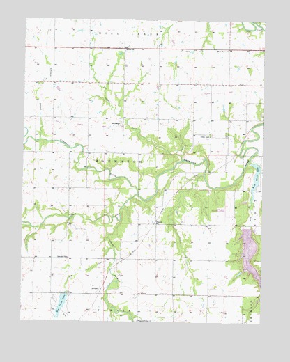
Marmaton, KS USGS Topographic Map
Click on map above to begin viewing in our Map Viewer.

This topographic map contains these locations and features:
Feature Name Type Latitude Longitude GNIS ID View Map
Bethal Community ChurchChurchN37.8623°W94.8229°2688813View Map
Bethel SchoolSchoolN37.8631°W94.8230°474766View Map
Bourbon CountyCivilN37.8552°W94.8493°484975View Map
Bourbon County DamDamN37.7614°W94.8525°479981View Map
Cedar CreekStreamN37.8178°W94.7922°474765View Map
Chambers BranchStreamN37.8106°W94.7808°482830View Map
Elm CreekStreamN37.7806°W94.8280°474771View Map
Elm Creek LakeReservoirN37.7568°W94.8543°474770View Map
Elm Creek Lake County ParkParkN37.7614°W94.8525°479818View Map
Fort Scott Municipal AirportAirportN37.7941°W94.7668°474768View Map
Fort Scott Municipal DamDamN37.7900°W94.7569°479921View Map
Gilfillan (historical)LocaleN37.8631°W94.8233°481883View Map
Harmony School (historical)SchoolN37.8048°W94.8552°482843View Map
HollisterPopulated PlaceN37.7628°W94.8358°484697View Map
Hollister Wildlife AreaParkN37.8042°W94.8100°479819View Map
Jubilee School (historical)SchoolN37.7762°W94.7783°482849View Map
Lake Fort ScottReservoirN37.7808°W94.7573°480983View Map
MarmatonPopulated PlaceN37.8320°W94.8247°474764View Map
Marmaton CemeteryCemeteryN37.8203°W94.8319°474763View Map
Ozark School (historical)SchoolN37.8048°W94.8552°482861View Map
Paint CreekStreamN37.8028°W94.8150°474762View Map
Pawnee CreekStreamN37.7917°W94.8239°474757View Map
Pleasant Valley CemeteryCemeteryN37.7504°W94.8151°2673201View Map
Pleasant Valley ChurchChurchN37.7505°W94.8144°474772View Map
Robinson BranchStreamN37.8250°W94.8669°474759View Map
Rock CreekStreamN37.8000°W94.7558°474773View Map
Rock Creek LakeReservoirN37.8102°W94.7539°474769View Map
Rock Creek Lake DamDamN37.8162°W94.7544°480008View Map
RonaldPopulated PlaceN37.7917°W94.8044°484698View Map
Schofield SchoolSchoolN37.7764°W94.8511°474760View Map
Township of MarmatonCivilN37.8124°W94.8289°474758View Map
Union Bend SchoolSchoolN37.8270°W94.7780°474761View Map
West Plains SchoolSchoolN37.8631°W94.7691°474767View Map

Note: Coordinates in the location and feature list above are referenced to NAD83 datum.


Copyright (C) 2008-2024 Ryan Niemi / Sunset Dynamics ... All Rights Reserved