TopoQuest Logo
Do you find TopoQuest useful?
Help keep TopoQuest running and adding new maps/features by donating!
Bitcoin:  19c7KJd3qBynnjoSw5npx9KScwjBe4ifkT
Litecoin:  LXs6TkuXGGXo1vDsWCkWVdjQX94eUKd6ui
Home View Maps Find Maps Find Places Resources & Links


Marthasville, Missouri Topographic Map

USGS Map Title: Marthasville, MO
USGS Map MRC: 38091F1
DRG (GeoTIFF) Download: o38091f1.tif


Neighboring USGS Topographic Map Quads:


  Warrenton, MO  
38091G2
 

  Wright City, MO  
38091G1
 

  Foristell, MO  
38090G8
 

  Treloar, MO  
38091F2
 

  Marthasville, MO  
38091F1
 

  New Melle, MO  
38090F8
 

  New Haven, MO  
38091E2
 

  Washington West, MO  
38091E1
 

  Washington East, MO  
38090E8


Map MRC Location:

N39°
W92°
N39°
W91°
H8 H7 H6 H5 H4 H3 H2 H1
G8 G7 G6 G5 G4 G3 G2 G1
F8 F7 F6 F5 F4 F3 F2 F1
E8 E7 E6 E5 E4 E3 E2 E1
D8 D7 D6 D5 D4 D3 D2 D1
C8 C7 C6 C5 C4 C3 C2 C1
B8 B7 B6 B5 B4 B3 B2 B1
A8 A7 A6 A5 A4 A3 A2 A1
N38°
W92°
N38°
W91°

Marthasville, MO USGS 1:24K Topographic Map Preview:
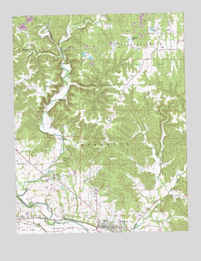
Marthasville, MO USGS Topographic Map
Click on map above to begin viewing in our Map Viewer.

This topographic map contains these locations and features:
Feature Name Type Latitude Longitude GNIS ID View Map
American Legion HallBuildingN38.6573°W91.0979°730381View Map
American Legion ParkParkN38.6578°W91.0988°713260View Map
Brinkman School (historical)SchoolN38.6259°W91.0985°747952View Map
Cave CreekStreamN38.7428°W91.0835°730382View Map
Cedar Grove School (historical)SchoolN38.6581°W91.0951°747951View Map
Cedar Valley School (historical)SchoolN38.6545°W91.0240°747955View Map
Charrette (historical)Populated PlaceN38.6520°W91.0974°740070View Map
City of MarthasvilleCivilN38.6309°W91.0572°2395029View Map
College CreekStreamN38.6456°W91.0138°755910View Map
D Bunge Lake DamDamN38.6550°W91.1035°765509View Map
Dry ForkStreamN38.6520°W91.1199°735583View Map
Dryer School (historical)SchoolN38.7167°W91.1179°747950View Map
Engemann SpringSpringN38.6791°W91.0899°717589View Map
Forest Grove School (historical)SchoolN38.7128°W91.0385°747954View Map
Forest Haven Lake DamDamN38.7384°W91.0335°765508View Map
Grand CanyonValleyN38.6589°W91.1038°730383View Map
H Bunge Lake DamDamN38.6617°W91.0835°765510View Map
Hearse CreekStreamN38.7256°W91.0874°719318View Map
Koepke Lake North DamDamN38.7184°W91.0735°764340View Map
Koepke Lake South DamDamN38.7250°W91.0701°765479View Map
La Charrette BottomBendN38.6278°W91.0893°720711View Map
Lake of the Woods DamDamN38.7200°W91.0668°765480View Map
MarthasvillePopulated PlaceN38.6284°W91.0576°721912View Map
Marthasville Elementary SchoolSchoolN38.6272°W91.0506°730384View Map
Marthasville Post OfficePost OfficeN38.6278°W91.0609°2782932View Map
Marthasville Volunteer Fire Department Station 1BuildingN38.6287°W91.0555°2620378View Map
North Fork Charrette CreekStreamN38.7309°W91.0910°723455View Map
Owl CreekStreamN38.7464°W91.1010°723924View Map
PeersPopulated PlaceN38.6342°W91.1218°724180View Map
Township of CharretteCivilN38.6590°W91.0819°767500View Map
Tuque RidgeRidgeN38.7045°W91.0463°730385View Map
Tuque School (historical)SchoolN38.7287°W91.0099°747953View Map
Vatterot DamDamN38.7417°W91.0235°765218View Map
Wildwood LakesLakeN38.7356°W91.0390°728851View Map
Wolf CreekStreamN38.6437°W91.0190°756921View Map
Wonder LakeReservoirN38.7408°W91.0236°758364View Map
Wright City Fire Protection District Station 2BuildingN38.7319°W91.0410°2621291View Map

Note: Coordinates in the location and feature list above are referenced to NAD83 datum.


Copyright (C) 2008-2024 Ryan Niemi / Sunset Dynamics ... All Rights Reserved