TopoQuest Logo
Do you find TopoQuest useful?
Help keep TopoQuest running and adding new maps/features by donating!
Bitcoin:  19c7KJd3qBynnjoSw5npx9KScwjBe4ifkT
Litecoin:  LXs6TkuXGGXo1vDsWCkWVdjQX94eUKd6ui
Home View Maps Find Maps Find Places Resources & Links


Wright City, Missouri Topographic Map

USGS Map Title: Wright City, MO
USGS Map MRC: 38091G1
DRG (GeoTIFF) Download: o38091g1.tif


Neighboring USGS Topographic Map Quads:


  Hawk Point, MO  
38091H2
 

  Warrenton NE, MO  
38091H1
 

  Troy, MO  
38090H8
 

  Warrenton, MO  
38091G2
 

  Wright City, MO  
38091G1
 

  Foristell, MO  
38090G8
 

  Treloar, MO  
38091F2
 

  Marthasville, MO  
38091F1
 

  New Melle, MO  
38090F8


Map MRC Location:

N39°
W92°
N39°
W91°
H8 H7 H6 H5 H4 H3 H2 H1
G8 G7 G6 G5 G4 G3 G2 G1
F8 F7 F6 F5 F4 F3 F2 F1
E8 E7 E6 E5 E4 E3 E2 E1
D8 D7 D6 D5 D4 D3 D2 D1
C8 C7 C6 C5 C4 C3 C2 C1
B8 B7 B6 B5 B4 B3 B2 B1
A8 A7 A6 A5 A4 A3 A2 A1
N38°
W92°
N38°
W91°

Wright City, MO USGS 1:24K Topographic Map Preview:
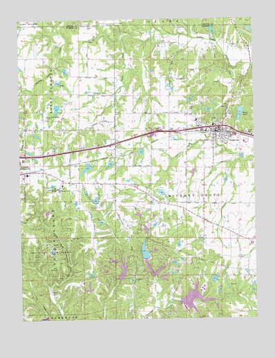
Wright City, MO USGS Topographic Map
Click on map above to begin viewing in our Map Viewer.

This topographic map contains these locations and features:
Feature Name Type Latitude Longitude GNIS ID View Map
Boone Trail Farm LakeReservoirN38.8132°W91.0894°764337View Map
Boone Trail Farm Lake DamDamN38.8150°W91.0868°764336View Map
Boulanger Lake DamDamN38.8400°W91.1051°761404View Map
Brandt School (historical)SchoolN38.8070°W91.0982°730350View Map
Broussard Lake DamDamN38.8484°W91.1051°761431View Map
C E F AirportAirportN38.8094°W91.1033°758984View Map
Cedar Knoll Farm LakeReservoirN38.8026°W91.0497°761430View Map
Cedar Knoll Farm Lake DamDamN38.8050°W91.0518°761429View Map
City of TruesdaleCivilN38.8124°W91.1220°2397065View Map
City of Wright CityCivilN38.8341°W91.0398°2397382View Map
Crow BranchStreamN38.8659°W91.0701°730353View Map
Dunn Lake DamDamN38.8550°W91.1018°761405View Map
End Brook LakeReservoirN38.7669°W91.0493°764633View Map
Fawn Lake AirportAirportN38.8736°W91.0887°2679399View Map
Forest LakeReservoirN38.8355°W91.0074°718092View Map
Forest Lake DamDamN38.8378°W91.0076°760374View Map
Froelich Lake DamDamN38.7734°W91.0451°765216View Map
Gettinger Lake DamDamN38.7617°W91.0885°761799View Map
Gibson College (historical)SchoolN38.8422°W91.0106°730351View Map
Goat Spring School (historical)SchoolN38.8583°W91.0431°747929View Map
Harmonie ChurchChurchN38.7667°W91.0638°731578View Map
Hunt Lake DamDamN38.7917°W91.0468°765505View Map
InnsbrookPopulated PlaceN38.7692°W91.0521°1802737View Map
Innsbrook Estates Dam Number 1DamN38.7567°W91.0401°765466View Map
Joe Phegleg LakeReservoirN38.7617°W91.0016°764631View Map
Johnson Lake DamDamN38.8417°W91.0335°761428View Map
Lake Innsbrook DamDamN38.7684°W91.0551°761908View Map
Lake LucernReservoirN38.7689°W91.0536°764345View Map
Lake Lucern DamDamN38.7750°W91.0585°764344View Map
Lake ScheffborgReservoirN38.7850°W91.0601°765215View Map
Lake Scheffborg DamDamN38.7850°W91.0601°765214View Map
Leprechaun LakeReservoirN38.7735°W91.0432°765217View Map
Locust Grove School (historical)SchoolN38.8287°W91.0457°747930View Map
Mononame 318 DamDamN38.8034°W91.0801°764335View Map
Mount Airy CemeteryCemeteryN38.7753°W91.0087°722707View Map
Mudd Lake DamDamN38.8700°W91.0001°765213View Map
N and W Railroad Section 19 DamDamN38.8217°W91.0601°761407View Map
Nine Acre Lake Plat 6 DamDamN38.7667°W91.0518°764632View Map
Olive Ballas Realty Company Section 24 DamDamN38.8167°W91.0751°761403View Map
Palazzo Lake DamDamN38.8367°W91.0235°761406View Map
Passionist Fathers DamDamN38.8067°W91.1085°760290View Map
Passionist Fathers LakeReservoirN38.8058°W91.1077°760291View Map
Passionist Fathers SeminarySchoolN38.8039°W91.1043°724069View Map
Pitt School (historical)SchoolN38.7989°W91.0490°747931View Map
Pleasant Hill School (historical)SchoolN38.8478°W91.1021°747927View Map
Prior LakeReservoirN38.7700°W91.0468°762425View Map
Prior Lake DamDamN38.7700°W91.0468°762424View Map
Reifsnider State ForestForestN38.7789°W91.1074°725209View Map
Rocky Ridge School (historical)SchoolN38.7589°W91.0954°747928View Map
Rogers Lake DamDamN38.7934°W91.0618°765506View Map
Sherman Lake DamDamN38.7650°W91.0268°764343View Map
Shields Lake DamDamN38.7617°W91.0018°764630View Map
Siegmund Lake DamDamN38.7800°W91.0401°764346View Map
Skunk CreekStreamN38.8170°W91.0074°731653View Map
Skunk HollowValleyN38.8164°W91.0088°730352View Map
Stark Lake DamDamN38.7684°W91.0885°764341View Map
Thiele Lake DamDamN38.8700°W91.0201°761408View Map
Township of Hickory GroveCivilN38.7830°W91.0183°767501View Map
Upper Charrette School (historical)SchoolN38.7642°W91.0454°747932View Map
Village of InnsbrookCivilN38.7631°W91.0552°2398577View Map
Vitt Lake DamDamN38.7984°W91.0851°764334View Map
Wanderfern Lake DamDamN38.7667°W91.0735°761800View Map
Wesley ChurchChurchN38.8384°W91.0138°728520View Map
Windy Knoll LakeReservoirN38.7893°W91.0537°764339View Map
Windy Knoll Lake DamDamN38.7884°W91.0551°764338View Map
Wright CityPopulated PlaceN38.8275°W91.0201°736368View Map
Wright City Elementary SchoolSchoolN38.8347°W91.0414°2652432View Map
Wright City Fire Protection District Station 1BuildingN38.8277°W91.0259°2620331View Map
Wright City Fire Protection District Station 4BuildingN38.7651°W91.0412°2621286View Map
Wright City High SchoolSchoolN38.8328°W91.0307°2652430View Map
Wright City Middle SchoolSchoolN38.8345°W91.0442°2652431View Map
Wright City Post OfficePost OfficeN38.8285°W91.0222°2782737View Map

Note: Coordinates in the location and feature list above are referenced to NAD83 datum.


Copyright (C) 2008-2024 Ryan Niemi / Sunset Dynamics ... All Rights Reserved