TopoQuest Logo
Do you find TopoQuest useful?
Help keep TopoQuest running and adding new maps/features by donating!
Bitcoin:  19c7KJd3qBynnjoSw5npx9KScwjBe4ifkT
Litecoin:  LXs6TkuXGGXo1vDsWCkWVdjQX94eUKd6ui
Home View Maps Find Maps Find Places Resources & Links


McKinley, Minnesota Topographic Map

USGS Map Title: McKinley, MN
USGS Map MRC: 47092E4
DRG (GeoTIFF) Download: o47092e4.tif


Neighboring USGS Topographic Map Quads:


  Britt, MN  
47092F5
 

  Biwabik NW, MN  
47092F4
 

  Biwabik NE, MN  
47092F3
 

  Virginia, MN  
47092E5
 

  McKinley, MN  
47092E4
 

  Biwabik, MN  
47092E3
 

  Eveleth, MN  
47092D5
 

  Gilbert, MN  
47092D4
 

  Palo, MN  
47092D3


Map MRC Location:

N48°
W93°
N48°
W92°
H8 H7 H6 H5 H4 H3 H2 H1
G8 G7 G6 G5 G4 G3 G2 G1
F8 F7 F6 F5 F4 F3 F2 F1
E8 E7 E6 E5 E4 E3 E2 E1
D8 D7 D6 D5 D4 D3 D2 D1
C8 C7 C6 C5 C4 C3 C2 C1
B8 B7 B6 B5 B4 B3 B2 B1
A8 A7 A6 A5 A4 A3 A2 A1
N47°
W93°
N47°
W92°

McKinley, MN USGS 1:24K Topographic Map Preview:
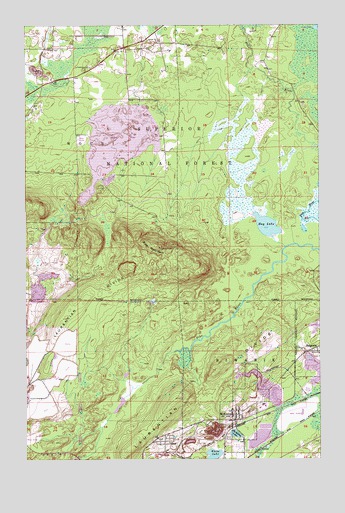
McKinley, MN USGS Topographic Map
Click on map above to begin viewing in our Map Viewer.

This topographic map contains these locations and features:
Feature Name Type Latitude Longitude GNIS ID View Map
Belgrade CaveReservoirN47.5269°W92.3791°660768View Map
City of McKinleyCivilN47.5091°W92.4056°2395073View Map
ElcorPopulated PlaceN47.5052°W92.4410°661197View Map
Elcor Post Office (historical)Post OfficeN47.5053°W92.4408°2123653View Map
Elcore Station (historical)LocaleN47.5053°W92.4408°2123651View Map
Florenton CemeteryCemeteryN47.6124°W92.4747°661292View Map
Hay LakeLakeN47.5671°W92.3974°661444View Map
Inland Steel Tailings BasinReservoirN47.5967°W92.4533°1776963View Map
Inland Steel Tailings DikeDamN47.5966°W92.4568°1776962View Map
Lola LakeLakeN47.6242°W92.3752°660567View Map
McKinleyPopulated PlaceN47.5127°W92.4110°661888View Map
McKinley Clearwater DikeDamN47.5066°W92.3968°1777135View Map
McKinley Clearwater PondReservoirN47.5061°W92.4009°1777136View Map
McKinley LakeLakeN47.5072°W92.4111°661889View Map
McKinley Post OfficePost OfficeN47.5128°W92.4108°2123606View Map
McKinley StationLocaleN47.5128°W92.4108°2123607View Map
McKinley Tailings BasinReservoirN47.5061°W92.4009°1776965View Map
McKinley Tailings DikeDamN47.5066°W92.3968°1776964View Map
McKinley Volunteer Fire DepartmentBuildingN47.5117°W92.4109°2666693View Map
Pike MountainSummitN47.5610°W92.4430°662187View Map
Saint Louis CountyCivilN47.5899°W92.4615°662850View Map
Sauntry Creek Settling BasinReservoirN47.5516°W92.4952°1777126View Map
Sauntry Creek Settling DikeDamN47.5516°W92.4952°1777125View Map
Township of WuoriCivilN47.5896°W92.4972°666058View Map
Unorganized Territory of Hay LakeCivilN47.5892°W92.3814°664426View Map
White LakeLakeN47.5007°W92.4212°662791View Map

Note: Coordinates in the location and feature list above are referenced to NAD83 datum.


Copyright (C) 2008-2024 Ryan Niemi / Sunset Dynamics ... All Rights Reserved