TopoQuest Logo
Do you find TopoQuest useful?
Help keep TopoQuest running and adding new maps/features by donating!
Bitcoin:  19c7KJd3qBynnjoSw5npx9KScwjBe4ifkT
Litecoin:  LXs6TkuXGGXo1vDsWCkWVdjQX94eUKd6ui
Home View Maps Find Maps Find Places Resources & Links


Mindenmines, Missouri Topographic Map

USGS Map Title: Mindenmines, MO
USGS Map MRC: 37094D5
DRG (GeoTIFF) Download: o37094d5.tif


Neighboring USGS Topographic Map Quads:


  Arma, KS  
37094E6
 

  Liberal, MO  
37094E5
 

  Iantha, MO  
37094E4
 

  Pittsburg, KS  
37094D6
 

  Mindenmines, MO  
37094D5
 

  Nashville, MO  
37094D4
 

  Kirkwood, KS  
37094C6
 

  Asbury, MO  
37094C5
 

  Neck City, MO  
37094C4


Map MRC Location:

N38°
W95°
N38°
W94°
H8 H7 H6 H5 H4 H3 H2 H1
G8 G7 G6 G5 G4 G3 G2 G1
F8 F7 F6 F5 F4 F3 F2 F1
E8 E7 E6 E5 E4 E3 E2 E1
D8 D7 D6 D5 D4 D3 D2 D1
C8 C7 C6 C5 C4 C3 C2 C1
B8 B7 B6 B5 B4 B3 B2 B1
A8 A7 A6 A5 A4 A3 A2 A1
N37°
W95°
N37°
W94°

Mindenmines, MO USGS 1:24K Topographic Map Preview:
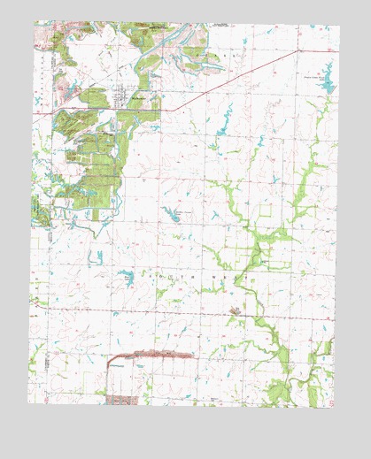
Mindenmines, MO USGS Topographic Map
Click on map above to begin viewing in our Map Viewer.

This topographic map contains these locations and features:
Feature Name Type Latitude Longitude GNIS ID View Map
Blackjack School (historical)SchoolN37.3767°W94.5502°714328View Map
City of MindenminesCivilN37.4728°W94.5888°2395342View Map
Fairview School (historical)SchoolN37.4067°W94.5911°717804View Map
Finley LakeReservoirN37.4818°W94.5048°762990View Map
Gardner Farms LakeReservoirN37.4369°W94.5666°762846View Map
Gardner Farms Lake DamDamN37.4351°W94.5652°762845View Map
Glendale ForkStreamN37.3814°W94.5191°718503View Map
Glendale School (historical)SchoolN37.4045°W94.5327°718505View Map
KKUZ-FM (Joplin)TowerN37.4506°W94.5575°759134View Map
MindenminesPopulated PlaceN37.4714°W94.5900°740004View Map
Mindenmines CemeteryCemeteryN37.4639°W94.5913°722417View Map
Mindenmines Post OfficePost OfficeN37.4744°W94.5887°2416129View Map
Mindenmines Volunteer Fire DepartmentBuildingN37.4734°W94.5886°2621014View Map
Moss LakeReservoirN37.4181°W94.5830°754149View Map
Moss Lake DamDamN37.4184°W94.5819°762985View Map
Number 180 ReservoirReservoirN37.4182°W94.5861°762986View Map
Prairie Center Farm DamDamN37.4784°W94.5052°762989View Map
Prairie Center Farm LakeReservoirN37.4778°W94.5044°754147View Map
Southwest School (historical)SchoolN37.3796°W94.5937°746188View Map
Township of South WestCivilN37.4215°W94.5594°766287View Map
West Star School (historical)SchoolN37.4489°W94.5225°728628View Map
Yale CemeteryCemeteryN37.4839°W94.6147°729183View Map

Note: Coordinates in the location and feature list above are referenced to NAD83 datum.


Copyright (C) 2008-2024 Ryan Niemi / Sunset Dynamics ... All Rights Reserved