TopoQuest Logo
Do you find TopoQuest useful?
Help keep TopoQuest running and adding new maps/features by donating!
Bitcoin:  19c7KJd3qBynnjoSw5npx9KScwjBe4ifkT
Litecoin:  LXs6TkuXGGXo1vDsWCkWVdjQX94eUKd6ui
Home View Maps Find Maps Find Places Resources & Links


Mount Landing, Virginia Topographic Map

USGS Map Title: Mount Landing, VA
USGS Map MRC: 37076H8
DRG (GeoTIFF) Download: o37076h8.tif


Neighboring USGS Topographic Map Quads:


  Loretto, VA  
38077A1
 

  Champlain, VA  
38076A8
 

  Montross, VA  
38076A7
 

  Cauthornville, VA  
37077H1
 

  Mount Landing, VA  
37076H8
 

  Tappahannock, VA  
37076H7
 

  Aylett, VA  
37077G1
 

  Millers Tavern, VA  
37076G8
 

  Dunnsville, VA  
37076G7


Map MRC Location:

N38°
W77°
N38°
W76°
H8 H7 H6 H5 H4 H3 H2 H1
G8 G7 G6 G5 G4 G3 G2 G1
F8 F7 F6 F5 F4 F3 F2 F1
E8 E7 E6 E5 E4 E3 E2 E1
D8 D7 D6 D5 D4 D3 D2 D1
C8 C7 C6 C5 C4 C3 C2 C1
B8 B7 B6 B5 B4 B3 B2 B1
A8 A7 A6 A5 A4 A3 A2 A1
N37°
W77°
N37°
W76°

Mount Landing, VA USGS 1:24K Topographic Map Preview:
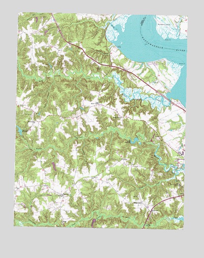
Mount Landing, VA USGS Topographic Map
Click on map above to begin viewing in our Map Viewer.

This topographic map contains these locations and features:
Feature Name Type Latitude Longitude GNIS ID View Map
Baker LandingLocaleN37.9496°W76.9055°1478006View Map
Bakers LandingLocaleN37.9499°W76.9064°1739408View Map
Brecknock BayBayN37.9779°W76.9150°1739414View Map
Broad CreekStreamN37.9890°W76.9236°1463841View Map
CaretPopulated PlaceN37.9826°W76.9614°1477176View Map
Caret Post OfficePost OfficeN37.9825°W76.9625°2519595View Map
Cedar PointCapeN37.9551°W76.8861°1739418View Map
Central DistrictCivilN37.8968°W76.9192°1927139View Map
Cheatswood Mill DamDamN37.9282°W76.9952°1489637View Map
Cheatwood MillpondReservoirN37.9314°W76.9973°1464761View Map
Church SwampSwampN37.9010°W76.8953°1464922View Map
Coopers PointCapeN37.9515°W76.8869°1739421View Map
Cortney DamDamN37.9118°W76.9730°1489653View Map
Criddlin SwampSwampN37.9280°W76.9509°1465432View Map
Croxton Mill (historical)LocaleN37.9065°W76.8839°1739423View Map
DeshaPopulated PlaceN37.9157°W76.9202°1477259View Map
DunbrookePopulated PlaceN37.8943°W76.9639°1495482View Map
Essex CountyCivilN37.9391°W76.9409°1480118View Map
Essex House Assisted Living FacilityBuildingN37.9549°W76.8970°2519991View Map
First Union ChurchChurchN37.9399°W76.9889°1466596View Map
Gram LandingLocaleN37.9549°W76.9219°1739429View Map
Gram LandingLocaleN37.9529°W76.9230°1478004View Map
Harry Lane SwampStreamN37.8801°W76.9127°1739430View Map
Henley ForkPopulated PlaceN37.8857°W76.8986°1477405View Map
Hermon CemeteryCemeteryN37.9460°W76.9969°1739431View Map
Hermon ChurchChurchN37.9457°W76.9969°1467953View Map
Hickory LandingLocaleN37.9557°W76.9202°1739432View Map
Hickory LandingLocaleN37.9574°W76.9200°1478013View Map
Hickory Road School (historical)SchoolN37.8971°W76.9977°1739433View Map
Hutchinson Mill (historical)LocaleN37.9282°W76.9950°1739434View Map
Jacks ForkPopulated PlaceN37.9187°W76.8789°1495748View Map
Jenkins LandingPopulated PlaceN37.9804°W76.9261°1495757View Map
KinoPopulated PlaceN37.9046°W76.9414°1477465View Map
Latane Mill (historical)LocaleN37.8757°W76.9669°1739436View Map
Lewis CreekStreamN37.9626°W76.9730°1469331View Map
Lewis CreekStreamN37.9826°W76.9283°1469332View Map
Longist ForksPopulated PlaceN37.8910°W76.9066°1477499View Map
Mallorys PointCapeN37.9715°W76.8758°1470031View Map
Mariners BranchStreamN37.8801°W76.9480°1739443View Map
MeadePopulated PlaceN37.8779°W76.9636°1477529View Map
Mose LandingLocaleN37.9543°W76.9094°1739446View Map
Mose LandingLocaleN37.9537°W76.9075°1478008View Map
Mount LandingPopulated PlaceN37.9401°W76.9214°1495972View Map
Mount Landing CreekStreamN37.9518°W76.8872°1470917View Map
Mount Zion ChurchChurchN37.8935°W76.9639°1471142View Map
Mount Zion ChurchChurchN37.9687°W76.9389°1471143View Map
Mulberry IslandIslandN37.9937°W76.8916°1474254View Map
Mulberry PointCapeN37.9857°W76.8919°1471250View Map
Persimmon Tree LandingLocaleN37.9501°W76.9155°1739451View Map
Persimmon Tree LandingLocaleN37.9493°W76.9141°1478005View Map
Pigeon HillPopulated PlaceN37.9368°W76.9464°1739452View Map
Quioccasin CreekStreamN37.9949°W76.9314°1472914View Map
RexburgPopulated PlaceN37.9365°W76.9869°1477678View Map
Riverside Tappahannock HospitalHospitalN37.9013°W76.8788°1475707View Map
Saint Johns ChurchChurchN37.9129°W76.9136°1473775View Map
Salt Bank LandingLocaleN37.9524°W76.9016°1739460View Map
Salt Bank LandingLocaleN37.9532°W76.9022°1478007View Map
Scott Mill (historical)LocaleN37.9265°W76.9094°1739461View Map
Scotts Mill DamDamN37.9251°W76.9080°1489639View Map
Scotts MillpondReservoirN37.9268°W76.9094°1502115View Map
Sturgeon SwampStreamN37.8821°W76.9355°1475273View Map
Tappahannock Seventh Day Adventist ChurchChurchN37.8996°W76.8752°2519833View Map
Upper Mount LandingPopulated PlaceN37.9474°W76.9386°1477833View Map
Waterview CreekStreamN37.9868°W76.8816°1476377View Map
Woodside Country ClubLocaleN37.9629°W76.9150°2520211View Map
Youngs SwampStreamN37.8818°W76.8830°1739475View Map

Note: Coordinates in the location and feature list above are referenced to NAD83 datum.


Copyright (C) 2008-2024 Ryan Niemi / Sunset Dynamics ... All Rights Reserved