TopoQuest Logo
Do you find TopoQuest useful?
Help keep TopoQuest running and adding new maps/features by donating!
Bitcoin:  19c7KJd3qBynnjoSw5npx9KScwjBe4ifkT
Litecoin:  LXs6TkuXGGXo1vDsWCkWVdjQX94eUKd6ui
Home View Maps Find Maps Find Places Resources & Links


New Sharon, Iowa Topographic Map

USGS Map Title: New Sharon, IA
USGS Map MRC: 41092D6
DRG (GeoTIFF) Download: o41092d6.tif


Neighboring USGS Topographic Map Quads:


  Sully, IA  
41092E7
 

  Searsboro, IA  
41092E6
 

  Montezuma, IA  
41092E5
 

  Peoria, IA  
41092D7
 

  New Sharon, IA  
41092D6
 

  Union Mills, IA  
41092D5
 

  Leighton, IA  
41092C7
 

  Oskaloosa, IA  
41092C6
 

  University Park, IA  
41092C5


Map MRC Location:

N42°
W93°
N42°
W92°
H8 H7 H6 H5 H4 H3 H2 H1
G8 G7 G6 G5 G4 G3 G2 G1
F8 F7 F6 F5 F4 F3 F2 F1
E8 E7 E6 E5 E4 E3 E2 E1
D8 D7 D6 D5 D4 D3 D2 D1
C8 C7 C6 C5 C4 C3 C2 C1
B8 B7 B6 B5 B4 B3 B2 B1
A8 A7 A6 A5 A4 A3 A2 A1
N41°
W93°
N41°
W92°

New Sharon, IA USGS 1:24K Topographic Map Preview:
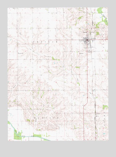
New Sharon, IA USGS Topographic Map
Click on map above to begin viewing in our Map Viewer.

This topographic map contains these locations and features:
Feature Name Type Latitude Longitude GNIS ID View Map
Assembly of God ChurchChurchN41.4686°W92.6494°1970850View Map
City of New SharonCivilN41.4701°W92.6509°2395214View Map
First Christian ChurchChurchN41.4708°W92.6530°1970851View Map
First Presbyterian ChurchChurchN41.4700°W92.6513°1970854View Map
Friends CemeteryCemeteryN41.4625°W92.6504°456784View Map
Friends ChurchChurchN41.4678°W92.6510°1970852View Map
Highland CemeteryCemeteryN41.4766°W92.6491°457458View Map
Jackson CemeteryCemeteryN41.4500°W92.7085°1970906View Map
LaceyLocaleN41.4008°W92.6402°1970728View Map
LaceyPopulated PlaceN41.4008°W92.6402°458162View Map
Lacey Post Office (historical)Post OfficeN41.4008°W92.6402°1970727View Map
Lacey United Methodist ChurchChurchN41.4011°W92.6396°1970849View Map
Mitchell CreekStreamN41.3792°W92.7171°459154View Map
New SharonLocaleN41.4667°W92.6474°1970842View Map
New SharonPopulated PlaceN41.4700°W92.6513°459488View Map
New Sharon Care CenterHospitalN41.4692°W92.6432°1970843View Map
New Sharon Fire and Rescue Association DepartmentBuildingN41.4700°W92.6499°1970847View Map
New Sharon LibraryBuildingN41.4689°W92.6519°1970846View Map
New Sharon Memorial ClinicHospitalN41.4692°W92.6432°1970844View Map
New Sharon Post OfficePost OfficeN41.4694°W92.6432°1970845View Map
North Mahaska Elementary SchoolSchoolN41.4597°W92.6484°1970856View Map
North Mahaska Junior - Senior High SchoolSchoolN41.4596°W92.6487°459605View Map
Prairie Knolls Country ClubLocaleN41.4750°W92.6446°1970855View Map
Township of MadisonCivilN41.3789°W92.6987°468326View Map
Township of PrairieCivilN41.4657°W92.6991°468573View Map
United Methodist ChurchChurchN41.4694°W92.6530°1970853View Map
Vander Waal Airport (historical)AirportN41.4578°W92.7374°1823445View Map
Weatherwax CemeteryCemeteryN41.4583°W92.7085°1970907View Map

Note: Coordinates in the location and feature list above are referenced to NAD83 datum.


Copyright (C) 2008-2024 Ryan Niemi / Sunset Dynamics ... All Rights Reserved