TopoQuest Logo
Do you find TopoQuest useful?
Help keep TopoQuest running and adding new maps/features by donating!
Bitcoin:  19c7KJd3qBynnjoSw5npx9KScwjBe4ifkT
Litecoin:  LXs6TkuXGGXo1vDsWCkWVdjQX94eUKd6ui
Home View Maps Find Maps Find Places Resources & Links


Peoria, Iowa Topographic Map

USGS Map Title: Peoria, IA
USGS Map MRC: 41092D7
DRG (GeoTIFF) Download: o41092d7.tif


Neighboring USGS Topographic Map Quads:


  Killduff, IA  
41092E8
 

  Sully, IA  
41092E7
 

  Searsboro, IA  
41092E6
 

  Pella, IA  
41092D8
 

  Peoria, IA  
41092D7
 

  New Sharon, IA  
41092D6
 

  Harvey, IA  
41092C8
 

  Leighton, IA  
41092C7
 

  Oskaloosa, IA  
41092C6


Map MRC Location:

N42°
W93°
N42°
W92°
H8 H7 H6 H5 H4 H3 H2 H1
G8 G7 G6 G5 G4 G3 G2 G1
F8 F7 F6 F5 F4 F3 F2 F1
E8 E7 E6 E5 E4 E3 E2 E1
D8 D7 D6 D5 D4 D3 D2 D1
C8 C7 C6 C5 C4 C3 C2 C1
B8 B7 B6 B5 B4 B3 B2 B1
A8 A7 A6 A5 A4 A3 A2 A1
N41°
W93°
N41°
W92°

Peoria, IA USGS 1:24K Topographic Map Preview:
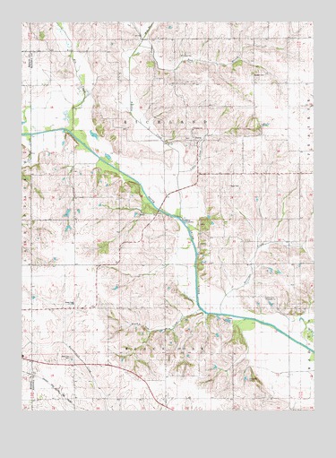
Peoria, IA USGS Topographic Map
Click on map above to begin viewing in our Map Viewer.

This topographic map contains these locations and features:
Feature Name Type Latitude Longitude GNIS ID View Map
Appel CemeteryCemeteryN41.4473°W92.7866°454214View Map
Baldwin CemeteryCemeteryN41.4828°W92.7768°454332View Map
Ballinger CreekStreamN41.4061°W92.7896°454337View Map
BerninaPopulated PlaceN41.4078°W92.7660°464267View Map
Bernina Post Office (historical)Post OfficeN41.4078°W92.7660°1970744View Map
Black Oak CemeteryCemeteryN41.3924°W92.8543°454664View Map
Black Oak CreekStreamN41.4078°W92.7988°1823446View Map
Buckley CreekStreamN41.4372°W92.8074°454941View Map
Centennial CemeteryCemeteryN41.3860°W92.7777°455268View Map
East Branch Buckley CreekStreamN41.4925°W92.8255°456122View Map
Elk CreekStreamN41.4647°W92.8544°456288View Map
Flint Post Office (historical)Post OfficeN41.4506°W92.7544°466602View Map
Granville (historical)Populated PlaceN41.4961°W92.7744°465505View Map
Lower Grove Community ChurchChurchN41.4111°W92.7713°458665View Map
Lower Grove ParkParkN41.4125°W92.7877°1970704View Map
Middle Branch Buckley CreekStreamN41.4944°W92.8230°459028View Map
PeoriaPopulated PlaceN41.4619°W92.8013°460077View Map
Peoria CemeteryCemeteryN41.4625°W92.8044°1970898View Map
Peoria Christian Reformed ChurchChurchN41.4653°W92.8019°1970916View Map
Peoria Christian SchoolSchoolN41.4658°W92.8020°1970917View Map
Peoria Post Office (historical)Post OfficeN41.4619°W92.8013°1970723View Map
Thunder CreekStreamN41.4639°W92.8713°462235View Map
Township of Black OakCivilN41.3760°W92.8158°467458View Map
Township of RichlandCivilN41.4622°W92.8117°468611View Map

Note: Coordinates in the location and feature list above are referenced to NAD83 datum.


Copyright (C) 2008-2024 Ryan Niemi / Sunset Dynamics ... All Rights Reserved