TopoQuest Logo
Do you find TopoQuest useful?
Help keep TopoQuest running and adding new maps/features by donating!
Bitcoin:  19c7KJd3qBynnjoSw5npx9KScwjBe4ifkT
Litecoin:  LXs6TkuXGGXo1vDsWCkWVdjQX94eUKd6ui
Home View Maps Find Maps Find Places Resources & Links


Oak Grove, Louisiana Topographic Map

USGS Map Title: Oak Grove, LA
USGS Map MRC: 32091G4
DRG (GeoTIFF) Download: o32091g4.tif


Neighboring USGS Topographic Map Quads:


  Laark, LA  
32091H5
 

  Fiske, LA  
32091H4
 

  Kilbourne, LA  
32091H3
 

  Goodwill, LA  
32091G5
 

  Oak Grove, LA  
32091G4
 

  Baxter Bayou, LA  
32091G3
 

  Bear Skin, LA  
32091F5
 

  Pioneer, LA  
32091F4
 

  Caraway Lake, LA  
32091F3


Map MRC Location:

N33°
W92°
N33°
W91°
H8 H7 H6 H5 H4 H3 H2 H1
G8 G7 G6 G5 G4 G3 G2 G1
F8 F7 F6 F5 F4 F3 F2 F1
E8 E7 E6 E5 E4 E3 E2 E1
D8 D7 D6 D5 D4 D3 D2 D1
C8 C7 C6 C5 C4 C3 C2 C1
B8 B7 B6 B5 B4 B3 B2 B1
A8 A7 A6 A5 A4 A3 A2 A1
N32°
W92°
N32°
W91°

Oak Grove, LA USGS 1:24K Topographic Map Preview:
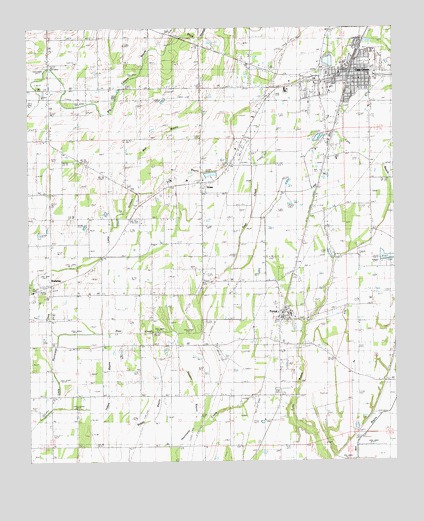
Oak Grove, LA USGS Topographic Map
Click on map above to begin viewing in our Map Viewer.

This topographic map contains these locations and features:
Feature Name Type Latitude Longitude GNIS ID View Map
Bell BayouStreamN32.8179°W91.4710°532906View Map
Big Black SloughLakeN32.8581°W91.4671°533034View Map
Big Venson BayouStreamN32.7610°W91.4437°553660View Map
Colewa BayouStreamN32.8704°W91.4515°554045View Map
Deer CreekStreamN32.7876°W91.4682°534459View Map
Fiske Union Volunteer Fire Department South StationBuildingN32.8416°W91.4923°2673016View Map
ForestPopulated PlaceN32.7921°W91.4134°543213View Map
Forest CemeteryCemeteryN32.7754°W91.4107°535036View Map
Forest Post OfficePost OfficeN32.7918°W91.4131°1630844View Map
Forest SchoolSchoolN32.7926°W91.4106°548777View Map
Forest Volunteer Fire Department Central StationBuildingN32.7836°W91.4145°2672846View Map
Forest Volunteer Fire Department SubstationBuildingN32.8317°W91.3794°2673015View Map
GreenPopulated PlaceN32.8301°W91.4407°540629View Map
Green ChapelChurchN32.8301°W91.4459°535383View Map
Green ChurchChurchN32.8315°W91.4398°535384View Map
Hixon ChurchChurchN32.7668°W91.4912°535683View Map
Kelly-Dumas AirportAirportN32.8508°W91.4039°1632898View Map
Little Colewa BayouStreamN32.8004°W91.4996°536518View Map
New Forest CemeteryCemeteryN32.7701°W91.4154°537568View Map
New Zion ChurchChurchN32.8429°W91.4943°537655View Map
Oak GrovePopulated PlaceN32.8610°W91.3884°1629988View Map
Oak Grove Elementary SchoolSchoolN32.8579°W91.3958°548781View Map
Oak Grove High SchoolSchoolN32.8593°W91.3948°548782View Map
Oak Grove Police DepartmentBuildingN32.8607°W91.3861°2755316View Map
Oak Grove Post OfficePost OfficeN32.8601°W91.3882°1630849View Map
Oak Grove Volunteer Fire DepartmentBuildingN32.8536°W91.3982°2672940View Map
Parish Governing Authority District CCivilN32.8012°W91.4079°1930311View Map
RedwingPopulated PlaceN32.8010°W91.4926°540628View Map
Redwing ChurchChurchN32.7976°W91.4915°538546View Map
Redwing School (historical)SchoolN32.8007°W91.4960°548784View Map
Sardis ChurchChurchN32.8160°W91.3826°539183View Map
Town of Oak GroveCivilN32.8620°W91.3911°2407017View Map
Village of ForestCivilN32.7924°W91.4126°2407457View Map
Ward FourCivilN32.8743°W91.4007°545276View Map
Ward ThreeCivilN32.8060°W91.4701°545275View Map
West Carroll Memorial HospitalHospitalN32.8686°W91.3827°548786View Map
West Carroll ParishCivilN32.7886°W91.4567°559578View Map
West Carroll Parish LibraryBuildingN32.8599°W91.3904°548787View Map
West Carroll Parish Sheriff's OfficeBuildingN32.8605°W91.3875°2755323View Map

Note: Coordinates in the location and feature list above are referenced to NAD83 datum.


Copyright (C) 2008-2024 Ryan Niemi / Sunset Dynamics ... All Rights Reserved