TopoQuest Logo
Do you find TopoQuest useful?
Help keep TopoQuest running and adding new maps/features by donating!
Bitcoin:  19c7KJd3qBynnjoSw5npx9KScwjBe4ifkT
Litecoin:  LXs6TkuXGGXo1vDsWCkWVdjQX94eUKd6ui
Home View Maps Find Maps Find Places Resources & Links


Kilbourne, Louisiana Topographic Map

USGS Map Title: Kilbourne, LA
USGS Map MRC: 32091H3
DRG (GeoTIFF) Download: o32091h3.tif


Neighboring USGS Topographic Map Quads:


  Empire, AR  
33091A4
 

  Eudora South, AR  
33091A3
 

  Readland, AR  
33091A2
 

  Fiske, LA  
32091H4
 

  Kilbourne, LA  
32091H3
 

  Millikin, LA  
32091H2
 

  Oak Grove, LA  
32091G4
 

  Baxter Bayou, LA  
32091G3
 

  Lake Providence, LA  
32091G2


Map MRC Location:

N33°
W92°
N33°
W91°
H8 H7 H6 H5 H4 H3 H2 H1
G8 G7 G6 G5 G4 G3 G2 G1
F8 F7 F6 F5 F4 F3 F2 F1
E8 E7 E6 E5 E4 E3 E2 E1
D8 D7 D6 D5 D4 D3 D2 D1
C8 C7 C6 C5 C4 C3 C2 C1
B8 B7 B6 B5 B4 B3 B2 B1
A8 A7 A6 A5 A4 A3 A2 A1
N32°
W92°
N32°
W91°

Kilbourne, LA USGS 1:24K Topographic Map Preview:
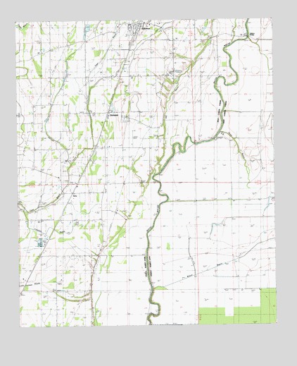
Kilbourne, LA USGS Topographic Map
Click on map above to begin viewing in our Map Viewer.

This topographic map contains these locations and features:
Feature Name Type Latitude Longitude GNIS ID View Map
Ashton BridgeBridgeN32.9929°W91.2621°540624View Map
Bethlehem ChurchChurchN32.9076°W91.3343°532996View Map
Bloomshade ChurchChurchN32.9948°W91.3343°533230View Map
ChickasawPopulated PlaceN32.9626°W91.3309°543082View Map
Church of ChristChurchN32.9621°W91.3465°540776View Map
Coleman BayouStreamN32.9240°W91.3723°534034View Map
Concord Volunteer Fire Department Oak Grove StationBuildingN32.9342°W91.3458°2673019View Map
Hill BayouStreamN32.9386°W91.3049°50107View Map
Hill ChurchChurchN32.9485°W91.3668°535671View Map
Hill School (historical)SchoolN32.9479°W91.3665°548779View Map
KilbournePopulated PlaceN32.9996°W91.3151°543353View Map
Kilbourne High SchoolSchoolN32.9982°W91.3196°548780View Map
Kilbourne Post OfficePost OfficeN32.9982°W91.3115°1630846View Map
Kilbourne Village Police DepartmentBuildingN32.9950°W91.3161°2755230View Map
Kilbourne Volunteer Fire DepartmentBuildingN32.9982°W91.3148°2672823View Map
Locust Grove ChurchChurchN32.9237°W91.3737°536653View Map
Parish Governing Authority District DCivilN32.8776°W91.3505°1930317View Map
TerryPopulated PlaceN32.9296°W91.3487°543720View Map
Terry Post OfficePost OfficeN32.9329°W91.3457°1630851View Map
Three BayouStreamN32.9540°W91.2762°539904View Map
Village of KilbourneCivilN32.9972°W91.3139°2407485View Map
Ward FiveCivilN32.9721°W91.3515°545277View Map
Wilson BayouStreamN32.8901°W91.3098°540478View Map

Note: Coordinates in the location and feature list above are referenced to NAD83 datum.


Copyright (C) 2008-2024 Ryan Niemi / Sunset Dynamics ... All Rights Reserved