TopoQuest Logo
Do you find TopoQuest useful?
Help keep TopoQuest running and adding new maps/features by donating!
Bitcoin:  19c7KJd3qBynnjoSw5npx9KScwjBe4ifkT
Litecoin:  LXs6TkuXGGXo1vDsWCkWVdjQX94eUKd6ui
Home View Maps Find Maps Find Places Resources & Links


Bennet, Nebraska Topographic Map

USGS Map Title: Bennet, NE
USGS Map MRC: 40096F5
DRG (GeoTIFF) Download: o40096f5.tif


Neighboring USGS Topographic Map Quads:


  Lincoln, NE  
40096G6
 

  Walton, NE  
40096G5
 

  Eagle, NE  
40096G4
 

  Roca, NE  
40096F6
 

  Bennet, NE  
40096F5
 

  Palmyra, NE  
40096F4
 

  Cortland, NE  
40096E6
 

  Firth, NE  
40096E5
 

  Douglas, NE  
40096E4


Map MRC Location:

N41°
W97°
N41°
W96°
H8 H7 H6 H5 H4 H3 H2 H1
G8 G7 G6 G5 G4 G3 G2 G1
F8 F7 F6 F5 F4 F3 F2 F1
E8 E7 E6 E5 E4 E3 E2 E1
D8 D7 D6 D5 D4 D3 D2 D1
C8 C7 C6 C5 C4 C3 C2 C1
B8 B7 B6 B5 B4 B3 B2 B1
A8 A7 A6 A5 A4 A3 A2 A1
N40°
W97°
N40°
W96°

Bennet, NE USGS 1:24K Topographic Map Preview:
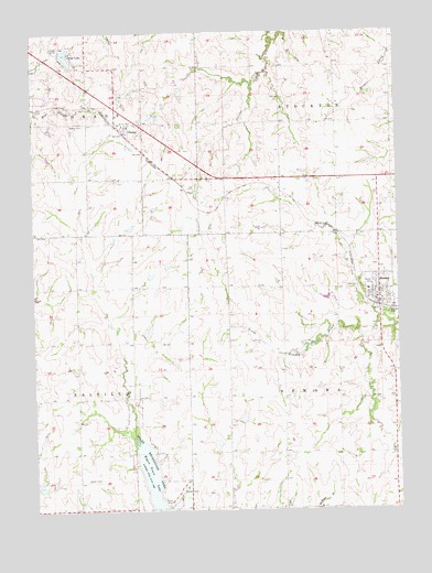
Bennet, NE USGS Topographic Map
Click on map above to begin viewing in our Map Viewer.

This topographic map contains these locations and features:
Feature Name Type Latitude Longitude GNIS ID View Map
BennetLocaleN40.6778°W96.5070°1899253View Map
BennetPopulated PlaceN40.6800°W96.5064°827321View Map
Bennet Community ChurchChurchN40.6800°W96.5064°1899251View Map
Bennet Fire and RescueBuildingN40.6801°W96.5056°2553360View Map
Bennet Post OfficePost OfficeN40.6798°W96.5080°1899280View Map
CheneyLocaleN40.7236°W96.5942°1899055View Map
CheneyPopulated PlaceN40.7256°W96.5961°828111View Map
Cheney CemeteryCemeteryN40.7258°W96.6070°828112View Map
Cheney Post Office (historical)Post OfficeN40.7256°W96.5961°1899056View Map
Cheney Public SchoolSchoolN40.7258°W96.5942°1899148View Map
Edenton South ParkParkN40.7486°W96.6197°1899312View Map
Farmers Co-op ElevatorLocaleN40.6800°W96.5064°1899252View Map
Grant Election PrecinctCivilN40.7133°W96.5964°1928917View Map
Harlan ReservoirReservoirN40.6313°W96.6235°1767763View Map
Hidden Valley Golf CourseLocaleN40.7375°W96.5753°1899030View Map
Jensen ParkParkN40.7261°W96.6058°1899315View Map
KEZG-FM (Lincoln)TowerN40.7272°W96.6139°837409View Map
Kuhn DamDamN40.6837°W96.5381°1770154View Map
Kuhn ReservoirReservoirN40.6843°W96.5383°1770155View Map
Mueller FieldAirportN40.6532°W96.6213°837697View Map
Nebraska Heart HospitalHospitalN40.7365°W96.5934°2578146View Map
Nemaha Election PrecinctCivilN40.6537°W96.5180°1929086View Map
Pine LakePopulated PlaceN40.7444°W96.6120°832112View Map
Pine Lake DamDamN40.7450°W96.6153°1767774View Map
Pine Lake Golf CourseLocaleN40.7439°W96.6067°1899033View Map
Pine Lake ReservoirReservoirN40.7439°W96.6131°1767775View Map
Saint Michael Catholic ChurchChurchN40.7261°W96.5953°1899054View Map
Salt Creek 9-3 DamDamN40.6517°W96.5836°1767734View Map
Salt Creek Dam 19-BDamN40.6983°W96.5936°1767760View Map
Salt Creek Dam 8-ADamN40.6417°W96.5620°1767758View Map
Salt Creek Dam 8-BDamN40.6483°W96.5553°1767740View Map
Salt Creek Dam 9-ADamN40.6700°W96.5870°1767768View Map
Salt Creek Reservoir 19-BReservoirN40.6989°W96.5918°1767761View Map
Salt Creek Reservoir 8-AReservoirN40.6423°W96.5626°1767759View Map
Salt Creek Reservoir 8-BReservoirN40.6486°W96.5539°1767741View Map
Salt Creek Reservoir 9-3ReservoirN40.6526°W96.5819°1767735View Map
Salt Creek Reservoir 9-AReservoirN40.6712°W96.5868°1767769View Map
Southeast Rural Fire District - Pine Lake StationBuildingN40.7412°W96.6143°2553252View Map
Stewart Field Airport (historical)AirportN40.6938°W96.5776°837494View Map
Stockton Election PrecinctCivilN40.7406°W96.5158°1929321View Map
Township of GrantCivilN40.7389°W96.6247°1899199View Map
Township of NemahaCivilN40.6528°W96.5031°1899125View Map
Township of SaltilloCivilN40.6528°W96.6247°1899198View Map
Township of StocktonCivilN40.7389°W96.5031°1899197View Map
Upper Salt Creek Dam 36-1DamN40.6883°W96.5803°1769190View Map
Upper Salt Creek Reservoir 36-1ReservoirN40.6886°W96.5793°1769191View Map
Village of BennetCivilN40.6818°W96.5040°2398094View Map
Wagon Train LakeReservoirN40.6312°W96.5852°834419View Map
Wagon Train Lake State Recreation AreaParkN40.6333°W96.5842°1898573View Map

Note: Coordinates in the location and feature list above are referenced to NAD83 datum.


Copyright (C) 2008-2024 Ryan Niemi / Sunset Dynamics ... All Rights Reserved