TopoQuest Logo
Do you find TopoQuest useful?
Help keep TopoQuest running and adding new maps/features by donating!
Bitcoin:  19c7KJd3qBynnjoSw5npx9KScwjBe4ifkT
Litecoin:  LXs6TkuXGGXo1vDsWCkWVdjQX94eUKd6ui
Home View Maps Find Maps Find Places Resources & Links


Oxford Junction, Iowa Topographic Map

USGS Map Title: Oxford Junction, IA
USGS Map MRC: 41090H8
DRG (GeoTIFF) Download: o41090h8.tif


Neighboring USGS Topographic Map Quads:


  Wyoming West, IA  
42091A1
 

  Wyoming East, IA  
42090A8
 

  Baldwin, IA  
42090A7
 

  Clarence, IA  
41091H1
 

  Oxford Junction, IA  
41090H8
 

  Lost Nation, IA  
41090H7
 

  Tipton East, IA  
41091G1
 

  Lowden, IA  
41090G8
 

  Wheatland, IA  
41090G7


Map MRC Location:

N42°
W91°
N42°
W90°
H8 H7 H6 H5 H4 H3 H2 H1
G8 G7 G6 G5 G4 G3 G2 G1
F8 F7 F6 F5 F4 F3 F2 F1
E8 E7 E6 E5 E4 E3 E2 E1
D8 D7 D6 D5 D4 D3 D2 D1
C8 C7 C6 C5 C4 C3 C2 C1
B8 B7 B6 B5 B4 B3 B2 B1
A8 A7 A6 A5 A4 A3 A2 A1
N41°
W91°
N41°
W90°

Oxford Junction, IA USGS 1:24K Topographic Map Preview:
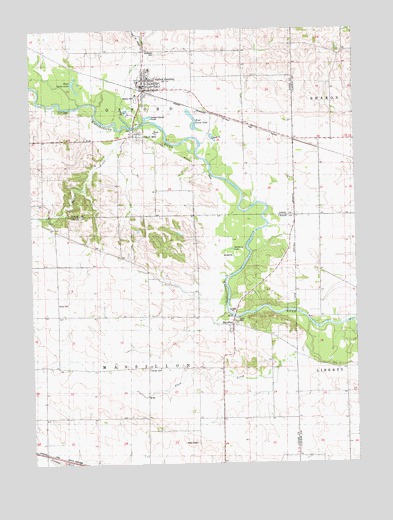
Oxford Junction, IA USGS Topographic Map
Click on map above to begin viewing in our Map Viewer.

This topographic map contains these locations and features:
Feature Name Type Latitude Longitude GNIS ID View Map
Assembly of God ChurchChurchN41.9836°W90.9535°2001835View Map
Benjamin Fraseur Log Cabin (historical)BuildingN41.9161°W90.9218°2001685View Map
Bennet LakeReservoirN41.9131°W90.9193°463498View Map
Bennet Lake DamDamN41.9131°W90.9193°463499View Map
Brink CemeteryCemeteryN41.9214°W90.9900°454829View Map
Bryan CreekStreamN41.9731°W90.9565°2676198View Map
Bullhead LakeLakeN41.9368°W90.9227°454976View Map
Center CemeteryCemeteryN41.9022°W90.9551°455272View Map
City of Oxford JunctionCivilN41.9837°W90.9541°2396119View Map
Diamond Community ChurchChurchN41.9156°W90.9215°2001686View Map
East Goose LakeLakeN41.9722°W90.9377°456155View Map
MassillonPopulated PlaceN41.9147°W90.9226°458853View Map
Massillon (historical)LocaleN41.9153°W90.9232°2001683View Map
Massillon Area ParkParkN41.9161°W90.9218°2001684View Map
Massillon CemeteryCemeteryN41.9153°W90.9210°2001687View Map
Massillon Post Office (historical)Post OfficeN41.9153°W90.9232°2001682View Map
Mayflower CemeteryCemeteryN41.9936°W90.9496°458866View Map
Midland Elementary SchoolSchoolN41.9887°W90.9537°2001837View Map
Midland Intermediate SchoolSchoolN41.9861°W90.9540°2001836View Map
Mill CreekStreamN41.9720°W90.9629°459088View Map
Oxford JunctionPopulated PlaceN41.9836°W90.9563°459977View Map
Oxford Junction (historical)LocaleN41.9828°W90.9557°2001832View Map
Oxford Junction CemeteryCemeteryN41.9765°W90.9857°2001877View Map
Oxford Junction City HallBuildingN41.9839°W90.9557°2001829View Map
Oxford Junction Post OfficePost OfficeN41.9834°W90.9546°2001828View Map
Oxford Junction Volunteer Fire DepartmentBuildingN41.9831°W90.9546°2001827View Map
Oxford MillsPopulated PlaceN41.9703°W90.9599°459978View Map
Oxford Mills (historical)LocaleN41.9703°W90.9599°2001793View Map
Oxford Mills Post Office (historical)Post OfficeN41.9703°W90.9599°2001792View Map
Plum CreekStreamN41.9161°W90.8935°460327View Map
Saint Marks Lutheran ChurchChurchN41.9859°W90.9563°2001834View Map
Township of MassillonCivilN41.9042°W90.9579°468368View Map
Township of OxfordCivilN41.9902°W90.9567°468492View Map
United Methodist ChurchChurchN41.9845°W90.9546°2001833View Map
Wapsie ParkParkN41.9806°W90.9585°1825065View Map
West Goose LakeLakeN41.9831°W90.9826°462861View Map
Wregie Memorial LibraryBuildingN41.9839°W90.9557°2001830View Map

Note: Coordinates in the location and feature list above are referenced to NAD83 datum.


Copyright (C) 2008-2024 Ryan Niemi / Sunset Dynamics ... All Rights Reserved