TopoQuest Logo
Do you find TopoQuest useful?
Help keep TopoQuest running and adding new maps/features by donating!
Bitcoin:  19c7KJd3qBynnjoSw5npx9KScwjBe4ifkT
Litecoin:  LXs6TkuXGGXo1vDsWCkWVdjQX94eUKd6ui
Home View Maps Find Maps Find Places Resources & Links


Berry, Kentucky Topographic Map

USGS Map Title: Berry, KY
USGS Map MRC: 38084E4
DRG (GeoTIFF) Download: o38084e4.tif


Neighboring USGS Topographic Map Quads:


  Williamstown, KY  
38084F5
 

  Goforth, KY  
38084F4
 

  Falmouth, KY  
38084F3
 

  Mason, KY  
38084E5
 

  Berry, KY  
38084E4
 

  Kelat, KY  
38084E3
 

  Sadieville, KY  
38084D5
 

  Breckinridge, KY  
38084D4
 

  Cynthiana, KY  
38084D3


Map MRC Location:

N39°
W85°
N39°
W84°
H8 H7 H6 H5 H4 H3 H2 H1
G8 G7 G6 G5 G4 G3 G2 G1
F8 F7 F6 F5 F4 F3 F2 F1
E8 E7 E6 E5 E4 E3 E2 E1
D8 D7 D6 D5 D4 D3 D2 D1
C8 C7 C6 C5 C4 C3 C2 C1
B8 B7 B6 B5 B4 B3 B2 B1
A8 A7 A6 A5 A4 A3 A2 A1
N38°
W85°
N38°
W84°

Berry, KY USGS 1:24K Topographic Map Preview:
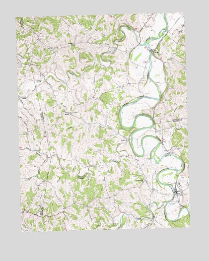
Berry, KY USGS Topographic Map
Click on map above to begin viewing in our Map Viewer.

This topographic map contains these locations and features:
Feature Name Type Latitude Longitude GNIS ID View Map
Beagle School (historical)SchoolN38.5137°W84.4503°2564157View Map
BerryPopulated PlaceN38.5206°W84.3844°486911View Map
Berry Fire DepartmentBuildingN38.5204°W84.3844°2636724View Map
Berry Railroad Station (historical)LocaleN38.5206°W84.3842°2564159View Map
BoydPopulated PlaceN38.5506°W84.3941°487760View Map
Boyd Post Office (historical)Post OfficeN38.5511°W84.3936°2564161View Map
Boyd Railroad Station (historical)LocaleN38.5508°W84.3936°2564162View Map
Boyer ChurchChurchN38.5565°W84.3941°487778View Map
Branch Post Office (historical)Post OfficeN38.5514°W84.4191°2564163View Map
Callensville (historical)Populated PlaceN38.6061°W84.4113°2564234View Map
Callensville Post Office (historical)Post OfficeN38.6139°W84.4088°2564235View Map
City of BerryCivilN38.5205°W84.3836°2403861View Map
ColemansvillePopulated PlaceN38.5279°W84.4069°489827View Map
Colemansville Post Office (historical)Post OfficeN38.5278°W84.4083°2564171View Map
Conway School (historical)SchoolN38.5280°W84.4076°2564176View Map
Coopertown CreekStreamN38.5873°W84.4847°490067View Map
Crooked CreekStreamN38.5584°W84.4183°490380View Map
Crooked Creek ChurchChurchN38.5681°W84.4622°490385View Map
Dunaway Post Office (historical)Post OfficeN38.5114°W84.4677°2564180View Map
Dunn CemeteryCemeteryN38.5028°W84.4952°491324View Map
DurbintownPopulated PlaceN38.5515°W84.4194°507894View Map
Ezra (historical)Populated PlaceN38.6181°W84.4877°2564247View Map
Ezra Post Office (historical)Post OfficeN38.6182°W84.4882°2564248View Map
Fork Lick (historical)LocaleN38.6171°W84.3901°2564252View Map
Fork Lick CreekStreamN38.6081°W84.4041°492338View Map
Gum Lick ChurchChurchN38.6059°W84.4744°493485View Map
Gum Lick Church CemeteryCemeteryN38.6063°W84.4748°2564222View Map
Gum Lick Spring (historical)LocaleN38.5945°W84.4333°2564223View Map
Harrison County Volunteer Fire Department HeadquartersBuildingN38.5209°W84.3845°2637108View Map
Jacks BranchStreamN38.5581°W84.4258°495088View Map
John Hardy BranchStreamN38.5342°W84.4341°495327View Map
Johnson Post Office (historical)Post OfficeN38.6085°W84.4044°2564273View Map
Little Fork Lick CreekStreamN38.6056°W84.4266°496736View Map
Long BranchStreamN38.5056°W84.4036°497081View Map
Low Branch Fork Lick CreekStreamN38.5886°W84.4553°2564282View Map
MarcusPopulated PlaceN38.5681°W84.4641°508540View Map
Marcus Post Office (historical)Post OfficeN38.5681°W84.4637°2564286View Map
Monday BranchStreamN38.5606°W84.3799°498479View Map
MorganPopulated PlaceN38.6028°W84.3988°498582View Map
Morgan CemeteryCemeteryN38.5967°W84.4027°498589View Map
Morgan Post Office (historical)Post OfficeN38.6028°W84.3987°2564292View Map
Morgan Railroad Station (historical)LocaleN38.6026°W84.3987°2564293View Map
Mount Pleasant School (historical)SchoolN38.5765°W84.4470°2564300View Map
Mouth of Raven Post Office (historical)Post OfficeN38.5129°W84.3919°2564107View Map
Mud Lick BranchStreamN38.5329°W84.3838°499004View Map
North Fork Raven CreekStreamN38.5070°W84.4261°499563View Map
Oak Hill Farm (historical)LocaleN38.5253°W84.3797°2564108View Map
Orange Grove (historical)LocaleN38.6188°W84.4889°2564306View Map
Pythian Grove CemeteryCemeteryN38.5220°W84.4002°501472View Map
Ramey BranchStreamN38.5348°W84.4622°501551View Map
Raven CreekStreamN38.5148°W84.3916°501604View Map
Roanoke CemeteryCemeteryN38.6086°W84.4571°2564318View Map
Roanoke ChurchChurchN38.6076°W84.4580°502034View Map
Roanoke School (historical)SchoolN38.6083°W84.4581°2564319View Map
Robinson CemeteryCemeteryN38.5012°W84.4938°502087View Map
Scaffold Lick CreekStreamN38.5423°W84.4783°503031View Map
Shinkle CreekStreamN38.5970°W84.4958°503393View Map
Snake Lick CreekStreamN38.5467°W84.3983°503841View Map
Thompson CemeteryCemeteryN38.5148°W84.4841°505200View Map
Thompson School (historical)SchoolN38.5506°W84.4390°2564324View Map
Whitehead Colemans Broad Ford Mill (historical)LocaleN38.5494°W84.3948°2564147View Map

Note: Coordinates in the location and feature list above are referenced to NAD83 datum.


Copyright (C) 2008-2024 Ryan Niemi / Sunset Dynamics ... All Rights Reserved