TopoQuest Logo
Do you find TopoQuest useful?
Help keep TopoQuest running and adding new maps/features by donating!
Bitcoin:  19c7KJd3qBynnjoSw5npx9KScwjBe4ifkT
Litecoin:  LXs6TkuXGGXo1vDsWCkWVdjQX94eUKd6ui
Home View Maps Find Maps Find Places Resources & Links


Pisgah, Iowa Topographic Map

USGS Map Title: Pisgah, IA
USGS Map MRC: 41095G8
DRG (GeoTIFF) Download: o41095g8.tif


Neighboring USGS Topographic Map Quads:


  Blencoe, IA  
41096H1
 

  Moorhead NW, IA  
41095H8
 

  Moorhead, IA  
41095H7
 

  Little Sioux, IA  
41096G1
 

  Pisgah, IA  
41095G8
 

  Moorhead SE, IA  
41095G7
 

  Mondamin, IA  
41096F1
 

  Missouri Valley NW, IA  
41095F8
 

  Logan, IA  
41095F7


Map MRC Location:

N42°
W96°
N42°
W95°
H8 H7 H6 H5 H4 H3 H2 H1
G8 G7 G6 G5 G4 G3 G2 G1
F8 F7 F6 F5 F4 F3 F2 F1
E8 E7 E6 E5 E4 E3 E2 E1
D8 D7 D6 D5 D4 D3 D2 D1
C8 C7 C6 C5 C4 C3 C2 C1
B8 B7 B6 B5 B4 B3 B2 B1
A8 A7 A6 A5 A4 A3 A2 A1
N41°
W96°
N41°
W95°

Pisgah, IA USGS 1:24K Topographic Map Preview:
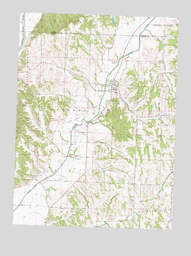
Pisgah, IA USGS Topographic Map
Click on map above to begin viewing in our Map Viewer.

This topographic map contains these locations and features:
Feature Name Type Latitude Longitude GNIS ID View Map
City of PisgahCivilN41.8304°W95.9264°2396216View Map
Cobb CreekStreamN41.8367°W95.9303°455504View Map
Fountainbleau CemeteryCemeteryN41.8296°W95.9966°1982126View Map
Loess Hills State ForestForestN41.8083°W95.9170°1982093View Map
Loess Hills State Forest Service OfficeBuildingN41.8318°W95.9278°2577344View Map
OrsonPopulated PlaceN41.7794°W95.9833°464685View Map
Orson (historical)LocaleN41.7794°W95.9833°1981982View Map
Orson Post Office (historical)Post OfficeN41.7794°W95.9833°1981983View Map
PisgahPopulated PlaceN41.8314°W95.9256°460192View Map
Pisgah City HallBuildingN41.8314°W95.9256°1982056View Map
Pisgah Fire DepartmentBuildingN41.8312°W95.9254°1982028View Map
Pisgah Methodist ChurchChurchN41.8344°W95.9256°1982030View Map
Pisgah Post OfficePost OfficeN41.8319°W95.9267°1982029View Map
Reorganized Church of Jesus Christ of Latter Day SaintsChurchN41.8325°W95.9253°1982032View Map
Soldier ValleyLocaleN41.7903°W95.9525°466152View Map
Soldier Valley (historical)LocaleN41.7911°W95.9642°1981984View Map
Soldier Valley CemeteryCemeteryN41.7916°W95.9548°461746View Map
Soldier Valley Post Office (historical)Post OfficeN41.7903°W95.9525°1981981View Map
Stowe CreekStreamN41.8672°W95.9022°462021View Map
Township of JacksonCivilN41.8125°W95.9522°468102View Map
United Pentecostal ChurchChurchN41.8319°W95.9247°1982031View Map

Note: Coordinates in the location and feature list above are referenced to NAD83 datum.


Copyright (C) 2008-2024 Ryan Niemi / Sunset Dynamics ... All Rights Reserved