TopoQuest Logo
Do you find TopoQuest useful?
Help keep TopoQuest running and adding new maps/features by donating!
Bitcoin:  19c7KJd3qBynnjoSw5npx9KScwjBe4ifkT
Litecoin:  LXs6TkuXGGXo1vDsWCkWVdjQX94eUKd6ui
Home View Maps Find Maps Find Places Resources & Links


Missouri Valley NW, Iowa Topographic Map

USGS Map Title: Missouri Valley NW, IA
USGS Map MRC: 41095F8
DRG (GeoTIFF) Download: o41095f8.tif


Neighboring USGS Topographic Map Quads:


  Little Sioux, IA  
41096G1
 

  Pisgah, IA  
41095G8
 

  Moorhead SE, IA  
41095G7
 

  Mondamin, IA  
41096F1
 

  Missouri Valley NW, IA  
41095F8
 

  Logan, IA  
41095F7
 

  Modale, IA  
41096E1
 

  Missouri Valley, IA  
41095E8
 

  Beebeetown, IA  
41095E7


Map MRC Location:

N42°
W96°
N42°
W95°
H8 H7 H6 H5 H4 H3 H2 H1
G8 G7 G6 G5 G4 G3 G2 G1
F8 F7 F6 F5 F4 F3 F2 F1
E8 E7 E6 E5 E4 E3 E2 E1
D8 D7 D6 D5 D4 D3 D2 D1
C8 C7 C6 C5 C4 C3 C2 C1
B8 B7 B6 B5 B4 B3 B2 B1
A8 A7 A6 A5 A4 A3 A2 A1
N41°
W96°
N41°
W95°

Missouri Valley NW, IA USGS 1:24K Topographic Map Preview:
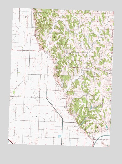
Missouri Valley NW, IA USGS Topographic Map
Click on map above to begin viewing in our Map Viewer.

This topographic map contains these locations and features:
Feature Name Type Latitude Longitude GNIS ID View Map
Bigler's Grove Post Office (historical)Post OfficeN41.7389°W95.9031°1981973View Map
CalhounPopulated PlaceN41.6317°W95.8953°455050View Map
Calhoun CemeteryCemeteryN41.6392°W95.8942°455051View Map
Calhoun Post Office (historical)Post OfficeN41.6317°W95.8953°1981990View Map
East Soldier DitchCanalN41.7230°W95.9770°456201View Map
EchoPopulated PlaceN41.7419°W95.9417°464198View Map
Echo Post Office (historical)Post OfficeN41.7472°W95.9417°1981991View Map
MagnoliaPopulated PlaceN41.6958°W95.8767°458733View Map
Magnolia CemeteryCemeteryN41.6903°W95.8803°458734View Map
Magnolia Post Office (historical)Post OfficeN41.6958°W95.8767°1981992View Map
Melrose Post Office (historical)Post OfficeN41.6736°W95.9336°1981994View Map
Nelson DitchCanalN41.6830°W95.9850°459453View Map
Raglan Post Office (historical)Post OfficeN41.7111°W95.9170°1981993View Map
Sawmill Hollow Wildlife AreaParkN41.6500°W95.9086°1982150View Map
Steer CreekStreamN41.6742°W95.9553°461981View Map
Township of RaglanCivilN41.7288°W95.9515°468586View Map
Township of TaylorCivilN41.6484°W95.9680°468785View Map
Vaile Wetland Nature AreaParkN41.6417°W95.9586°1981961View Map
West Soldier DitchCanalN41.6947°W95.9920°462915View Map

Note: Coordinates in the location and feature list above are referenced to NAD83 datum.


Copyright (C) 2008-2024 Ryan Niemi / Sunset Dynamics ... All Rights Reserved