TopoQuest Logo
Do you find TopoQuest useful?
Help keep TopoQuest running and adding new maps/features by donating!
Bitcoin:  19c7KJd3qBynnjoSw5npx9KScwjBe4ifkT
Litecoin:  LXs6TkuXGGXo1vDsWCkWVdjQX94eUKd6ui
Home View Maps Find Maps Find Places Resources & Links


Plum City, Wisconsin Topographic Map

USGS Map Title: Plum City, WI
USGS Map MRC: 44092F2
DRG (GeoTIFF) Download: o44092f2.tif


Neighboring USGS Topographic Map Quads:


  El Paso, WI  
44092G3
 

  Spring Valley, WI  
44092G2
 

  Weston, WI  
44092G1
 

  Waverly, WI  
44092F3
 

  Plum City, WI  
44092F2
 

  Arkansaw, WI  
44092F1
 

  Maiden Rock, WI  
44092E3
 

  Nerike Hill, WI  
44092E2
 

  Ella, WI  
44092E1


Map MRC Location:

N45°
W93°
N45°
W92°
H8 H7 H6 H5 H4 H3 H2 H1
G8 G7 G6 G5 G4 G3 G2 G1
F8 F7 F6 F5 F4 F3 F2 F1
E8 E7 E6 E5 E4 E3 E2 E1
D8 D7 D6 D5 D4 D3 D2 D1
C8 C7 C6 C5 C4 C3 C2 C1
B8 B7 B6 B5 B4 B3 B2 B1
A8 A7 A6 A5 A4 A3 A2 A1
N44°
W93°
N44°
W92°

Plum City, WI USGS 1:24K Topographic Map Preview:
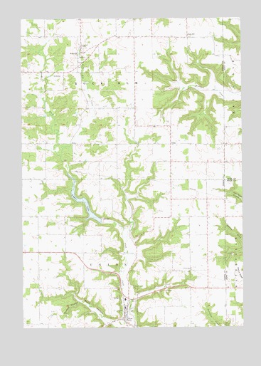
Plum City, WI USGS Topographic Map
Click on map above to begin viewing in our Map Viewer.

This topographic map contains these locations and features:
Feature Name Type Latitude Longitude GNIS ID View Map
0.46 ReservoirReservoirN44.6600°W92.1552°1793636View Map
2 ReservoirReservoirN44.6866°W92.1902°1792383View Map
Clipperdale School (historical)SchoolN44.6691°W92.1557°1578310View Map
Corner View School (historical)SchoolN44.6991°W92.1957°1578313View Map
ExilePopulated PlaceN44.6991°W92.1657°1577593View Map
Farm HillLocaleN44.7425°W92.1563°1564858View Map
Farm Hill Catholic CemeteryCemeteryN44.7433°W92.1563°1964273View Map
Gilles G 9016 DamDamN44.6600°W92.1552°1793635View Map
Gilles School (historical)SchoolN44.6402°W92.1546°1578329View Map
Maiden Rock - Plum City - Stockholm Emergency Medical ServicesBuildingN44.6289°W92.1894°2698426View Map
Nugget LakeReservoirN44.6690°W92.2148°1570578View Map
Nugget Lake 18ReservoirN44.6773°W92.2197°1792385View Map
Plum CityPopulated PlaceN44.6291°W92.1924°1571686View Map
Plum City - Township of Union Fire DepartmentBuildingN44.6289°W92.1894°2697809View Map
Plum City Elementary SchoolSchoolN44.6331°W92.1922°2715814View Map
Plum City High SchoolSchoolN44.6363°W92.1921°2715665View Map
Plum City Trailer CourtPopulated PlaceN44.6275°W92.2008°2611799View Map
Plum City Union CemeteryCemeteryN44.6411°W92.1895°1571687View Map
Plum Creek 2 E4499 DamDamN44.6683°W92.2068°1792384View Map
Plum Creek 3 E4499 DamDamN44.6866°W92.1902°1792382View Map
Plum Creek Woods State Natural AreaParkN44.6606°W92.1700°2063297View Map
Poplar Grove School (historical)SchoolN44.6586°W92.1868°1578358View Map
Poplar Hill CemeteryCemeteryN44.7380°W92.2130°1571772View Map
Rock ElmPopulated PlaceN44.7366°W92.2166°1572442View Map
Rock Elm CreekStreamN44.6950°W92.2291°1572443View Map
Rush CouleeValleyN44.6273°W92.1922°1572732View Map
Town of Rock ElmCivilN44.7282°W92.1960°1584053View Map
Town of UnionCivilN44.6414°W92.1958°1584312View Map
Tripple Hill School (historical)SchoolN44.7322°W92.1852°1578371View Map
Union School (historical)SchoolN44.6625°W92.2407°1578372View Map
Village of Plum CityCivilN44.6338°W92.1919°1583943View Map
Wildcat CouleeValleyN44.6353°W92.2185°1576736View Map

Note: Coordinates in the location and feature list above are referenced to NAD83 datum.


Copyright (C) 2008-2024 Ryan Niemi / Sunset Dynamics ... All Rights Reserved