TopoQuest Logo
Do you find TopoQuest useful?
Help keep TopoQuest running and adding new maps/features by donating!
Bitcoin:  19c7KJd3qBynnjoSw5npx9KScwjBe4ifkT
Litecoin:  LXs6TkuXGGXo1vDsWCkWVdjQX94eUKd6ui
Home View Maps Find Maps Find Places Resources & Links


Maiden Rock, Wisconsin Topographic Map

USGS Map Title: Maiden Rock, WI
USGS Map MRC: 44092E3
DRG (GeoTIFF) Download: o44092e3.tif


Neighboring USGS Topographic Map Quads:


  Ellsworth, WI  
44092F4
 

  Waverly, WI  
44092F3
 

  Plum City, WI  
44092F2
 

  Bay City, WI  
44092E4
 

  Maiden Rock, WI  
44092E3
 

  Nerike Hill, WI  
44092E2
 

  Lake City NW, MN  
44092D4
 

  Lake City, MN  
44092D3
 

  Pepin, WI  
44092D2


Map MRC Location:

N45°
W93°
N45°
W92°
H8 H7 H6 H5 H4 H3 H2 H1
G8 G7 G6 G5 G4 G3 G2 G1
F8 F7 F6 F5 F4 F3 F2 F1
E8 E7 E6 E5 E4 E3 E2 E1
D8 D7 D6 D5 D4 D3 D2 D1
C8 C7 C6 C5 C4 C3 C2 C1
B8 B7 B6 B5 B4 B3 B2 B1
A8 A7 A6 A5 A4 A3 A2 A1
N44°
W93°
N44°
W92°

Maiden Rock, WI USGS 1:24K Topographic Map Preview:
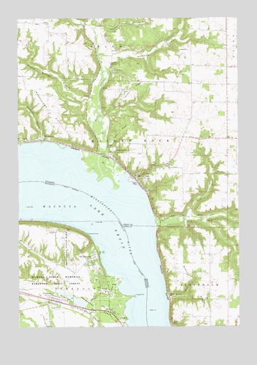
Maiden Rock, WI USGS Topographic Map
Click on map above to begin viewing in our Map Viewer.

This topographic map contains these locations and features:
Feature Name Type Latitude Longitude GNIS ID View Map
.25 ReservoirReservoirN44.6100°W92.2802°1793506View Map
1 ReservoirReservoirN44.5819°W92.2858°1793013View Map
Bremenington CouleeValleyN44.6227°W92.3359°1562174View Map
Carson RidgeRidgeN44.5794°W92.3166°1562747View Map
Christ Episcopal ChurchChurchN44.5253°W92.3361°2064949View Map
Craig Sticht H 862 DamDamN44.5816°W92.2868°1793012View Map
Crystal Springs CouleeValleyN44.5922°W92.3348°1563602View Map
Dennis Haglund G8609 DamDamN44.6100°W92.2802°1793505View Map
Episcopal CemeteryCemeteryN44.5192°W92.3294°2065020View Map
Foley BranchStreamN44.6219°W92.3293°1565096View Map
Fort Beauharnois Historical MarkerParkN44.5056°W92.3217°2065031View Map
Fort Beauharnois Wayside ParkParkN44.5056°W92.3217°2065030View Map
French Trading Posts of Lake Pepin Historical MarkerParkN44.5056°W92.3217°2065029View Map
FrontenacPopulated PlaceN44.5111°W92.3566°643972View Map
Frontenac AirportAirportN44.5058°W92.3653°660172View Map
Frontenac Census Designated PlaceCensusN44.5061°W92.3511°2628678View Map
Frontenac Post OfficePost OfficeN44.5103°W92.3517°2064946View Map
Frontenac State ParkParkN44.5075°W92.3263°643975View Map
Frontenac StationLocaleN44.5094°W92.3517°2064947View Map
Garrard BluffCliffN44.5325°W92.3349°644047View Map
Geology of Frontenac State Park Historical MarkerParkN44.5056°W92.3217°2065028View Map
Harold RidgeRidgeN44.5975°W92.3113°1566077View Map
Herbison School (historical)SchoolN44.6194°W92.2560°1578334View Map
Lake PepinLakeN44.5458°W92.3318°1571193View Map
Little Pine CreekStreamN44.5358°W92.2974°1568354View Map
Long PointCapeN44.5124°W92.3105°2761262View Map
Maiden RockPopulated PlaceN44.5608°W92.3096°1568900View Map
Maiden RockSummitN44.5011°W92.2893°1568902View Map
Maiden Rock Bluff State Natural AreaParkN44.5047°W92.2855°2061660View Map
Maiden Rock CemeteryCemeteryN44.5719°W92.3213°1568903View Map
Maiden Rock Volunteer Fire DepartmentBuildingN44.5598°W92.3088°2697794View Map
Morgan CouleeValleyN44.6104°W92.3189°1569728View Map
Morgan Coulee Prairie State Natural AreaParkN44.6131°W92.3119°2063296View Map
North Branch Pine CreekStreamN44.5441°W92.2782°1570391View Map
Old FrontenacPopulated PlaceN44.5261°W92.3321°648923View Map
Ottman LandingAirportN44.5938°W92.2582°2444138View Map
Pine CreekStreamN44.5425°W92.2977°1571438View Map
Point-no-PointCapeN44.5375°W92.3360°649610View Map
Rainbow SpringsSpringN44.6066°W92.3221°1572045View Map
Rush RiverStreamN44.5580°W92.3307°1581706View Map
Rush River Delta State Natural AreaParkN44.5656°W92.3294°2063298View Map
Saint John's Lutheran ChurchChurchN44.5122°W92.3561°2064948View Map
SalemPopulated PlaceN44.6230°W92.3574°1577809View Map
Salem Lutheran CemeteryCemeteryN44.6230°W92.3632°1964283View Map
Salem Lutheran ChurchChurchN44.6227°W92.3632°1964284View Map
Skunk HollowValleyN44.5114°W92.2899°1574251View Map
Spring BrookStreamN44.6097°W92.3290°2746843View Map
Town of StockholmCivilN44.5021°W92.2552°1584229View Map
Villa Maria AcademySchoolN44.5144°W92.3257°653657View Map
Villa Marie Academy CemeteryCemeteryN44.5133°W92.3305°2065021View Map
Village of Maiden RockCivilN44.5660°W92.3078°1583628View Map
WarrentownPopulated PlaceN44.5758°W92.3585°1576223View Map
Warrentown CouleeValleyN44.5757°W92.3619°1576224View Map
Warrentown RidgeRidgeN44.5911°W92.3574°1576225View Map
West BluffRidgeN44.5191°W92.2791°1576456View Map

Note: Coordinates in the location and feature list above are referenced to NAD83 datum.


Copyright (C) 2008-2024 Ryan Niemi / Sunset Dynamics ... All Rights Reserved