TopoQuest Logo
Do you find TopoQuest useful?
Help keep TopoQuest running and adding new maps/features by donating!
Bitcoin:  19c7KJd3qBynnjoSw5npx9KScwjBe4ifkT
Litecoin:  LXs6TkuXGGXo1vDsWCkWVdjQX94eUKd6ui
Home View Maps Find Maps Find Places Resources & Links


Bruno, Nebraska Topographic Map

USGS Map Title: Bruno, NE
USGS Map MRC: 41096C8
DRG (GeoTIFF) Download: o41096c8.tif


Neighboring USGS Topographic Map Quads:


  Schuyler, NE  
41097D1
 

  Rogers, NE  
41096D8
 

  North Bend, NE  
41096D7
 

  David City East, NE  
41097C1
 

  Bruno, NE  
41096C8
 

  Prague, NE  
41096C7
 

  Brainard, NE  
41097B1
 

  Loma, NE  
41096B8
 

  Touhy, NE  
41096B7


Map MRC Location:

N42°
W97°
N42°
W96°
H8 H7 H6 H5 H4 H3 H2 H1
G8 G7 G6 G5 G4 G3 G2 G1
F8 F7 F6 F5 F4 F3 F2 F1
E8 E7 E6 E5 E4 E3 E2 E1
D8 D7 D6 D5 D4 D3 D2 D1
C8 C7 C6 C5 C4 C3 C2 C1
B8 B7 B6 B5 B4 B3 B2 B1
A8 A7 A6 A5 A4 A3 A2 A1
N41°
W97°
N41°
W96°

Bruno, NE USGS 1:24K Topographic Map Preview:
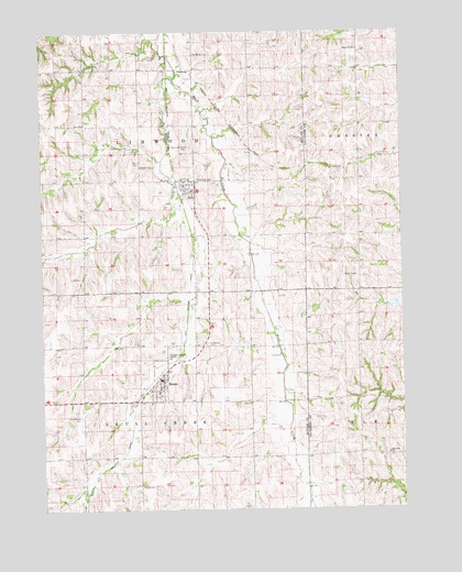
Bruno, NE USGS Topographic Map
Click on map above to begin viewing in our Map Viewer.

This topographic map contains these locations and features:
Feature Name Type Latitude Longitude GNIS ID View Map
AbiePopulated PlaceN41.3342°W96.9489°826891View Map
Abie (historical)LocaleN41.3333°W96.9525°1881470View Map
Abie Grain Company ElevatorLocaleN41.3342°W96.9489°1881466View Map
Abie Post OfficePost OfficeN41.3342°W96.9489°1881468View Map
Abie Public SchoolSchoolN41.3328°W96.9475°1881471View Map
Abie Sky Ranch (historical)AirportN41.3667°W96.9506°837464View Map
Abie Volunteer Fire DepartmentBuildingN41.3337°W96.9506°1881467View Map
Bohemian CemeteryCemeteryN41.3367°W96.9464°827542View Map
Bohemian CemeteryCemeteryN41.2933°W96.9434°827546View Map
BrunoPopulated PlaceN41.2839°W96.9586°827707View Map
Bruno (historical)LocaleN41.2856°W96.9592°1881451View Map
Bruno Co-op Grain Association ElevatorLocaleN41.2839°W96.9586°1881447View Map
Bruno Post OfficePost OfficeN41.2838°W96.9591°1881450View Map
Bruno Public SchoolSchoolN41.2853°W96.9575°1881452View Map
Bruno Volunteer Fire DepartmentBuildingN41.2782°W96.9842°1881448View Map
Cottonwood Creek Reservoir 6-DReservoirN41.3041°W96.8766°1766866View Map
Elmwood SchoolSchoolN41.2645°W96.8806°829097View Map
Fricke CemeteryCemeteryN41.2564°W96.9667°829417View Map
Jessen DamDamN41.2817°W96.8903°1767267View Map
Jessen ReservoirReservoirN41.2817°W96.8903°1767268View Map
Nimberg (historical)LocaleN41.3653°W96.9473°1881358View Map
NimburgPopulated PlaceN41.3653°W96.9473°831628View Map
Nimburg CemeteryCemeteryN41.3695°W96.9470°831629View Map
Numberg Post Office (historical)Post OfficeN41.3653°W96.9473°1881359View Map
Saint Anthony CemeteryCemeteryN41.2745°W96.9873°832835View Map
Saints Peter and Paul Catholic ChurchChurchN41.3364°W96.9489°1881469View Map
Saints Peter and Paul CemeteryCemeteryN41.3450°W96.9492°833118View Map
School Number 80SchoolN41.3703°W96.8900°837110View Map
Township of LinwoodCivilN41.3507°W96.9658°838097View Map
Township of Skull CreekCivilN41.2636°W96.9662°838257View Map
Village of AbieCivilN41.3340°W96.9495°2397906View Map
Village of BrunoCivilN41.2831°W96.9609°2397477View Map

Note: Coordinates in the location and feature list above are referenced to NAD83 datum.


Copyright (C) 2008-2024 Ryan Niemi / Sunset Dynamics ... All Rights Reserved