TopoQuest Logo
Do you find TopoQuest useful?
Help keep TopoQuest running and adding new maps/features by donating!
Bitcoin:  19c7KJd3qBynnjoSw5npx9KScwjBe4ifkT
Litecoin:  LXs6TkuXGGXo1vDsWCkWVdjQX94eUKd6ui
Home View Maps Find Maps Find Places Resources & Links


Primm Springs, Tennessee Topographic Map

USGS Map Title: Primm Springs, TN
USGS Map MRC: 35087G2
DRG (GeoTIFF) Download: o35087g2.tif


Neighboring USGS Topographic Map Quads:


  Lyles, TN  
35087H3
 

  Craigfield, TN  
35087H2
 

  Fairview, TN  
35087H1
 

  Littlelot, TN  
35087G3
 

  Primm Springs, TN  
35087G2
 

  Theta, TN  
35087G1
 

  Greenfield Bend, TN  
35087F3
 

  Williamsport, TN  
35087F2
 

  Godwin, TN  
35087F1


Map MRC Location:

N36°
W88°
N36°
W87°
H8 H7 H6 H5 H4 H3 H2 H1
G8 G7 G6 G5 G4 G3 G2 G1
F8 F7 F6 F5 F4 F3 F2 F1
E8 E7 E6 E5 E4 E3 E2 E1
D8 D7 D6 D5 D4 D3 D2 D1
C8 C7 C6 C5 C4 C3 C2 C1
B8 B7 B6 B5 B4 B3 B2 B1
A8 A7 A6 A5 A4 A3 A2 A1
N35°
W88°
N35°
W87°

Primm Springs, TN USGS 1:24K Topographic Map Preview:
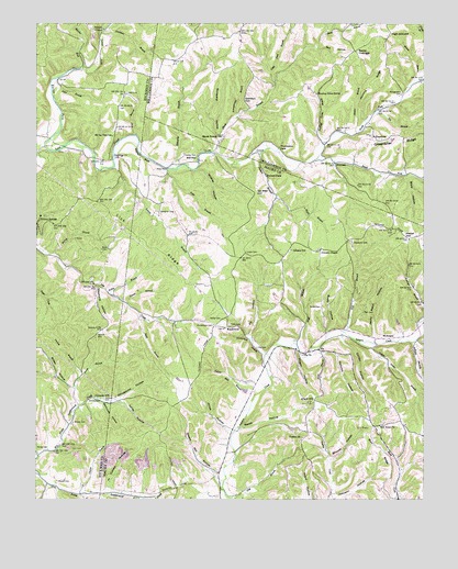
Primm Springs, TN USGS Topographic Map
Click on map above to begin viewing in our Map Viewer.

This topographic map contains these locations and features:
Feature Name Type Latitude Longitude GNIS ID View Map
Adkison BranchStreamN35.7915°W87.1289°1303419View Map
Ashworth CemeteryCemeteryN35.8176°W87.1478°1275953View Map
Badger HollowValleyN35.7511°W87.2349°1276072View Map
Baker CemeteryCemeteryN35.8156°W87.2292°1276153View Map
Barren ForkStreamN35.8428°W87.2483°1269317View Map
Beasley ChurchChurchN35.8442°W87.1550°1276682View Map
Beasley CrossroadsPopulated PlaceN35.8678°W87.1472°1314641View Map
Bibbs HollowValleyN35.7788°W87.2381°1277206View Map
Big BranchStreamN35.8520°W87.1406°1277257View Map
Black BranchStreamN35.8292°W87.1725°1277545View Map
Boneyard HollowValleyN35.8455°W87.1906°1277948View Map
Box HollowValleyN35.8684°W87.1596°1278090View Map
Brady CemeteryCemeteryN35.8006°W87.1583°1278207View Map
Brady HollowValleyN35.7937°W87.1562°1278209View Map
Brooks CemeteryCemeteryN35.7765°W87.2292°1305435View Map
Burr RidgeRidgeN35.7634°W87.1400°1279109View Map
Byrd BranchStreamN35.7984°W87.2167°1305581View Map
Byrd CemeteryCemeteryN35.7953°W87.2136°1646155View Map
Charter BranchStreamN35.7515°W87.2361°1280286View Map
Corner School (historical)SchoolN35.8434°W87.2156°1323682View Map
Daniel BranchStreamN35.8017°W87.2217°1282019View Map
Davidson BranchStreamN35.8723°W87.2297°1282095View Map
District 1 (historical)CivilN35.8001°W87.1667°1310210View Map
Dorton HollowValleyN35.7926°W87.1514°1282659View Map
Edwards BranchStreamN35.8373°W87.2075°1283543View Map
Elam BranchStreamN35.7898°W87.1603°1283587View Map
Elam HillSummitN35.7765°W87.1603°1283592View Map
Ellmore SchoolSchoolN35.7976°W87.2072°1283707View Map
Elmo School (historical)SchoolN35.7973°W87.2070°1323688View Map
FlyPopulated PlaceN35.7895°W87.1586°1284532View Map
Fly CemeteryCemeteryN35.7901°W87.1786°1284533View Map
Fly ChurchChurchN35.7881°W87.1639°1284535View Map
Fly HollowValleyN35.7931°W87.1812°1284536View Map
Forked Deer HollowValleyN35.7913°W87.1271°1284636View Map
Gardner CemeteryCemeteryN35.7717°W87.1925°1646230View Map
Gordon HillSummitN35.8555°W87.1823°1285699View Map
Goshen CemeteryCemeteryN35.7659°W87.1644°1646239View Map
Goshen ChurchChurchN35.7665°W87.1639°1306500View Map
GreenbrierPopulated PlaceN35.8451°W87.1417°1315154View Map
Greenbrier CemeteryCemeteryN35.8456°W87.1419°1321934View Map
Greenbrier School (historical)SchoolN35.8456°W87.1422°1321935View Map
Greenbrier United Methodist ChurchChurchN35.8453°W87.1411°1321936View Map
Grindstone HollowValleyN35.7766°W87.2235°1286310View Map
Hanes BranchStreamN35.7748°W87.2364°1286719View Map
Hanes CemeteryCemeteryN35.7634°W87.2461°1286720View Map
Harbison CemeteryCemeteryN35.7556°W87.1917°1646253View Map
Harris BranchStreamN35.8595°W87.1283°1286944View Map
Hastings BranchStreamN35.7981°W87.1250°1287095View Map
High GroundSummitN35.8720°W87.1363°1287695View Map
Hill BranchStreamN35.7940°W87.1506°1287779View Map
Hill TownPopulated PlaceN35.7692°W87.1414°1313226View Map
Hill Town ChurchChurchN35.7692°W87.1392°1306573View Map
Hilltown CemeteryCemeteryN35.7692°W87.1389°1646263View Map
Hogan HollowValleyN35.7892°W87.1664°1287990View Map
Hominy RidgeRidgeN35.8656°W87.1376°1288191View Map
Hunting Camp BranchStreamN35.8434°W87.1572°1288755View Map
Hunting Camp SpringSpringN35.8567°W87.1594°1288757View Map
Indian Camp BranchStreamN35.7917°W87.1470°1288938View Map
Jenny Patch HollowValleyN35.7930°W87.1408°1289388View Map
Johnson CemeteryCemeteryN35.7765°W87.2278°1289554View Map
Johnson ChapelChurchN35.8153°W87.1586°1306631View Map
Johnson HollowValleyN35.7506°W87.1529°1289612View Map
Johnson SchoolSchoolN35.8156°W87.1681°1289653View Map
Johnson-Oakley CemeteryCemeteryN35.7906°W87.1608°1646290View Map
Johnsons Chapel CemeteryCemeteryN35.8156°W87.1592°1646289View Map
Johnsons MillPopulated PlaceN35.7767°W87.2308°1315303View Map
Jones HollowValleyN35.7685°W87.1877°1289801View Map
Jones Valley CemeteryCemeteryN35.7520°W87.2364°1319091View Map
Kelley BranchStreamN35.8042°W87.2270°1289996View Map
Kelley CemeteryCemeteryN35.7973°W87.1906°1290002View Map
Kelley HollowValleyN35.7763°W87.2222°1290008View Map
KinderhookPopulated PlaceN35.7951°W87.1892°1315330View Map
Kinderhook BranchStreamN35.7876°W87.1764°1290182View Map
Kinderhook CemeteryCemeteryN35.7956°W87.1928°1290183View Map
Leatherwood (historical)Populated PlaceN35.7537°W87.2258°1313235View Map
Lick Creek (historical)Populated PlaceN35.8453°W87.2464°1311365View Map
Lick RidgeRidgeN35.8220°W87.2206°1291239View Map
Little Dam BranchStreamN35.8598°W87.1736°1291470View Map
Litton CemeteryCemeteryN35.8151°W87.1825°1291723View Map
Locust ForkStreamN35.8637°W87.2356°1291782View Map
Lucketts Chapel (historical)ChurchN35.7981°W87.2103°1323715View Map
Lunns BranchStreamN35.8373°W87.2250°1306714View Map
Mayberry (historical)Populated PlaceN35.8292°W87.2145°1313511View Map
Mayberry CemeteryCemeteryN35.8401°W87.2258°1293003View Map
McCoy BranchStreamN35.8148°W87.2445°1293199View Map
McKnightPopulated PlaceN35.7920°W87.1386°1315488View Map
McKnight CemeteryCemeteryN35.7962°W87.1386°1646461View Map
Mill SeatPopulated PlaceN35.8392°W87.2045°1315511View Map
Montgomery CemeteryCemeteryN35.8567°W87.1322°1294198View Map
Mount La View SchoolSchoolN35.8456°W87.2256°1294655View Map
Nellums HollowValleyN35.7887°W87.1573°1295364View Map
New Flys VillagePopulated PlaceN35.7890°W87.1650°1647718View Map
North Fork Lick CreekStreamN35.8398°W87.1597°1295897View Map
Oakley CemeteryCemeteryN35.8409°W87.2025°1296195View Map
Oakley CemeteryCemeteryN35.7848°W87.1789°1646487View Map
Oakley Mill BranchStreamN35.7778°W87.1792°1296197View Map
Oakley Mill CreekStreamN35.7923°W87.1803°1313519View Map
Oil Well HillSummitN35.8304°W87.1793°1296257View Map
Page BranchStreamN35.7909°W87.1661°1296646View Map
Parham ChapelChurchN35.8734°W87.2283°1296770View Map
Pennywinkle BranchStreamN35.8506°W87.1856°1297162View Map
Piner FordCrossingN35.8373°W87.2081°1315716View Map
Porters BranchStreamN35.8415°W87.1781°1306913View Map
Potts BranchStreamN35.8370°W87.2075°1298364View Map
Potts CemeteryCemeteryN35.7962°W87.1878°1298366View Map
Primm SpringsSpringN35.8244°W87.2468°1311374View Map
Puckett BranchStreamN35.7812°W87.2372°1298645View Map
Rail CemeteryCemeteryN35.7992°W87.1442°1298818View Map
Roach HollowValleyN35.7688°W87.1838°1299548View Map
Santa Fe Division (historical)CensusN35.7587°W87.1547°1648872View Map
Sewell CemeteryCemeteryN35.8001°W87.1303°1646587View Map
Shoal BranchStreamN35.8415°W87.1931°1270136View Map
Shoals Branch SchoolSchoolN35.8459°W87.1903°1303597View Map
Shop HollowValleyN35.8349°W87.1297°1270168View Map
Shouse HollowValleyN35.7600°W87.1549°1270230View Map
Simon BranchStreamN35.8465°W87.1470°1270325View Map
Slaughter CemeteryCemeteryN35.8259°W87.2108°1270487View Map
South Fork Lick CreekStreamN35.8395°W87.1597°1270874View Map
Steam Mill HollowValleyN35.7562°W87.1919°1271294View Map
Stephens HollowValleyN35.8061°W87.2304°1271340View Map
Stillhouse HollowValleyN35.7752°W87.2284°1271417View Map
Sylvan Heights SchoolSchoolN35.7762°W87.1597°1303982View Map
Tunnel HollowValleyN35.7523°W87.2275°1272985View Map
Tyler BranchStreamN35.8603°W87.2436°1273145View Map
Vestal HillSummitN35.8184°W87.1297°1273441View Map
Warf BranchStreamN35.8456°W87.2181°1273809View Map
Warf CemeteryCemeteryN35.8570°W87.2214°1273810View Map
WhiteoakPopulated PlaceN35.8384°W87.1536°1314504View Map
Wildcat HollowValleyN35.8367°W87.1982°1274543View Map
Wilson CemeteryCemeteryN35.7548°W87.2433°1274806View Map
Woody CemeteryCemeteryN35.7703°W87.2378°1275107View Map
Worley BluffCliffN35.8403°W87.2167°1275125View Map

Note: Coordinates in the location and feature list above are referenced to NAD83 datum.


Copyright (C) 2008-2024 Ryan Niemi / Sunset Dynamics ... All Rights Reserved