TopoQuest Logo
Do you find TopoQuest useful?
Help keep TopoQuest running and adding new maps/features by donating!
Bitcoin:  19c7KJd3qBynnjoSw5npx9KScwjBe4ifkT
Litecoin:  LXs6TkuXGGXo1vDsWCkWVdjQX94eUKd6ui
Home View Maps Find Maps Find Places Resources & Links


Richey, Mississippi Topographic Map

USGS Map Title: Richey, MS
USGS Map MRC: 33090A6
DRG (GeoTIFF) Download: o33090a6.tif


Neighboring USGS Topographic Map Quads:


  Hollandale, MS  
33090B7
 

  Midnight NW, MS  
33090B6
 

  Bellewood, MS  
33090B5
 

  Delta City, MS  
33090A7
 

  Richey, MS  
33090A6
 

  Midnight, MS  
33090A5
 

  Rolling Fork East, MS  
32090H7
 

  Bayland, MS  
32090H6
 

  Louise, MS  
32090H5


Map MRC Location:

N34°
W91°
N34°
W90°
H8 H7 H6 H5 H4 H3 H2 H1
G8 G7 G6 G5 G4 G3 G2 G1
F8 F7 F6 F5 F4 F3 F2 F1
E8 E7 E6 E5 E4 E3 E2 E1
D8 D7 D6 D5 D4 D3 D2 D1
C8 C7 C6 C5 C4 C3 C2 C1
B8 B7 B6 B5 B4 B3 B2 B1
A8 A7 A6 A5 A4 A3 A2 A1
N33°
W91°
N33°
W90°

Richey, MS USGS 1:24K Topographic Map Preview:
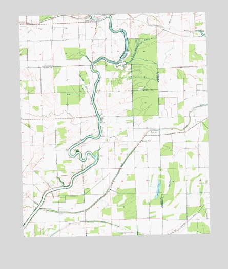
Richey, MS USGS Topographic Map
Click on map above to begin viewing in our Map Viewer.

This topographic map contains these locations and features:
Feature Name Type Latitude Longitude GNIS ID View Map
Alligator LakeLakeN33.0265°W90.6601°666230View Map
AuterPopulated PlaceN33.0429°W90.7107°711120View Map
B G Janous Pond DamDamN33.1001°W90.6301°681849View Map
B G Janous Pond DamDamN33.1085°W90.6351°681857View Map
Big BasinBasinN33.0451°W90.7007°667071View Map
BommersPopulated PlaceN33.0557°W90.6965°709217View Map
Bommers FerryCrossingN33.0571°W90.6982°667416View Map
Buck BayouStreamN33.1171°W90.6487°667719View Map
Caney BayouStreamN33.0679°W90.6990°668030View Map
De Viney BayouStreamN33.0776°W90.7023°669162View Map
Ditchlow BayouStreamN33.1246°W90.6895°669290View Map
Fish BayouStreamN33.0179°W90.7395°669975View Map
Free Negro BayouStreamN33.0973°W90.7015°670186View Map
Hughey PointCapeN33.0571°W90.6965°687110View Map
KongoPopulated PlaceN33.1179°W90.7384°687238View Map
Little BasinBasinN33.0482°W90.7143°672533View Map
Locust Grove ChurchChurchN33.0157°W90.7359°672752View Map
Long LakeLakeN33.0287°W90.6515°672837View Map
MurphyPopulated PlaceN33.1210°W90.7015°674474View Map
Murphy BayouStreamN33.1246°W90.7018°674475View Map
Murphy FerryCrossingN33.1221°W90.6979°674485View Map
Rattler BayouStreamN33.1232°W90.6637°684973View Map
RicheyPopulated PlaceN33.0301°W90.7329°676633View Map
Short Jerusalem ChurchChurchN33.1248°W90.6929°677745View Map
Straight BayouLocaleN33.0529°W90.6701°678326View Map
Straight BayouStreamN33.0162°W90.7393°678327View Map
Straight Bayou ChurchChurchN33.0582°W90.6632°678329View Map
Turkeyfoot BayouStreamN33.0285°W90.7232°678961View Map
Twin Lakes BayouStreamN33.0985°W90.6820°679007View Map
Whatley Lake DamDamN33.1018°W90.6551°681854View Map

Note: Coordinates in the location and feature list above are referenced to NAD83 datum.


Copyright (C) 2008-2024 Ryan Niemi / Sunset Dynamics ... All Rights Reserved