TopoQuest Logo
Do you find TopoQuest useful?
Help keep TopoQuest running and adding new maps/features by donating!
Bitcoin:  19c7KJd3qBynnjoSw5npx9KScwjBe4ifkT
Litecoin:  LXs6TkuXGGXo1vDsWCkWVdjQX94eUKd6ui
Home View Maps Find Maps Find Places Resources & Links


Midnight NW, Mississippi Topographic Map

USGS Map Title: Midnight NW, MS
USGS Map MRC: 33090B6
DRG (GeoTIFF) Download: o33090b6.tif


Neighboring USGS Topographic Map Quads:


  Tribbett, MS  
33090C7
 

  Kinlock, MS  
33090C6
 

  Inverness, MS  
33090C5
 

  Hollandale, MS  
33090B7
 

  Midnight NW, MS  
33090B6
 

  Bellewood, MS  
33090B5
 

  Delta City, MS  
33090A7
 

  Richey, MS  
33090A6
 

  Midnight, MS  
33090A5


Map MRC Location:

N34°
W91°
N34°
W90°
H8 H7 H6 H5 H4 H3 H2 H1
G8 G7 G6 G5 G4 G3 G2 G1
F8 F7 F6 F5 F4 F3 F2 F1
E8 E7 E6 E5 E4 E3 E2 E1
D8 D7 D6 D5 D4 D3 D2 D1
C8 C7 C6 C5 C4 C3 C2 C1
B8 B7 B6 B5 B4 B3 B2 B1
A8 A7 A6 A5 A4 A3 A2 A1
N33°
W91°
N33°
W90°

Midnight NW, MS USGS 1:24K Topographic Map Preview:
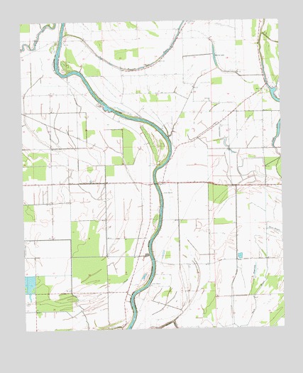
Midnight NW, MS USGS Topographic Map
Click on map above to begin viewing in our Map Viewer.

This topographic map contains these locations and features:
Feature Name Type Latitude Longitude GNIS ID View Map
Beasley BayouStreamN33.2443°W90.7295°666672View Map
Booth Lake DamDamN33.2201°W90.6468°681931View Map
Broad LakeLakeN33.1482°W90.6384°667583View Map
Central ChurchChurchN33.2321°W90.6870°668276View Map
Cochran Brothers Lake DamDamN33.2168°W90.6551°681926View Map
Cold Lake ChurchChurchN33.2173°W90.6590°668656View Map
Dave Jones Catfish Ponds DamDamN33.1835°W90.6918°681904View Map
Grant Lake DamDamN33.1785°W90.6601°681901View Map
H D Tharp Lake DamDamN33.1468°W90.6418°681876View Map
H D Tharp Pond DamDamN33.2135°W90.6734°681923View Map
H D Tharp Pond DamDamN33.2235°W90.6651°681938View Map
Herron Brothers Lake DamDamN33.2101°W90.6768°681920View Map
Lock Church (historical)ChurchN33.1854°W90.6826°684962View Map
Martin Hawkins Pond DamDamN33.1885°W90.6784°681909View Map
Martin LakeLakeN33.2357°W90.6565°673193View Map
Mills BayouStreamN33.1554°W90.6898°673654View Map
New Foundation Church (historical)ChurchN33.2082°W90.6556°684969View Map
O J Turner Third Lake DamDamN33.1568°W90.6334°681888View Map
Pickell Lake DamDamN33.1551°W90.6501°681886View Map
R B Hoke Lake DamDamN33.2151°W90.6634°681925View Map
R L Hoke Lake DamDamN33.2218°W90.6618°681936View Map
Rising Star Church (historical)ChurchN33.1643°W90.6845°684974View Map
Slater Ferry (historical)CrossingN33.2423°W90.7315°687323View Map
Sunflower ChapelChurchN33.1260°W90.7045°678413View Map
Supervisor District 2CivilN33.2072°W90.6307°711886View Map
Tisdale Lake DamDamN33.2185°W90.6551°681930View Map
Watson School (historical)SchoolN33.1332°W90.6945°684991View Map

Note: Coordinates in the location and feature list above are referenced to NAD83 datum.


Copyright (C) 2008-2024 Ryan Niemi / Sunset Dynamics ... All Rights Reserved