TopoQuest Logo
Do you find TopoQuest useful?
Help keep TopoQuest running and adding new maps/features by donating!
Bitcoin:  19c7KJd3qBynnjoSw5npx9KScwjBe4ifkT
Litecoin:  LXs6TkuXGGXo1vDsWCkWVdjQX94eUKd6ui
Home View Maps Find Maps Find Places Resources & Links


Rock House, Arizona Topographic Map

USGS Map Title: Rock House, AZ
USGS Map MRC: 33110H7
DRG (GeoTIFF) Download: o33110h7.tif


Neighboring USGS Topographic Map Quads:


  Young, AZ  
34110A8
 

  Gentry Mountain, AZ  
34110A7
 

  Oak Creek Ranch, AZ  
34110A6
 

  McFadden Peak, AZ  
33110H8
 

  Rock House, AZ  
33110H7
 

  Double Buttes, AZ  
33110H6
 

  Aztec Peak, AZ  
33110G8
 

  Sombrero Peak, AZ  
33110G7
 

  Picacho Colorado, AZ  
33110G6


Map MRC Location:

N34°
W111°
N34°
W110°
H8 H7 H6 H5 H4 H3 H2 H1
G8 G7 G6 G5 G4 G3 G2 G1
F8 F7 F6 F5 F4 F3 F2 F1
E8 E7 E6 E5 E4 E3 E2 E1
D8 D7 D6 D5 D4 D3 D2 D1
C8 C7 C6 C5 C4 C3 C2 C1
B8 B7 B6 B5 B4 B3 B2 B1
A8 A7 A6 A5 A4 A3 A2 A1
N33°
W111°
N33°
W110°

Rock House, AZ USGS 1:24K Topographic Map Preview:
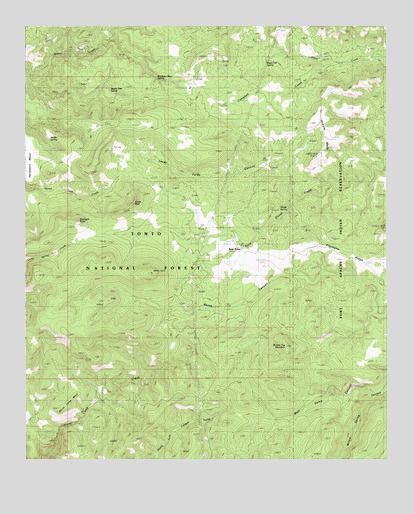
Rock House, AZ USGS Topographic Map
Click on map above to begin viewing in our Map Viewer.

This topographic map contains these locations and features:
Feature Name Type Latitude Longitude GNIS ID View Map
Asbestos SpringSpringN33.9600°W110.7923°39232View Map
Asbestos TankReservoirN33.9931°W110.8729°39233View Map
Brush Top TankReservoirN33.8987°W110.7859°39296View Map
Brushy Top MountainSummitN33.9075°W110.7859°26845View Map
Campbell CreekStreamN33.9889°W110.7660°27223View Map
Castle Butte TankReservoirN33.9378°W110.8588°39324View Map
Castle PeakSummitN33.9489°W110.8390°27348View Map
Copper Fork TankReservoirN33.8848°W110.8218°39378View Map
Cross TankReservoirN33.8913°W110.8105°39392View Map
Dead Cow SpringSpringN33.9892°W110.7923°39402View Map
Devils Playground TankReservoirN33.9459°W110.8618°39407View Map
Double ButtesSummitN33.9417°W110.7509°28549View Map
Dry Bone TankReservoirN33.8920°W110.8298°39420View Map
Duett Branch TankReservoirN33.9139°W110.8097°39427View Map
Duett TankReservoirN33.9037°W110.8032°39428View Map
Gunsight ButteSummitN33.9439°W110.8579°29631View Map
Hobble MesaSummitN33.9623°W110.7751°30001View Map
Horse CampLocaleN33.8917°W110.8523°30122View Map
Horse Camp MesaSummitN33.8923°W110.8604°41330View Map
Horse Camp Mesa TankReservoirN33.8854°W110.8705°39517View Map
Horse Camp WindmillLocaleN33.8925°W110.8501°41333View Map
Horse Canyon TankReservoirN33.9603°W110.8413°39518View Map
House SpringSpringN33.9650°W110.7848°39526View Map
Ironside Hill TankReservoirN33.9076°W110.8250°39538View Map
Juniper TankReservoirN33.8781°W110.8535°39552View Map
Lacey Forks CanyonValleyN33.9587°W110.7907°30837View Map
Lone Pine TankReservoirN33.8756°W110.8132°39574View Map
Middle Pasture TankReservoirN33.9306°W110.7898°41329View Map
Middle SpringSpringN33.9676°W110.8672°39621View Map
Middle TankReservoirN33.9630°W110.8561°39622View Map
Middle Trap SpringSpringN33.9848°W110.8579°2061039View Map
Middleton Mesa SpringSpringN33.9848°W110.8302°39624View Map
Mineral TankReservoirN33.9756°W110.8590°39632View Map
Rock HouseLocaleN33.9362°W110.8012°33713View Map
Rodgers TankReservoirN33.8995°W110.7987°41332View Map
Sidehill TankReservoirN33.9523°W110.8723°39792View Map
Skid TankReservoirN33.9784°W110.8493°39796View Map
Well Camp CanyonValleyN33.8950°W110.7559°35955View Map
Well Camp TankReservoirN33.8862°W110.7848°39876View Map

Note: Coordinates in the location and feature list above are referenced to NAD83 datum.


Copyright (C) 2008-2024 Ryan Niemi / Sunset Dynamics ... All Rights Reserved