TopoQuest Logo
Do you find TopoQuest useful?
Help keep TopoQuest running and adding new maps/features by donating!
Bitcoin:  19c7KJd3qBynnjoSw5npx9KScwjBe4ifkT
Litecoin:  LXs6TkuXGGXo1vDsWCkWVdjQX94eUKd6ui
Home View Maps Find Maps Find Places Resources & Links


Short Mountain, Tennessee Topographic Map

USGS Map Title: Short Mountain, TN
USGS Map MRC: 35085G8
DRG (GeoTIFF) Download: o35085g8.tif


Neighboring USGS Topographic Map Quads:


  Auburntown, TN  
35086H1
 

  Gassaway, TN  
35085H8
 

  Smithville, TN  
35085H7
 

  Woodbury, TN  
35086G1
 

  Short Mountain, TN  
35085G8
 

  Dibrell, TN  
35085G7
 

  Hollow Springs, TN  
35086F1
 

  Centertown, TN  
35085F8
 

  McMinnville, TN  
35085F7


Map MRC Location:

N36°
W86°
N36°
W85°
H8 H7 H6 H5 H4 H3 H2 H1
G8 G7 G6 G5 G4 G3 G2 G1
F8 F7 F6 F5 F4 F3 F2 F1
E8 E7 E6 E5 E4 E3 E2 E1
D8 D7 D6 D5 D4 D3 D2 D1
C8 C7 C6 C5 C4 C3 C2 C1
B8 B7 B6 B5 B4 B3 B2 B1
A8 A7 A6 A5 A4 A3 A2 A1
N35°
W86°
N35°
W85°

Short Mountain, TN USGS 1:24K Topographic Map Preview:
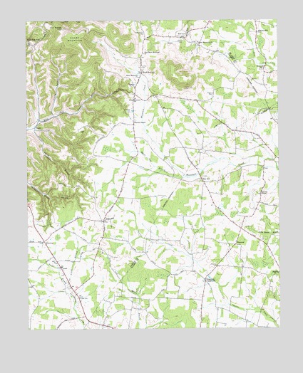
Short Mountain, TN USGS Topographic Map
Click on map above to begin viewing in our Map Viewer.

This topographic map contains these locations and features:
Feature Name Type Latitude Longitude GNIS ID View Map
Banks CemeteryCemeteryN35.8554°W85.8812°2710639View Map
Banks ChurchChurchN35.8556°W85.8817°1313845View Map
Blanton (historical)Populated PlaceN35.8326°W85.9694°1643502View Map
Blanton School (historical)SchoolN35.8306°W85.9583°1322644View Map
Blue HillPopulated PlaceN35.8103°W85.9130°1314700View Map
Blues Hill Church of ChristChurchN35.8092°W85.9119°1646732View Map
BluewingPopulated PlaceN35.7859°W85.9917°1314705View Map
Bluewing Baptist ChurchChurchN35.7853°W85.9925°1643504View Map
Bluewing Census Designated PlaceCensusN35.7923°W85.9942°2586042View Map
Bratchers CrossroadsPopulated PlaceN35.7695°W85.9117°1314726View Map
Bratchers Crossroads Free Methodist ChurchChurchN35.7701°W85.9122°1647848View Map
Center HillPopulated PlaceN35.7937°W85.9622°1280127View Map
Center Hill Baptist ChurchChurchN35.7945°W85.9625°1643522View Map
Center Hill School (historical)SchoolN35.7940°W85.9636°1643523View Map
Central View School (historical)SchoolN35.8103°W85.8830°1320523View Map
Cherry Springs School (historical)SchoolN35.7692°W85.9117°1320524View Map
Comer CemeteryCemeteryN35.8562°W85.9425°1281037View Map
Commissioner District 4CivilN35.8011°W85.9878°2464016View Map
Crane BranchStreamN35.7676°W85.9814°1281555View Map
Cross RoadsPopulated PlaceN35.8445°W85.9361°1647248View Map
DevenportPopulated PlaceN35.7517°W85.9625°1307406View Map
Dug HollowValleyN35.8452°W85.9581°1283086View Map
Eastside Elementary SchoolSchoolN35.7751°W85.9830°1643542View Map
Eastside Volunteer Fire DepartmentBuildingN35.7878°W85.9937°2654970View Map
FlatwoodPopulated PlaceN35.7840°W85.8969°1315063View Map
Flatwood CemeteryCemeteryN35.7756°W85.9064°1284451View Map
Gap of the MountainGapN35.8640°W85.9417°1643549View Map
Good CemeteryCemeteryN35.8301°W85.9733°1285611View Map
Good RidgeRidgeN35.8306°W85.9736°1643553View Map
Grizzle-Gunter CemeteryCemeteryN35.8706°W85.9414°1286329View Map
Half AcrePopulated PlaceN35.8681°W85.9222°1315175View Map
Henegar DamDamN35.8334°W85.9217°1302165View Map
Henegar LakeReservoirN35.8334°W85.9217°1302164View Map
Johnson HollowValleyN35.8309°W85.9969°1289614View Map
LeoniPopulated PlaceN35.7745°W85.9830°1315378View Map
Little Short MountainSummitN35.8517°W85.9250°1643580View Map
Mahathy Hill SchoolSchoolN35.8701°W85.8847°1313992View Map
Mason HollowValleyN35.8346°W85.9935°1643586View Map
Mason Hollow BranchStreamN35.8348°W85.9936°1643587View Map
Mason MountainSummitN35.8709°W85.9561°1643588View Map
Melton CemeteryCemeteryN35.8667°W85.9222°1293567View Map
Negro Gull (historical)Populated PlaceN35.7859°W85.9500°1643599View Map
New Short Mountain ChurchChurchN35.8615°W85.9414°1295651View Map
North Warren Volunteer Fire Department Station 3BuildingN35.8243°W85.8807°2654563View Map
Osment CemeteryCemeteryN35.8378°W85.9494°1296503View Map
Osment ChapelLocaleN35.8328°W85.9469°1296504View Map
Osment Chapel (historical)ChurchN35.8376°W85.9486°1643601View Map
Porter BranchStreamN35.7656°W85.9814°1298248View Map
Preston CemeteryCemeteryN35.8451°W85.9075°1298484View Map
Rainbow FallsFallsN35.7970°W85.9728°1643622View Map
Rainbow Falls Mill (historical)LocaleN35.7967°W85.9725°1643623View Map
Shanborne BranchStreamN35.8320°W85.9958°1301210View Map
Short MountainSummitN35.8665°W85.9758°1303609View Map
Short MountainLocaleN35.8540°W85.9428°1270206View Map
Short Mountain CampLocaleN35.8720°W85.9811°1303610View Map
Short Mountain ChurchChurchN35.8520°W85.9439°1303611View Map
Short Mountain ChurchChurchN35.8662°W85.9144°1303612View Map
Short Mountain Elementary SchoolSchoolN35.8437°W85.9461°1648152View Map
Short Mountain Volunteer Fire DepartmentBuildingN35.8445°W85.9456°2654969View Map
Stewart ChapelChurchN35.8048°W85.8844°1303836View Map
Stewart ChapelPopulated PlaceN35.8042°W85.8839°1647550View Map
Sugar Tree KnobPopulated PlaceN35.8653°W85.9958°1643642View Map
Sugar Tree Knob ChurchChurchN35.8665°W85.9989°1303904View Map
Thomas Town (historical)Populated PlaceN35.8070°W85.9767°1643650View Map
Tucker CemeteryCemeteryN35.7626°W85.9742°1272946View Map
Tuckers Chapel Methodist Church (historical)ChurchN35.8451°W85.9347°1643661View Map
Tuckers Chapel School (historical)SchoolN35.8442°W85.9347°1322656View Map
Vinson Cross RoadsLocaleN35.7903°W85.8942°1647551View Map
White Oak BranchStreamN35.8126°W85.9147°1274386View Map
Wood ChurchChurchN35.8487°W85.9469°1304658View Map
Wood School (historical)SchoolN35.8484°W85.9469°1643665View Map
WoodsPopulated PlaceN35.8456°W85.9458°1643669View Map
Young HollowValleyN35.8368°W85.9866°1275332View Map
Young Hollow BranchStreamN35.8365°W85.9867°1643670View Map

Note: Coordinates in the location and feature list above are referenced to NAD83 datum.


Copyright (C) 2008-2024 Ryan Niemi / Sunset Dynamics ... All Rights Reserved