TopoQuest Logo
Do you find TopoQuest useful?
Help keep TopoQuest running and adding new maps/features by donating!
Bitcoin:  19c7KJd3qBynnjoSw5npx9KScwjBe4ifkT
Litecoin:  LXs6TkuXGGXo1vDsWCkWVdjQX94eUKd6ui
Home View Maps Find Maps Find Places Resources & Links


Southwest Goldsboro, North Carolina Topographic Map

USGS Map Title: Southwest Goldsboro, NC
USGS Map MRC: 35078C1
DRG (GeoTIFF) Download: o35078c1.tif


Neighboring USGS Topographic Map Quads:


  Princeton, NC  
35078D2
 

  Northwest Goldsboro, NC  
35078D1
 

  Northeast Goldsboro, NC  
35077D8
 

  Grantham, NC  
35078C2
 

  Southwest Goldsboro, NC  
35078C1
 

  Southeast Goldsboro, NC  
35077C8
 

  Dobbersville, NC  
35078B2
 

  Mount Olive, NC  
35078B1
 

  Williams, NC  
35077B8


Map MRC Location:

N36°
W79°
N36°
W78°
H8 H7 H6 H5 H4 H3 H2 H1
G8 G7 G6 G5 G4 G3 G2 G1
F8 F7 F6 F5 F4 F3 F2 F1
E8 E7 E6 E5 E4 E3 E2 E1
D8 D7 D6 D5 D4 D3 D2 D1
C8 C7 C6 C5 C4 C3 C2 C1
B8 B7 B6 B5 B4 B3 B2 B1
A8 A7 A6 A5 A4 A3 A2 A1
N35°
W79°
N35°
W78°

Southwest Goldsboro, NC USGS 1:24K Topographic Map Preview:
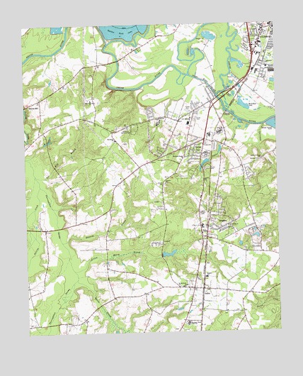
Southwest Goldsboro, NC USGS Topographic Map
Click on map above to begin viewing in our Map Viewer.

This topographic map contains these locations and features:
Feature Name Type Latitude Longitude GNIS ID View Map
Augusta ChurchChurchN35.3107°W78.0553°980366View Map
Big DitchStreamN35.3682°W78.0189°1023830View Map
Black Jack Grove ChurchChurchN35.3443°W78.0917°981533View Map
BrogdenPopulated PlaceN35.2927°W78.0344°1019314View Map
Brogden Census Designated PlaceCensusN35.2961°W78.0250°2402718View Map
Brogden Junior High SchoolSchoolN35.2932°W78.0375°1006978View Map
Brogden SchoolSchoolN35.2724°W78.0358°981960View Map
Brooks SwampStreamN35.2502°W78.0772°981984View Map
Carraway CreekStreamN35.3338°W78.0061°1019542View Map
Carver HeightsPopulated PlaceN35.3660°W78.0011°1005277View Map
DudleyPopulated PlaceN35.2674°W78.0375°984390View Map
Dudley ChurchChurchN35.2685°W78.0475°984391View Map
Dudley Fire DepartmentBuildingN35.2654°W78.0422°2639504View Map
Dudley Post OfficePost OfficeN35.2767°W78.0390°2505358View Map
Durhams LakeReservoirN35.2818°W78.0580°998734View Map
Durhams Lake DamDamN35.2818°W78.0580°998733View Map
Edwards BranchStreamN35.2871°W78.1069°984651View Map
Edwards Mobile Home ParkPopulated PlaceN35.3417°W78.0389°2505466View Map
Emmanuel ChurchChurchN35.3588°W78.0039°984774View Map
Fellowship Baptist ChurchChurchN35.3457°W78.0101°2505814View Map
FoxfirePopulated PlaceN35.2946°W78.0111°1005310View Map
GenoaPopulated PlaceN35.3263°W78.0403°1020411View Map
Greater Saint Johns ChurchChurchN35.3204°W78.0072°986039View Map
HillsdalePopulated PlaceN35.3393°W78.0617°1005273View Map
Horse BranchStreamN35.2979°W78.1236°987084View Map
J R Wells Lake AReservoirN35.2885°W78.0097°998750View Map
J R Wells Lake A DamDamN35.2885°W78.0097°998749View Map
Lafayette ParkPopulated PlaceN35.3141°W78.0414°1005305View Map
Lakewood EstatesPopulated PlaceN35.3049°W78.0278°1005309View Map
Love Memorial ChurchChurchN35.3368°W78.0425°989057View Map
Mar Mac Volunteer Fire DepartmentBuildingN35.3360°W78.0472°2638626View Map
Mar-MacPopulated PlaceN35.3349°W78.0558°1867432View Map
Mar-Mac Census Designated PlaceCensusN35.3345°W78.0545°2403255View Map
Mar-Mac VillagePopulated PlaceN35.3466°W78.0325°1005275View Map
Mays ChapelChurchN35.2902°W78.0375°989505View Map
McArthur LakeLakeN35.3413°W78.0147°989525View Map
McArthur ManorPopulated PlaceN35.3552°W78.0053°1005276View Map
Neuse River Cut-OffBendN35.3507°W78.0330°990917View Map
Pleasant Acres Mobile Home ParkPopulated PlaceN35.2947°W78.0077°2505550View Map
Poplar BranchStreamN35.3360°W78.0183°992676View Map
Providence ChurchChurchN35.3282°W78.0800°992868View Map
Quaker Neck LakeLakeN35.3732°W78.0755°992934View Map
Quaker Neck Lake DamDamN35.3732°W78.0755°998881View Map
Resthaven Memorial ParkCemeteryN35.3332°W78.0733°993247View Map
Rhodes CemeteryCemeteryN35.3104°W78.0561°993265View Map
Riverview Mobile Home ParkPopulated PlaceN35.3504°W78.0337°2505567View Map
Robin Lake EstatesPopulated PlaceN35.2852°W78.0100°1005308View Map
Rollingwood EstatesPopulated PlaceN35.2924°W78.0294°1005311View Map
Round-A-Bout Mobile Home ParkPopulated PlaceN35.3658°W78.0703°2505570View Map
Saint Andrews ChurchChurchN35.2932°W78.0244°993860View Map
Saint Johns ChurchChurchN35.3196°W78.0089°993942View Map
Saint Matthews ChurchChurchN35.2685°W78.0492°994056View Map
Scott HillsPopulated PlaceN35.3241°W78.0586°1005940View Map
South GoldsboroPopulated PlaceN35.3577°W78.0058°1022709View Map
South HavenPopulated PlaceN35.2835°W78.0155°1005307View Map
Southern Mobile Home VillagePopulated PlaceN35.3152°W78.0144°2505658View Map
Southern Wayne High SchoolSchoolN35.2541°W78.0453°995243View Map
Spring HopePopulated PlaceN35.3021°W78.0386°1005306View Map
Stevens MillPopulated PlaceN35.3449°W78.1167°995483View Map
SummitPopulated PlaceN35.3413°W78.0408°1005274View Map
Tabernacle Prayer for All PeopleChurchN35.3692°W78.0018°2506175View Map
Tar Kiln BranchStreamN35.3143°W78.1194°995853View Map
Thoroughfare SwampStreamN35.3099°W78.1172°1025750View Map
Thoroughfare Volunteer Fire DepartmentBuildingN35.2987°W78.0826°2639012View Map
Township of BrogdenCivilN35.2772°W78.0677°1027309View Map
Wayne CountyCivilN35.3640°W78.0040°1026128View Map
Wayne Memorial ParkCemeteryN35.3213°W78.0347°996891View Map
WFMC-AM (Goldsboro)TowerN35.3738°W78.0111°1018439View Map
White Oaks EstatesPopulated PlaceN35.3200°W78.0216°2505692View Map
WOKN-FM (Goldsboro)TowerN35.3738°W78.0111°1018266View Map
Woodland Friends ChurchChurchN35.3213°W78.0453°997590View Map
Yellow Marsh BranchStreamN35.2754°W78.1011°997712View Map

Note: Coordinates in the location and feature list above are referenced to NAD83 datum.


Copyright (C) 2008-2024 Ryan Niemi / Sunset Dynamics ... All Rights Reserved