TopoQuest Logo
Do you find TopoQuest useful?
Help keep TopoQuest running and adding new maps/features by donating!
Bitcoin:  19c7KJd3qBynnjoSw5npx9KScwjBe4ifkT
Litecoin:  LXs6TkuXGGXo1vDsWCkWVdjQX94eUKd6ui
Home View Maps Find Maps Find Places Resources & Links


Sunrise, Tennessee Topographic Map

USGS Map Title: Sunrise, TN
USGS Map MRC: 35087F4
DRG (GeoTIFF) Download: o35087f4.tif


Neighboring USGS Topographic Map Quads:


  Whitfield, TN  
35087G5
 

  Centerville, TN  
35087G4
 

  Littlelot, TN  
35087G3
 

  Beaverdam Springs, TN  
35087F5
 

  Sunrise, TN  
35087F4
 

  Greenfield Bend, TN  
35087F3
 

  Hohenwald, TN  
35087E5
 

  Gordonsburg, TN  
35087E4
 

  Mount Joy, TN  
35087E3


Map MRC Location:

N36°
W88°
N36°
W87°
H8 H7 H6 H5 H4 H3 H2 H1
G8 G7 G6 G5 G4 G3 G2 G1
F8 F7 F6 F5 F4 F3 F2 F1
E8 E7 E6 E5 E4 E3 E2 E1
D8 D7 D6 D5 D4 D3 D2 D1
C8 C7 C6 C5 C4 C3 C2 C1
B8 B7 B6 B5 B4 B3 B2 B1
A8 A7 A6 A5 A4 A3 A2 A1
N35°
W88°
N35°
W87°

Sunrise, TN USGS 1:24K Topographic Map Preview:
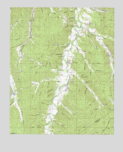
Sunrise, TN USGS Topographic Map
Click on map above to begin viewing in our Map Viewer.

This topographic map contains these locations and features:
Feature Name Type Latitude Longitude GNIS ID View Map
Aetna Brushy SchoolSchoolN35.6653°W87.4961°1275500View Map
Anderson CemeteryCemeteryN35.7273°W87.4208°1275701View Map
Anderson CemeteryCemeteryN35.7273°W87.4211°1275702View Map
Big HollowValleyN35.6783°W87.4515°1277317View Map
Big HollowValleyN35.6890°W87.4442°1277318View Map
Blue Buck CreekStreamN35.7312°W87.4150°1269365View Map
Blue Buck Creek MinesMineN35.7276°W87.4072°1319050View Map
BondPopulated PlaceN35.7242°W87.4006°1305341View Map
Bond School (historical)SchoolN35.7253°W87.3997°1319052View Map
Buck HollowValleyN35.6583°W87.3945°1278819View Map
BuffaloPopulated PlaceN35.6876°W87.4881°1314763View Map
Buffalo HollowValleyN35.6913°W87.4603°1278913View Map
Burns HollowValleyN35.6937°W87.4657°1279091View Map
Campground CemeteryCemeteryN35.7023°W87.4367°1319054View Map
Campground ChurchChurchN35.7015°W87.4364°1279477View Map
Cave HollowValleyN35.6399°W87.4488°1279929View Map
Clagett HollowValleyN35.7471°W87.4494°1305937View Map
Coleman HollowValleyN35.6442°W87.4624°1280951View Map
Coleman Hollow ProspectMineN35.6467°W87.4597°1319065View Map
Coopers Bluebuck CreekStreamN35.7301°W87.4153°1311346View Map
Copperas BranchStreamN35.6740°W87.4336°1281266View Map
Copperas Branch ProspectMineN35.6712°W87.4853°1319068View Map
Davidson HollowValleyN35.6867°W87.3989°1282110View Map
Davis CemeteryCemeteryN35.7295°W87.3983°1282145View Map
DeansPopulated PlaceN35.7376°W87.4739°1306308View Map
Devore HollowValleyN35.6555°W87.4919°1282409View Map
Falls BranchStreamN35.6867°W87.4314°1284101View Map
Falls Branch MineMineN35.6734°W87.4070°1319074View Map
Gordon HollowValleyN35.7059°W87.4132°1285700View Map
Greenbrier HollowValleyN35.6954°W87.4078°1286153View Map
Grimmett HillSummitN35.7348°W87.4278°1286298View Map
Haw BranchStreamN35.7151°W87.4267°1287162View Map
Horse BranchStreamN35.6623°W87.4439°1288387View Map
House HollowValleyN35.7442°W87.3766°1269654View Map
Hurricane HollowValleyN35.6686°W87.4446°1288823View Map
Hutchinson Spring MinesMineN35.6884°W87.4400°1319087View Map
Hutchison SpringSpringN35.6881°W87.4374°1288869View Map
Indian Creek MinesMineN35.7476°W87.4689°1319088View Map
Jenkins Branch MineMineN35.6287°W87.4664°1319089View Map
Jenkins FallsFallsN35.6321°W87.4668°1289356View Map
Jenkins HollowValleyN35.6330°W87.4586°1289361View Map
Jones BranchStreamN35.6345°W87.4528°1289693View Map
Little Piney Creek MineMineN35.7451°W87.4839°1651171View Map
Lovell HollowValleyN35.6869°W87.3757°1292146View Map
Lower Pine BranchStreamN35.6784°W87.4306°1292226View Map
Lower Pine Branch MinesMineN35.6787°W87.4261°1319097View Map
Mathis HollowValleyN35.6566°W87.4936°1292938View Map
Mathis Hollow MineMineN35.6553°W87.4989°1319105View Map
Meetinghouse HollowValleyN35.7026°W87.4362°1293545View Map
Meetinghouse Hollow MineMineN35.7034°W87.4372°1319107View Map
Millstone HollowValleyN35.6773°W87.4577°1294007View Map
Morgan HollowValleyN35.6873°W87.4013°1294371View Map
Morris CemeteryCemeteryN35.6303°W87.4520°1294417View Map
Morris HollowValleyN35.7393°W87.4224°1294434View Map
Muddy BranchStreamN35.6656°W87.4950°1295035View Map
Nun HollowValleyN35.7007°W87.4250°1296016View Map
Nun Hollow MineMineN35.6967°W87.4297°1319115View Map
Peery SpringSpringN35.6942°W87.4368°1297119View Map
Pettas HollowValleyN35.6754°W87.4633°1297262View Map
Pine Grove ChurchChurchN35.6762°W87.4095°1297529View Map
Prickett BranchStreamN35.7234°W87.3997°1298524View Map
Rawleigh ChapelChurchN35.7298°W87.4142°1298977View Map
Righhand HollowValleyN35.7198°W87.4758°1311375View Map
Robinson HillSummitN35.7487°W87.4639°1299707View Map
Rochelle HollowValleyN35.7445°W87.4231°1299722View Map
Roderick HollowValleyN35.6551°W87.4492°1299958View Map
Roderick Hollow MineMineN35.6523°W87.4533°1319126View Map
Rube HollowValleyN35.6937°W87.4041°1300219View Map
Scotch HollowValleyN35.6643°W87.4454°1300916View Map
Shop HollowValleyN35.6808°W87.4156°1270164View Map
Shop HollowValleyN35.6899°W87.4525°1270165View Map
Short BranchStreamN35.7134°W87.4256°1303604View Map
Short Branch MineMineN35.6965°W87.4056°1319130View Map
Simmons BranchStreamN35.6912°W87.4328°1270291View Map
Simmons Branch MinesMineN35.6903°W87.4481°1319131View Map
Simmons HollowValleyN35.6707°W87.4064°1270318View Map
Spring HollowValleyN35.6513°W87.3917°1303771View Map
Steep HollowValleyN35.6463°W87.4419°1271315View Map
Stewart HollowValleyN35.6982°W87.3779°1271372View Map
Stillhouse HollowValleyN35.7310°W87.4240°1271416View Map
Storehouse HollowValleyN35.6915°W87.4572°1271530View Map
Sugarcamp HollowValleyN35.6800°W87.4138°1271716View Map
SunrisePopulated PlaceN35.6831°W87.4397°1314363View Map
Sunrise SchoolSchoolN35.6787°W87.4397°1271875View Map
Swan BluffPopulated PlaceN35.7142°W87.4286°1314367View Map
Swan Bluff SpringSpringN35.7081°W87.4347°1271935View Map
Swan Bluff-Haw Branch MinesMineN35.7159°W87.4308°1319137View Map
Swan Creek MinesMineN35.7440°W87.4167°1319136View Map
Tatum HollowValleyN35.6976°W87.4675°1272175View Map
Totty HollowValleyN35.7289°W87.4143°1272785View Map
Totty Hollow MinesMineN35.7231°W87.4081°1319139View Map
Trestle HollowValleyN35.7143°W87.4824°1304160View Map
Ugly CreekStreamN35.7226°W87.3967°1273158View Map
Ugly Creek MinesMineN35.7037°W87.3811°1319141View Map
Upper Pine BranchStreamN35.6740°W87.4322°1273304View Map
Upper Pine Branch MinesMineN35.6709°W87.4311°1319143View Map
WatsonPopulated PlaceN35.7009°W87.4870°1314479View Map
Watson CemeteryCemeteryN35.7265°W87.4770°1273922View Map
Wheat CemeteryCemeteryN35.7234°W87.3970°1274276View Map
Whiteside CemeteryCemeteryN35.6703°W87.4375°1274466View Map
York HollowValleyN35.6550°W87.3907°1275313View Map

Note: Coordinates in the location and feature list above are referenced to NAD83 datum.


Copyright (C) 2008-2024 Ryan Niemi / Sunset Dynamics ... All Rights Reserved