TopoQuest Logo
Do you find TopoQuest useful?
Help keep TopoQuest running and adding new maps/features by donating!
Bitcoin:  19c7KJd3qBynnjoSw5npx9KScwjBe4ifkT
Litecoin:  LXs6TkuXGGXo1vDsWCkWVdjQX94eUKd6ui
Home View Maps Find Maps Find Places Resources & Links


Whitfield, Tennessee Topographic Map

USGS Map Title: Whitfield, TN
USGS Map MRC: 35087G5
DRG (GeoTIFF) Download: o35087g5.tif


Neighboring USGS Topographic Map Quads:


  Bucksnort, TN  
35087H6
 

  Spot, TN  
35087H5
 

  Texas Hollow, TN  
35087H4
 

  Coble, TN  
35087G6
 

  Whitfield, TN  
35087G5
 

  Centerville, TN  
35087G4
 

  Pleasantville, TN  
35087F6
 

  Beaverdam Springs, TN  
35087F5
 

  Sunrise, TN  
35087F4


Map MRC Location:

N36°
W88°
N36°
W87°
H8 H7 H6 H5 H4 H3 H2 H1
G8 G7 G6 G5 G4 G3 G2 G1
F8 F7 F6 F5 F4 F3 F2 F1
E8 E7 E6 E5 E4 E3 E2 E1
D8 D7 D6 D5 D4 D3 D2 D1
C8 C7 C6 C5 C4 C3 C2 C1
B8 B7 B6 B5 B4 B3 B2 B1
A8 A7 A6 A5 A4 A3 A2 A1
N35°
W88°
N35°
W87°

Whitfield, TN USGS 1:24K Topographic Map Preview:
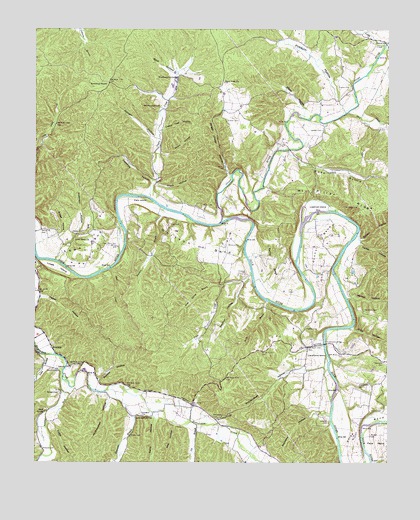
Whitfield, TN USGS Topographic Map
Click on map above to begin viewing in our Map Viewer.

This topographic map contains these locations and features:
Feature Name Type Latitude Longitude GNIS ID View Map
Anderson HollowValleyN35.8094°W87.6170°1275718View Map
Berry HollowValleyN35.7629°W87.5820°1277060View Map
Bird CreekStreamN35.8512°W87.5145°1277504View Map
Black HollowValleyN35.8304°W87.5823°1277575View Map
Bluewater BranchStreamN35.7709°W87.5995°1277824View Map
Bluff SpringSpringN35.7646°W87.6215°1277834View Map
Bridge HollowValleyN35.8140°W87.6216°1278348View Map
Briggs Chapel HollowValleyN35.8327°W87.5566°1278379View Map
Capshaw HollowValleyN35.8314°W87.5836°1279642View Map
Carothers CemeteryCemeteryN35.7939°W87.5083°1279696View Map
Carothers IslandIslandN35.7801°W87.5211°1279699View Map
Carter HollowValleyN35.8131°W87.5102°1279816View Map
Cherry Tree HollowValleyN35.8461°W87.5798°1280358View Map
Clifty HollowValleyN35.7884°W87.5127°1280737View Map
Coble HollowValleyN35.7615°W87.6200°1280839View Map
Council BendBendN35.8137°W87.5233°1306137View Map
Dodd CemeteryCemeteryN35.8337°W87.5220°1282552View Map
Dodd HollowValleyN35.8397°W87.5353°1282554View Map
Easley BendBendN35.8081°W87.5403°1283312View Map
Eastern ShoalBarN35.8020°W87.5283°1311349View Map
Elkins CemeteryCemeteryN35.7576°W87.5906°1283652View Map
Field CemeteryCemeteryN35.8189°W87.5772°1284231View Map
Field IslandIslandN35.8256°W87.5850°1284235View Map
Fowlkes CemeteryCemeteryN35.7884°W87.5289°1284755View Map
Frazier CemeteryCemeteryN35.8487°W87.5575°1284853View Map
Frazier CemeteryCemeteryN35.8581°W87.5136°1284854View Map
Grand View School (historical)SchoolN35.8226°W87.5342°1319079View Map
Harber HollowValleyN35.7500°W87.5500°1286789View Map
Hassell CemeteryCemeteryN35.8459°W87.5236°1287090View Map
Hedge CemeteryCemeteryN35.8164°W87.6120°1287323View Map
Hickman CemeteryCemeteryN35.8042°W87.5508°1287553View Map
Hicks FordCrossingN35.8240°W87.5809°1311359View Map
Huddleston BridgeBridgeN35.7845°W87.5225°1288599View Map
Huddleston CemeteryCemeteryN35.7728°W87.5103°1288600View Map
Huddlestons FordCrossingN35.7848°W87.5225°1311361View Map
Jenkins CemeteryCemeteryN35.7623°W87.5217°1289344View Map
Joe BranchStreamN35.7609°W87.5672°1289460View Map
Kirk HollowValleyN35.7607°W87.5753°1290296View Map
Lancaster CemeteryCemeteryN35.7637°W87.5870°1290572View Map
Lancaster SpringSpringN35.7626°W87.5891°1290577View Map
Liberty ChurchChurchN35.7770°W87.6167°1291130View Map
Log ShoalBarN35.8209°W87.5156°1311366View Map
Logshoal IslandIslandN35.8242°W87.5253°1291827View Map
Lovets ShoalBarN35.8145°W87.5931°1311368View Map
Lovett IslandIslandN35.8056°W87.6178°1292161View Map
Lowe BendBendN35.8120°W87.6053°1292189View Map
Lowe Bend CemeteryCemeteryN35.8126°W87.6017°1292190View Map
Lowe Bend ChurchChurchN35.8148°W87.6109°1292191View Map
Lowe Bend School (historical)SchoolN35.8145°W87.6109°1319096View Map
Lowe BranchStreamN35.7806°W87.6214°1292197View Map
Malugin CemeteryCemeteryN35.7703°W87.6164°1292551View Map
Malugin HollowValleyN35.8435°W87.5829°1292554View Map
Mayberry HollowValleyN35.7638°W87.5206°1293007View Map
McClanahan HollowValleyN35.7777°W87.5236°1293148View Map
McClanahan HollowValleyN35.7694°W87.5982°1293150View Map
McCollum CemeteryCemeteryN35.7634°W87.5617°1293172View Map
McCollum HillSummitN35.7634°W87.5550°1293175View Map
McGill HollowValleyN35.8391°W87.5811°1293318View Map
Moss Spring BranchStreamN35.8003°W87.5589°1294509View Map
Mount Carmel School (historical)SchoolN35.7876°W87.5300°1319109View Map
Mount Pillar CemeteryCemeteryN35.8242°W87.5111°1294734View Map
Mount Pillar RidgeRidgeN35.8256°W87.5097°1294735View Map
Mount Pillar School (historical)SchoolN35.8276°W87.5281°1319111View Map
Muddy BranchStreamN35.8701°W87.5011°1295036View Map
Murphy CemeteryCemeteryN35.7770°W87.6195°1295116View Map
Nicks CemeteryCemeteryN35.8245°W87.5664°1295747View Map
Oakmont CemeteryCemeteryN35.7789°W87.5008°1296199View Map
Oil SpringSpringN35.8265°W87.5422°1311370View Map
Pace BendBendN35.7576°W87.5020°1296631View Map
Panther BranchStreamN35.8220°W87.5817°1296720View Map
Peeler HollowValleyN35.7978°W87.6233°1297113View Map
Pickard CemeteryCemeteryN35.7537°W87.6222°1297380View Map
Piney RiverStreamN35.8192°W87.5595°1306897View Map
Possum HollowValleyN35.8532°W87.5171°1298299View Map
Pretty CreekStreamN35.8709°W87.5011°1298488View Map
Primm HollowValleyN35.7738°W87.6023°1298533View Map
Quillen HollowValleyN35.8144°W87.5097°1298763View Map
Richmond RoadsLocaleN35.8592°W87.5992°1299376View Map
Rock Field ChurchChurchN35.8603°W87.5578°1299760View Map
Rocky BranchStreamN35.7970°W87.5433°1299858View Map
Scotts FordCrossingN35.8270°W87.5909°1311376View Map
Settle Point School (historical)SchoolN35.7667°W87.5684°1319127View Map
Shipp BendBendN35.7601°W87.5108°1270123View Map
Shouse CemeteryCemeteryN35.7648°W87.5058°1270228View Map
Skull CreekStreamN35.8059°W87.5984°1270449View Map
Spot HollowValleyN35.8623°W87.5769°1271022View Map
Sulphur ForkStreamN35.7745°W87.6153°1271781View Map
Sulphur HollowValleyN35.8020°W87.5513°1271784View Map
Tarkiln HollowValleyN35.8387°W87.6250°1272129View Map
Taylor CreekStreamN35.8262°W87.5845°1272231View Map
Trace CreekStreamN35.8045°W87.5486°1272818View Map
Walker HollowValleyN35.7976°W87.5145°1273634View Map
Weatherspoon CemeteryCemeteryN35.8520°W87.5814°1273979View Map
Weatherspoon SpringSpringN35.8612°W87.5746°1273981View Map
Webb HollowValleyN35.8528°W87.5310°1274030View Map
WhitfieldPopulated PlaceN35.7831°W87.6189°1314506View Map
Whitson BendBendN35.8120°W87.5717°1274489View Map
Whitson Bend School (historical)SchoolN35.8134°W87.5739°1319149View Map
Whitson CemeteryCemeteryN35.8123°W87.5525°1274492View Map
WHLP-FM (Centerville)TowerN35.8276°W87.5672°1640069View Map

Note: Coordinates in the location and feature list above are referenced to NAD83 datum.


Copyright (C) 2008-2024 Ryan Niemi / Sunset Dynamics ... All Rights Reserved