TopoQuest Logo
Do you find TopoQuest useful?
Help keep TopoQuest running and adding new maps/features by donating!
Bitcoin:  19c7KJd3qBynnjoSw5npx9KScwjBe4ifkT
Litecoin:  LXs6TkuXGGXo1vDsWCkWVdjQX94eUKd6ui
Home View Maps Find Maps Find Places Resources & Links


Thackery, Ohio Topographic Map

USGS Map Title: Thackery, OH
USGS Map MRC: 40083A8
DRG (GeoTIFF) Download: o40083a8.tif


Neighboring USGS Topographic Map Quads:


  Fletcher, OH  
40084B1
 

  Saint Paris, OH  
40083B8
 

  Northville, OH  
40083B7
 

  Christiansburg, OH  
40084A1
 

  Thackery, OH  
40083A8
 

  Urbana West, OH  
40083A7
 

  New Carlisle, OH  
39084H1
 

  Donnelsville, OH  
39083H8
 

  Springfield, OH  
39083H7


Map MRC Location:

N41°
W84°
N41°
W83°
H8 H7 H6 H5 H4 H3 H2 H1
G8 G7 G6 G5 G4 G3 G2 G1
F8 F7 F6 F5 F4 F3 F2 F1
E8 E7 E6 E5 E4 E3 E2 E1
D8 D7 D6 D5 D4 D3 D2 D1
C8 C7 C6 C5 C4 C3 C2 C1
B8 B7 B6 B5 B4 B3 B2 B1
A8 A7 A6 A5 A4 A3 A2 A1
N40°
W84°
N40°
W83°

Thackery, OH USGS 1:24K Topographic Map Preview:
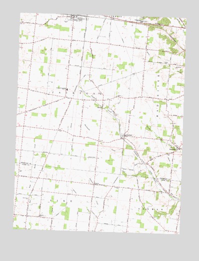
Thackery, OH USGS Topographic Map
Click on map above to begin viewing in our Map Viewer.

This topographic map contains these locations and features:
Feature Name Type Latitude Longitude GNIS ID View Map
Apple School (historical)SchoolN40.1095°W83.9516°1077589View Map
Bar W Equestrian CenterLocaleN40.0775°W83.9833°2557132View Map
Beech Crossing School (historical)SchoolN40.0173°W83.9038°1077617View Map
Beech Grove CemeteryCemeteryN40.0178°W83.9888°1037796View Map
Blacksnake CreekStreamN40.0503°W83.9141°1065924View Map
BryarPopulated PlaceN40.0234°W83.8838°1062411View Map
Christiansburg-Jackson High SchoolSchoolN40.0820°W83.9627°1060963View Map
Circle FarmsLocaleN40.0506°W83.9558°2630845View Map
Coffin Station (historical)LocaleN40.0401°W83.9030°1062450View Map
DarnellPopulated PlaceN40.0717°W83.9366°1064509View Map
Deer CreekStreamN40.0378°W83.9019°1039652View Map
DialtonPopulated PlaceN40.0273°W83.9405°1064539View Map
Dialton Post Office (historical)Post OfficeN40.0278°W83.9402°1966292View Map
Evergreen CemeteryCemeteryN40.1223°W83.9660°1040270View Map
Grafton CemeteryCemeteryN40.0784°W83.9255°1041012View Map
Grafton ChurchChurchN40.0801°W83.9369°1041013View Map
Grafton School (historical)SchoolN40.0828°W83.9441°1077595View Map
Graham Local High SchoolSchoolN40.1228°W83.9097°1041022View Map
Helvie CemeteryCemeteryN40.0339°W83.9963°1041478View Map
Hill CemeteryCemeteryN40.0673°W83.9277°1041577View Map
Jenking-Kite CemeteryCemeteryN40.0959°W83.8819°1042074View Map
Jerusalem CemeteryCemeteryN40.0259°W83.9213°1042089View Map
Kitty CreekStreamN40.0506°W83.8816°1048418View Map
Mammal CemeteryCemeteryN40.0076°W83.9799°1042912View Map
Mohawk School (historical)SchoolN40.0584°W83.9824°1077599View Map
Mount Zion CemeteryCemeteryN40.0804°W83.9512°1043649View Map
Myrtle Tree CemeteryCemeteryN40.1206°W83.8930°1961152View Map
Myrtle Tree ChurchChurchN40.1206°W83.8947°1065091View Map
Newsom Chapel CemeteryCemeteryN40.0423°W83.9452°1961153View Map
Paris Court EastPopulated PlaceN40.1247°W83.9558°2630827View Map
Prince CemeteryCemeteryN40.0987°W83.8905°1044773View Map
Proctor (historical)Populated PlaceN40.0517°W83.9713°1077606View Map
Reeds AirportAirportN40.0792°W83.8983°1082991View Map
School Number 6 (historical)SchoolN40.1070°W83.9985°1077609View Map
Seth CornersLocaleN40.0301°W83.9824°1077621View Map
Shaffer CemeteryCemeteryN40.0467°W83.8849°1046129View Map
Terre HautePopulated PlaceN40.0495°W83.8780°1046992View Map
Terre Haute CemeteryCemeteryN40.0523°W83.8808°1961156View Map
Terre Haute Post Office (historical)Post OfficeN40.0501°W83.8777°1965563View Map
Terre Haute United Methodist ChurchChurchN40.0512°W83.8799°1063637View Map
ThackeryPopulated PlaceN40.0556°W83.9188°1046996View Map
Thackery DitchCanalN40.0178°W83.9499°1046997View Map
Thackery Post Office (historical)Post OfficeN40.0556°W83.9194°1965564View Map
Township of JacksonCivilN40.0812°W83.9744°1085842View Map
Windy CornerPopulated PlaceN40.0264°W83.9263°1067503View Map
Yale School (historical)SchoolN40.0220°W83.9794°1077622View Map
Zerkle CemeteryCemeteryN40.0428°W83.8980°1048234View Map

Note: Coordinates in the location and feature list above are referenced to NAD83 datum.


Copyright (C) 2008-2024 Ryan Niemi / Sunset Dynamics ... All Rights Reserved