TopoQuest Logo
Do you find TopoQuest useful?
Help keep TopoQuest running and adding new maps/features by donating!
Bitcoin:  19c7KJd3qBynnjoSw5npx9KScwjBe4ifkT
Litecoin:  LXs6TkuXGGXo1vDsWCkWVdjQX94eUKd6ui
Home View Maps Find Maps Find Places Resources & Links


Tohatchi, New Mexico Topographic Map

USGS Map Title: Tohatchi, NM
USGS Map MRC: 35108G7
DRG (GeoTIFF) Download: o35108g7.tif


Neighboring USGS Topographic Map Quads:


  Todilto Park, NM  
35108H8
 

  Chuska Peak, NM  
35108H7
 

  Coyote Canyon NW, NM  
35108H6
 

  Crevasse Canyon, NM  
35108G8
 

  Tohatchi, NM  
35108G7
 

  Chuska Lake, NM  
35108G6
 

  Tse Bonita School, NM  
35108F8
 

  Twin Lakes, NM  
35108F7
 

  Big Rock Hill, NM  
35108F6


Map MRC Location:

N36°
W109°
N36°
W108°
H8 H7 H6 H5 H4 H3 H2 H1
G8 G7 G6 G5 G4 G3 G2 G1
F8 F7 F6 F5 F4 F3 F2 F1
E8 E7 E6 E5 E4 E3 E2 E1
D8 D7 D6 D5 D4 D3 D2 D1
C8 C7 C6 C5 C4 C3 C2 C1
B8 B7 B6 B5 B4 B3 B2 B1
A8 A7 A6 A5 A4 A3 A2 A1
N35°
W109°
N35°
W108°

Tohatchi, NM USGS 1:24K Topographic Map Preview:
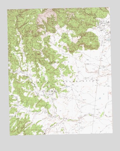
Tohatchi, NM USGS Topographic Map
Click on map above to begin viewing in our Map Viewer.

This topographic map contains these locations and features:
Feature Name Type Latitude Longitude GNIS ID View Map
14K-301 Water WellWellN35.8570°W108.7668°921872View Map
14K-301A Water WellWellN35.8611°W108.7615°921287View Map
14K-315 Water WellWellN35.8233°W108.7798°921842View Map
14N-35 Water WellWellN35.7889°W108.8293°921829View Map
14T-502 Water WellWellN35.7883°W108.8306°921828View Map
14T-514 Water WellWellN35.8570°W108.7670°921285View Map
Black Springs WashStreamN35.7645°W108.8098°886456View Map
Boarding School Water WellWellN35.8611°W108.7615°921288View Map
Catron WashStreamN35.7683°W108.8187°887293View Map
Chuska Boarding SchoolSchoolN35.8589°W108.7615°934203View Map
Chuska WashStreamN35.8097°W108.8481°887593View Map
Day School Water WellWellN35.7895°W108.8293°922525View Map
Etsitty Water WellWellN35.8300°W108.8676°921845View Map
Mexican Spring WashStreamN35.7686°W108.8187°897411View Map
Mexican SpringsPopulated PlaceN35.7928°W108.8270°902834View Map
Mexican Springs Post OfficePost OfficeN35.7928°W108.8270°937506View Map
Mexican Springs Weather StationLocaleN35.7928°W108.8270°932602View Map
NakaibitoPopulated PlaceN35.7928°W108.8270°1852629View Map
Nakaibito Census Designated PlaceCensusN35.7826°W108.8039°2408899View Map
Navajo Indian Reservation Historical MarkerParkN35.8589°W108.7615°932362View Map
Norcross WashStreamN35.7875°W108.7893°892551View Map
North Fork Catron WashStreamN35.7778°W108.8618°892587View Map
Owls Nest WashArroyoN35.7764°W108.8598°900616View Map
Saint Mary ChurchChurchN35.8589°W108.7615°920216View Map
Separate HillSummitN35.8411°W108.7862°901090View Map
Sitting Coyote MesaSummitN35.8070°W108.7645°901089View Map
South Fork Catron WashStreamN35.7781°W108.8618°895044View Map
South Fork Catron WashArroyoN35.7786°W108.8645°900615View Map
TohatchiPopulated PlaceN35.8589°W108.7615°902849View Map
Tohatchi Census Designated PlaceCensusN35.8410°W108.7506°2409328View Map
Tohatchi Elementary SchoolSchoolN35.8589°W108.7615°934101View Map
Tohatchi Emergency Medical ServicesBuildingN35.8581°W108.7625°2657654View Map
Tohatchi High SchoolSchoolN35.8589°W108.7615°901384View Map
Tohatchi Middle SchoolSchoolN35.8589°W108.7615°901386View Map
Tohatchi Post OfficePost OfficeN35.8558°W108.7647°937802View Map
Tohatchi Special Education and Training CenterSchoolN35.8589°W108.7615°934069View Map
Tohatchi Village SiteLocaleN35.8589°W108.7615°936014View Map
Tohatchi Weather StationLocaleN35.8589°W108.7615°931774View Map
Whiskey Lake T20n DamDamN35.8683°W108.8690°924162View Map

Note: Coordinates in the location and feature list above are referenced to NAD83 datum.


Copyright (C) 2008-2024 Ryan Niemi / Sunset Dynamics ... All Rights Reserved