TopoQuest Logo
Do you find TopoQuest useful?
Help keep TopoQuest running and adding new maps/features by donating!
Bitcoin:  19c7KJd3qBynnjoSw5npx9KScwjBe4ifkT
Litecoin:  LXs6TkuXGGXo1vDsWCkWVdjQX94eUKd6ui
Home View Maps Find Maps Find Places Resources & Links


Twin Lakes, New Mexico Topographic Map

USGS Map Title: Twin Lakes, NM
USGS Map MRC: 35108F7
DRG (GeoTIFF) Download: o35108f7.tif


Neighboring USGS Topographic Map Quads:


  Crevasse Canyon, NM  
35108G8
 

  Tohatchi, NM  
35108G7
 

  Chuska Lake, NM  
35108G6
 

  Tse Bonita School, NM  
35108F8
 

  Twin Lakes, NM  
35108F7
 

  Big Rock Hill, NM  
35108F6
 

  Samson Lake, NM  
35108E8
 

  Gallup West, NM  
35108E7
 

  Gallup East, NM  
35108E6


Map MRC Location:

N36°
W109°
N36°
W108°
H8 H7 H6 H5 H4 H3 H2 H1
G8 G7 G6 G5 G4 G3 G2 G1
F8 F7 F6 F5 F4 F3 F2 F1
E8 E7 E6 E5 E4 E3 E2 E1
D8 D7 D6 D5 D4 D3 D2 D1
C8 C7 C6 C5 C4 C3 C2 C1
B8 B7 B6 B5 B4 B3 B2 B1
A8 A7 A6 A5 A4 A3 A2 A1
N35°
W109°
N35°
W108°

Twin Lakes, NM USGS 1:24K Topographic Map Preview:
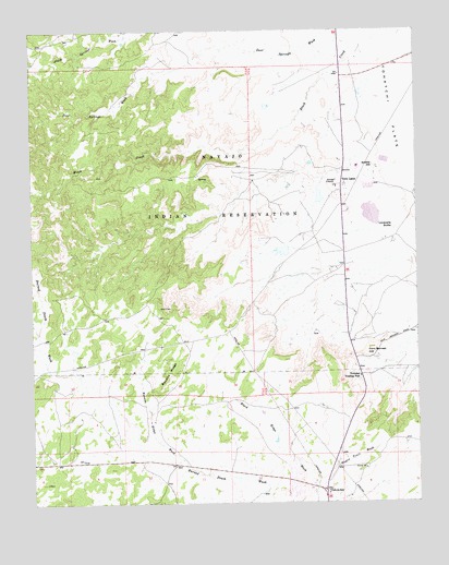
Twin Lakes, NM USGS Topographic Map
Click on map above to begin viewing in our Map Viewer.

This topographic map contains these locations and features:
Feature Name Type Latitude Longitude GNIS ID View Map
10019 Water WellWellN35.6250°W108.7662°929894View Map
14K-314 Water WellWellN35.7106°W108.8034°922360View Map
14T-323 Water WellWellN35.7334°W108.7756°921817View Map
14T-501 Water WellWellN35.7092°W108.7734°921810View Map
14T-532 Water WellWellN35.6870°W108.7959°921804View Map
14T-533 Water WellWellN35.6684°W108.8362°922377View Map
14Y-9A Water WellWellN35.6581°W108.7695°921793View Map
16T-524 Water WellWellN35.6467°W108.8365°921962View Map
16T-526 Water WellWellN35.6270°W108.7526°921790View Map
16T-608 Water WellWellN35.6334°W108.8298°922383View Map
Banana RidgeRidgeN35.6595°W108.8306°886032View Map
Banana Ridge WashStreamN35.6364°W108.8273°886033View Map
Corn Burned HillSummitN35.6650°W108.7679°899589View Map
Fort Defiance Historical MarkerParkN35.6281°W108.7804°932409View Map
Gossip HillSummitN35.7142°W108.7645°899650View Map
Navajo Estates Volunteer Fire Department Station 1 HeadquartersBuildingN35.6306°W108.7881°2657820View Map
Navajo School MineMineN35.7397°W108.8554°917565View Map
PWSI000269 Water WellWellN35.7061°W108.7773°933111View Map
Tohatchi FlatsFlatN35.7284°W108.7587°895723View Map
Tohlakai Trading PostLocaleN35.6584°W108.7695°902850View Map
Twin LakesPopulated PlaceN35.7092°W108.7748°902375View Map
Twin Lakes Census Designated PlaceCensusN35.6834°W108.7709°2409374View Map
Twin Lakes ChapterCivilN35.7081°W108.8062°2419505View Map
Umbrella ButteSummitN35.6981°W108.7581°899971View Map
Wagon Trail WashStreamN35.6295°W108.7831°896186View Map
Yah-ta-heyPopulated PlaceN35.6281°W108.7804°898615View Map

Note: Coordinates in the location and feature list above are referenced to NAD83 datum.


Copyright (C) 2008-2024 Ryan Niemi / Sunset Dynamics ... All Rights Reserved