TopoQuest Logo
Do you find TopoQuest useful?
Help keep TopoQuest running and adding new maps/features by donating!
Bitcoin:  19c7KJd3qBynnjoSw5npx9KScwjBe4ifkT
Litecoin:  LXs6TkuXGGXo1vDsWCkWVdjQX94eUKd6ui
Home View Maps Find Maps Find Places Resources & Links


Alden, Kansas Topographic Map

USGS Map Title: Alden, KS
USGS Map MRC: 38098B3
DRG (GeoTIFF) Download: o38098b3.tif


Neighboring USGS Topographic Map Quads:


  Raymond, KS  
38098C4
 

  Chase, KS  
38098C3
 

  Lyons, KS  
38098C2
 

  Alden NW, KS  
38098B4
 

  Alden, KS  
38098B3
 

  Sterling, KS  
38098B2
 

  Little Salt Marsh, KS  
38098A4
 

  Alden SE, KS  
38098A3
 

  Sterling SW, KS  
38098A2


Map MRC Location:

N39°
W99°
N39°
W98°
H8 H7 H6 H5 H4 H3 H2 H1
G8 G7 G6 G5 G4 G3 G2 G1
F8 F7 F6 F5 F4 F3 F2 F1
E8 E7 E6 E5 E4 E3 E2 E1
D8 D7 D6 D5 D4 D3 D2 D1
C8 C7 C6 C5 C4 C3 C2 C1
B8 B7 B6 B5 B4 B3 B2 B1
A8 A7 A6 A5 A4 A3 A2 A1
N38°
W99°
N38°
W98°

Alden, KS USGS 1:24K Topographic Map Preview:
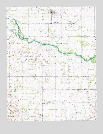
Alden, KS USGS Topographic Map
Click on map above to begin viewing in our Map Viewer.

This topographic map contains these locations and features:
Feature Name Type Latitude Longitude GNIS ID View Map
AldenPopulated PlaceN38.2422°W98.3120°475900View Map
Alden Elementary School (historical)SchoolN38.2467°W98.3137°481221View Map
Alden Fire DepartmentBuildingN38.2431°W98.3118°2111091View Map
Alden Gas Storage FieldOilfieldN38.2075°W98.3062°475899View Map
Alden Post OfficePost OfficeN38.2440°W98.3119°2693598View Map
Alden Wastewater PlantLocaleN38.2328°W98.3081°2691977View Map
Avery (historical)LocaleN38.1436°W98.2962°482519View Map
City of AldenCivilN38.2439°W98.3120°2393912View Map
Fritzpatrick Gas FieldOilfieldN38.1956°W98.2537°475897View Map
Kilbourns CornerPopulated PlaceN38.1592°W98.3262°484754View Map
McVays CornerPopulated PlaceN38.1589°W98.2523°484755View Map
Peace Valley CemeteryCemeteryN38.1523°W98.2885°475895View Map
Rino Oil FieldOilfieldN38.1742°W98.3190°475898View Map
Sleeper Airfield (historical)AirportN38.2392°W98.3256°475901View Map
Sterling Country ClubLocaleN38.2116°W98.2554°2694535View Map
Township of ValleyCivilN38.2171°W98.3163°475785View Map
Township of WalnutCivilN38.1299°W98.3075°475892View Map
Triumph ChurchChurchN38.1731°W98.2887°475896View Map
West Salem ChurchChurchN38.1439°W98.3256°475891View Map
Wisby Oil FieldOilfieldN38.1445°W98.3420°475894View Map

Note: Coordinates in the location and feature list above are referenced to NAD83 datum.


Copyright (C) 2008-2024 Ryan Niemi / Sunset Dynamics ... All Rights Reserved