TopoQuest Logo
Do you find TopoQuest useful?
Help keep TopoQuest running and adding new maps/features by donating!
Bitcoin:  19c7KJd3qBynnjoSw5npx9KScwjBe4ifkT
Litecoin:  LXs6TkuXGGXo1vDsWCkWVdjQX94eUKd6ui
Home View Maps Find Maps Find Places Resources & Links


Vineland, Missouri Topographic Map

USGS Map Title: Vineland, MO
USGS Map MRC: 38090A5
DRG (GeoTIFF) Download: o38090a5.tif


Neighboring USGS Topographic Map Quads:


  Fletcher, MO  
38090B6
 

  De Soto, MO  
38090B5
 

  Festus, MO  
38090B4
 

  Tiff, MO  
38090A6
 

  Vineland, MO  
38090A5
 

  Halifax, MO  
38090A4
 

  Mineral Point, MO  
37090H6
 

  Bonne Terre, MO  
37090H5
 

  French Village, MO  
37090H4


Map MRC Location:

N39°
W91°
N39°
W90°
H8 H7 H6 H5 H4 H3 H2 H1
G8 G7 G6 G5 G4 G3 G2 G1
F8 F7 F6 F5 F4 F3 F2 F1
E8 E7 E6 E5 E4 E3 E2 E1
D8 D7 D6 D5 D4 D3 D2 D1
C8 C7 C6 C5 C4 C3 C2 C1
B8 B7 B6 B5 B4 B3 B2 B1
A8 A7 A6 A5 A4 A3 A2 A1
N38°
W91°
N38°
W90°

Vineland, MO USGS 1:24K Topographic Map Preview:
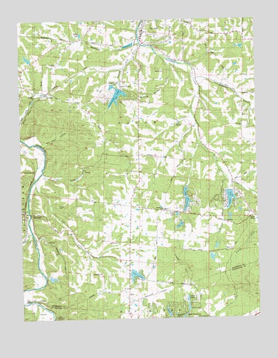
Vineland, MO USGS Topographic Map
Click on map above to begin viewing in our Map Viewer.

This topographic map contains these locations and features:
Feature Name Type Latitude Longitude GNIS ID View Map
Big Chief HollowValleyN38.0734°W90.6131°738361View Map
Big LakeReservoirN38.0390°W90.5413°738366View Map
Big Lake DamDamN38.0401°W90.5401°764264View Map
Big Woods Lake DamDamN38.0751°W90.6135°765425View Map
BlackwellPopulated PlaceN38.0437°W90.6240°755784View Map
Blackwell School (historical)SchoolN38.0448°W90.6246°757809View Map
Blue SpringsSpringN38.0011°W90.6077°757090View Map
Buster CemeteryCemeteryN38.0289°W90.5129°715113View Map
Carson CreekStreamN38.0614°W90.6137°738362View Map
Chadburn Mine (historical)MineN38.0098°W90.5151°757810View Map
Clear LakeReservoirN38.0529°W90.5381°738363View Map
Clear Lake DamDamN38.0551°W90.5385°764237View Map
Cole LakeReservoirN38.0182°W90.5653°758269View Map
Cole Lake DamDamN38.0184°W90.5668°764240View Map
Coles CemeteryCemeteryN38.0028°W90.6169°757091View Map
Coles LandingLocaleN38.0073°W90.6229°757092View Map
De Soto Rural Fire Protection District Station 2BuildingN38.0537°W90.5128°2620436View Map
DeSoto LakeReservoirN38.1189°W90.5924°716762View Map
Dierberg LakeReservoirN38.1058°W90.5103°764242View Map
Dierberg Lake DamDamN38.1051°W90.5101°764241View Map
Dresser Number 10 DamDamN38.0184°W90.6101°764967View Map
Dripping SpringSpringN38.1078°W90.5428°737743View Map
Dripping Spring School (historical)SchoolN38.1101°W90.5287°737740View Map
Dripping Springs HollowValleyN38.1064°W90.5451°717055View Map
Falling Rock BranchStreamN38.1153°W90.5607°717833View Map
Fishermans LakeReservoirN38.0978°W90.5757°738358View Map
Fletcher BranchStreamN38.0567°W90.5135°738367View Map
Flowing WellSpringN38.0931°W90.6172°738360View Map
Forest LakeReservoirN38.0034°W90.5373°757086View Map
Forest Lake DamDamN38.0034°W90.5385°765001View Map
Hamman CemeteryCemeteryN38.0320°W90.5743°742814View Map
Joachim CemeteryCemeteryN38.1005°W90.5508°720326View Map
KOLS-FM (De Soto)TowerN38.0237°W90.5673°759116View Map
Lake Timberline Fire DepartmentBuildingN38.0002°W90.5508°2620397View Map
Lembeck LakeReservoirN38.1144°W90.5669°758301View Map
Lembeck Lake DamDamN38.1151°W90.5635°764127View Map
Little Lake DamDamN38.0434°W90.5418°764263View Map
Lower Valle Mines DamDamN38.0317°W90.5218°764239View Map
Lucas Lake DamDamN38.0434°W90.5151°764261View Map
Lucus DamDamN38.0451°W90.5101°764158View Map
McGehan School (historical)SchoolN38.0687°W90.5571°737741View Map
McMullen BranchStreamN38.1003°W90.5329°722160View Map
MelzoPopulated PlaceN38.0101°W90.5696°741059View Map
Mill CreekStreamN38.0362°W90.6198°756390View Map
Mononame 215 ReservoirReservoirN38.0255°W90.5245°764129View Map
Mononame 258 DamDamN38.1084°W90.6201°764262View Map
Moontown CemeteryCemeteryN38.0190°W90.5826°722561View Map
Moontown School (historical)SchoolN38.0087°W90.5926°737739View Map
Mothershead School (historical)SchoolN38.1178°W90.6032°737737View Map
Mount Olive CemeteryCemeteryN38.0802°W90.5069°2702379View Map
Mount Olive ChurchChurchN38.0806°W90.5082°722816View Map
Old Blackwell CemeteryCemeteryN38.0624°W90.6174°757084View Map
Perrys Lead Mine (historical)MineN38.0109°W90.5110°757811View Map
Phantom LakeReservoirN38.0019°W90.5439°757088View Map
Prospect School (historical)SchoolN38.0289°W90.5451°737742View Map
Rowe CemeteryCemeteryN38.0403°W90.5171°725638View Map
Rustic Hills Resort Lake DamDamN38.1134°W90.5085°764265View Map
Silver LakeReservoirN38.0080°W90.5377°757085View Map
Small LakeReservoirN38.0436°W90.5428°738365View Map
Spring Dale School (historical)SchoolN38.0648°W90.5879°737738View Map
Spring LakeReservoirN38.0936°W90.5738°765011View Map
Spring Lake DamDamN38.0984°W90.5751°765010View Map
Summer Set Lake DamDamN38.0967°W90.5718°764266View Map
Summerset LakeReservoirN38.0939°W90.5738°738359View Map
Sunrise LakeReservoirN38.0481°W90.5373°738364View Map
Sunrise Lake DamDamN38.0506°W90.5376°765007View Map
Sunrise SchoolSchoolN38.0456°W90.5496°727322View Map
Tiff CreekStreamN38.0576°W90.6176°727651View Map
Township of ValleCivilN38.0917°W90.5708°766828View Map
Tunnel (historical)LocaleN38.0087°W90.5129°756804View Map
Upper Valle Mines DamDamN38.0267°W90.5235°764128View Map
Valle LakeReservoirN38.0502°W90.5144°728097View Map
Valle Lake DamDamN38.0516°W90.5130°764238View Map
Valley View ChurchChurchN38.0437°W90.5035°742813View Map
Vinegar HillSummitN38.0178°W90.5365°738368View Map
VinelandPopulated PlaceN38.0953°W90.6129°736360View Map
Vineyard CemeteryCemeteryN38.0475°W90.6036°728209View Map
Wahoo LakeReservoirN38.0026°W90.5480°757089View Map
Wahoo Lake DamDamN38.0012°W90.5468°763806View Map
Walther ParkParkN38.1198°W90.5590°742812View Map
Whitehead CreekStreamN38.1151°W90.5612°728776View Map
Winter Haven LakeReservoirN38.0867°W90.5785°765009View Map
Winter Haven Lake DamDamN38.0867°W90.5785°765008View Map

Note: Coordinates in the location and feature list above are referenced to NAD83 datum.


Copyright (C) 2008-2024 Ryan Niemi / Sunset Dynamics ... All Rights Reserved