TopoQuest Logo
Do you find TopoQuest useful?
Help keep TopoQuest running and adding new maps/features by donating!
Bitcoin:  19c7KJd3qBynnjoSw5npx9KScwjBe4ifkT
Litecoin:  LXs6TkuXGGXo1vDsWCkWVdjQX94eUKd6ui
Home View Maps Find Maps Find Places Resources & Links


Zearing, Iowa Topographic Map

USGS Map Title: Zearing, IA
USGS Map MRC: 42093B3
DRG (GeoTIFF) Download: o42093b3.tif


Neighboring USGS Topographic Map Quads:


  Radcliffe, IA  
42093C4
 

  Hubbard, IA  
42093C3
 

  New Providence, IA  
42093C2
 

  McCallsburg, IA  
42093B4
 

  Zearing, IA  
42093B3
 

  State Center NW, IA  
42093B2
 

  Nevada, IA  
42093A4
 

  Colo, IA  
42093A3
 

  State Center, IA  
42093A2


Map MRC Location:

N43°
W94°
N43°
W93°
H8 H7 H6 H5 H4 H3 H2 H1
G8 G7 G6 G5 G4 G3 G2 G1
F8 F7 F6 F5 F4 F3 F2 F1
E8 E7 E6 E5 E4 E3 E2 E1
D8 D7 D6 D5 D4 D3 D2 D1
C8 C7 C6 C5 C4 C3 C2 C1
B8 B7 B6 B5 B4 B3 B2 B1
A8 A7 A6 A5 A4 A3 A2 A1
N42°
W94°
N42°
W93°

Zearing, IA USGS 1:24K Topographic Map Preview:
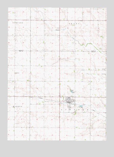
Zearing, IA USGS Topographic Map
Click on map above to begin viewing in our Map Viewer.

This topographic map contains these locations and features:
Feature Name Type Latitude Longitude GNIS ID View Map
Bethel United Methodist ChurchChurchN42.1447°W93.2947°1999350View Map
City of ZearingCivilN42.1589°W93.2972°2397397View Map
Colo - Nesco Elementary Learning CenterSchoolN42.1655°W93.2978°1999354View Map
Colonial Manor of ZearingHospitalN42.1625°W93.2919°1999353View Map
Cornerstone Church of ChristChurchN42.1622°W93.2947°1999348View Map
Dakins LakeReservoirN42.1712°W93.2946°455770View Map
Dakins Lake ParkParkN42.1714°W93.2908°463901View Map
Saint Gabriel's Catholic ChurchChurchN42.1572°W93.2974°1999349View Map
Sunset Post Office (historical)Post OfficeN42.1667°W93.3419°1999110View Map
Township of LincolnCivilN42.1658°W93.2892°468271View Map
Veterans Memorial FieldParkN42.1611°W93.2919°1999343View Map
ZearingPopulated PlaceN42.1611°W93.2972°463254View Map
Zearing (historical)LocaleN42.1608°W93.2960°1999347View Map
Zearing CemeteryCemeteryN42.1666°W93.2949°1999491View Map
Zearing Christian ChurchChurchN42.1614°W93.2991°1999351View Map
Zearing Fire DepartmentBuildingN42.1609°W93.2964°2577233View Map
Zearing Medical ClinicHospitalN42.1608°W93.2974°1999352View Map
Zearing Post OfficePost OfficeN42.1608°W93.2980°1999345View Map
Zearing Public LibraryBuildingN42.1608°W93.2969°1999344View Map
Zearing Town HallBuildingN42.1611°W93.2980°1999346View Map

Note: Coordinates in the location and feature list above are referenced to NAD83 datum.


Copyright (C) 2008-2024 Ryan Niemi / Sunset Dynamics ... All Rights Reserved