TopoQuest Logo
Do you find TopoQuest useful?
Help keep TopoQuest running and adding new maps/features by donating!
Bitcoin:  19c7KJd3qBynnjoSw5npx9KScwjBe4ifkT
Litecoin:  LXs6TkuXGGXo1vDsWCkWVdjQX94eUKd6ui
Home View Maps Find Maps Find Places Resources & Links


Bradford, Tennessee Topographic Map

USGS Map Title: Bradford, TN
USGS Map MRC: 36088A7
DRG (GeoTIFF) Download: o36088a7.tif


Neighboring USGS Topographic Map Quads:


  Rutherford, TN  
36088B8
 

  Greenfield, TN  
36088B7
 

  Pillowville, TN  
36088B6
 

  Dyer, TN  
36088A8
 

  Bradford, TN  
36088A7
 

  Trezevant West, TN  
36088A6
 

  Trenton, TN  
35088H8
 

  Milan, TN  
35088H7
 

  Atwood, TN  
35088H6


Map MRC Location:

N37°
W89°
N37°
W88°
H8 H7 H6 H5 H4 H3 H2 H1
G8 G7 G6 G5 G4 G3 G2 G1
F8 F7 F6 F5 F4 F3 F2 F1
E8 E7 E6 E5 E4 E3 E2 E1
D8 D7 D6 D5 D4 D3 D2 D1
C8 C7 C6 C5 C4 C3 C2 C1
B8 B7 B6 B5 B4 B3 B2 B1
A8 A7 A6 A5 A4 A3 A2 A1
N36°
W89°
N36°
W88°

Bradford, TN USGS 1:24K Topographic Map Preview:
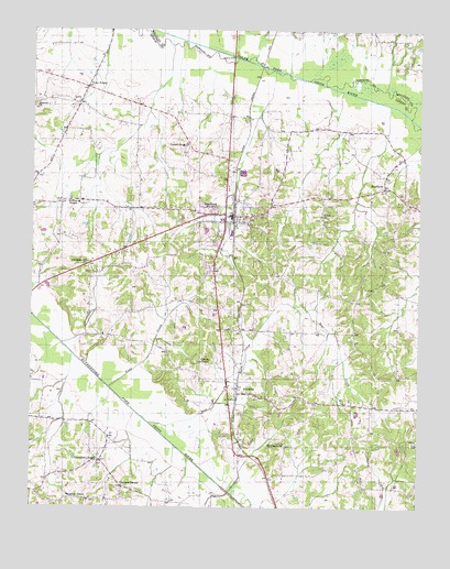
Bradford, TN USGS Topographic Map
Click on map above to begin viewing in our Map Viewer.

This topographic map contains these locations and features:
Feature Name Type Latitude Longitude GNIS ID View Map
Antioch CemeteryCemeteryN36.1062°W88.8737°1322041View Map
Antioch ChurchChurchN36.1053°W88.8742°1304856View Map
Bear CreekStreamN36.0220°W88.8370°1276581View Map
BradfordPopulated PlaceN36.0765°W88.8101°1305379View Map
Bradford CreekStreamN36.1145°W88.7970°1647624View Map
Bradford Division (historical)CensusN36.0673°W88.7978°1648695View Map
Bradford First Baptist ChurchChurchN36.0751°W88.8095°1322063View Map
Bradford Police DepartmentBuildingN36.0766°W88.8091°2765870View Map
Bradford Post OfficePost OfficeN36.0765°W88.8117°1651844View Map
Bradford Volunteer Fire DepartmentBuildingN36.0760°W88.8096°2653736View Map
Bruff CemeteryCemeteryN36.0573°W88.7642°1278662View Map
Chestnut Hill ChurchChurchN36.0640°W88.8573°1305892View Map
Chestnut Hill School (historical)SchoolN36.0642°W88.8565°1322074View Map
Church of ChristChurchN36.0834°W88.7614°1322118View Map
Coats BranchStreamN36.1206°W88.8095°1280817View Map
Commissioner District 17CivilN36.0545°W88.8092°2464401View Map
Cottnell BranchStreamN36.1131°W88.7823°1281352View Map
Davidson ChapelChurchN36.0120°W88.8528°1306274View Map
Davidson Chapel CemeteryCemeteryN36.0117°W88.8523°1322085View Map
Davidson Chapel School (historical)SchoolN36.0117°W88.8517°1322086View Map
Davis ChapelChurchN36.0451°W88.8517°1322087View Map
District 14 (historical)CivilN36.0667°W88.8417°1310201View Map
District 17 (historical)CivilN36.0501°W88.7542°1310203View Map
District 22 (historical)CivilN36.0292°W88.8084°1310206View Map
Dry CreekStreamN36.1095°W88.7753°1647626View Map
Four PointsPopulated PlaceN36.1101°W88.8578°1315073View Map
Griffins ChapelChurchN36.0798°W88.8601°1286274View Map
Griffins Chapel CemeteryCemeteryN36.0795°W88.8601°1322116View Map
Harmony Primitive Baptist ChurchChurchN36.0273°W88.7715°1322119View Map
IdlewildPopulated PlaceN36.0298°W88.8081°1288905View Map
Idlewild Baptist ChurchChurchN36.0295°W88.8045°1322132View Map
Idlewild High School (historical)SchoolN36.0306°W88.8112°1322133View Map
Idlewild Post OfficePost OfficeN36.0296°W88.8081°1651859View Map
Locust Grove CemeteryCemeteryN36.0937°W88.8256°1322142View Map
Locust Grove ChurchChurchN36.0945°W88.8251°1291786View Map
Locust Grove CreekStreamN36.1209°W88.8303°1647627View Map
LynnPopulated PlaceN36.1056°W88.8601°1292343View Map
Mosley BranchStreamN36.1137°W88.7926°1294489View Map
Mount Pisgah CemeteryCemeteryN36.0162°W88.7928°1322166View Map
Mount Pisgah ChurchChurchN36.0165°W88.7931°1294744View Map
Mount Pisgah School (historical)SchoolN36.0173°W88.7928°1322167View Map
Oak Grove School (historical)SchoolN36.1062°W88.8603°1322184View Map
Olivers ChapelChurchN36.0381°W88.8203°1322190View Map
Olivers Chapel CemeteryCemeteryN36.0376°W88.8214°1322191View Map
Persimmon Grove School (historical)SchoolN36.0840°W88.7623°1322195View Map
Shiloh CemeteryCemeteryN36.0759°W88.7820°1322216View Map
Shiloh ChurchChurchN36.0765°W88.7817°1303586View Map
SkullbonePopulated PlaceN36.0840°W88.7612°1303656View Map
Swindle School (historical)SchoolN36.0176°W88.7551°1322227View Map
Toms CreekStreamN36.0312°W88.8498°1272763View Map
Town of BradfordCivilN36.0740°W88.8157°2405311View Map
Tuckers CornerPopulated PlaceN36.0051°W88.8456°1304184View Map
Vaughns GrovePopulated PlaceN36.0020°W88.8562°1314454View Map
Vaughns Grove CemeteryCemeteryN36.0017°W88.8559°1322234View Map
Vaughns Grove Church of ChristChurchN36.0020°W88.8556°1322235View Map

Note: Coordinates in the location and feature list above are referenced to NAD83 datum.


Copyright (C) 2008-2024 Ryan Niemi / Sunset Dynamics ... All Rights Reserved