TopoQuest Logo
Do you find TopoQuest useful?
Help keep TopoQuest running and adding new maps/features by donating!
Bitcoin:  19c7KJd3qBynnjoSw5npx9KScwjBe4ifkT
Litecoin:  LXs6TkuXGGXo1vDsWCkWVdjQX94eUKd6ui
Home View Maps Find Maps Find Places Resources & Links


Pillowville, Tennessee Topographic Map

USGS Map Title: Pillowville, TN
USGS Map MRC: 36088B6
DRG (GeoTIFF) Download: o36088b6.tif


Neighboring USGS Topographic Map Quads:


  Martin, TN  
36088C7
 

  Dresden, TN  
36088C6
 

  Como, TN  
36088C5
 

  Greenfield, TN  
36088B7
 

  Pillowville, TN  
36088B6
 

  McKenzie, TN  
36088B5
 

  Bradford, TN  
36088A7
 

  Trezevant West, TN  
36088A6
 

  Trezevant East, TN  
36088A5


Map MRC Location:

N37°
W89°
N37°
W88°
H8 H7 H6 H5 H4 H3 H2 H1
G8 G7 G6 G5 G4 G3 G2 G1
F8 F7 F6 F5 F4 F3 F2 F1
E8 E7 E6 E5 E4 E3 E2 E1
D8 D7 D6 D5 D4 D3 D2 D1
C8 C7 C6 C5 C4 C3 C2 C1
B8 B7 B6 B5 B4 B3 B2 B1
A8 A7 A6 A5 A4 A3 A2 A1
N36°
W89°
N36°
W88°

Pillowville, TN USGS 1:24K Topographic Map Preview:
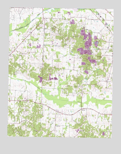
Pillowville, TN USGS Topographic Map
Click on map above to begin viewing in our Map Viewer.

This topographic map contains these locations and features:
Feature Name Type Latitude Longitude GNIS ID View Map
Beech Springs CemeteryCemeteryN36.1806°W88.6328°1322261View Map
Beech Springs ChurchChurchN36.1792°W88.6314°1305071View Map
Cane CreekStreamN36.2220°W88.7495°1275387View Map
Center Point School (historical)SchoolN36.2395°W88.6323°1322282View Map
Coats School (historical)SchoolN36.1595°W88.7426°1322285View Map
Cotton CreekStreamN36.1651°W88.7006°1281356View Map
Cox CemeteryCemeteryN36.1909°W88.7123°1281490View Map
Crowley StorePopulated PlaceN36.1367°W88.6928°1281757View Map
Dunlap School (historical)SchoolN36.1320°W88.6937°1322303View Map
Edmonston CemeteryCemeteryN36.2134°W88.6931°1322308View Map
Garner BranchStreamN36.2431°W88.7370°1285171View Map
Gearins ChapelChurchN36.2028°W88.7492°1285267View Map
Gleason Clay Pit Number 3MineN36.2456°W88.6789°2674899View Map
Higgs CemeteryCemeteryN36.1939°W88.7367°1322340View Map
Hopewell CemeteryCemeteryN36.2131°W88.6259°1288297View Map
LibertyPopulated PlaceN36.2134°W88.7084°1291107View Map
Liberty Apostolic Pentecostsal ChurchChurchN36.2298°W88.6998°1322349View Map
Liberty Baptist ChurchChurchN36.2298°W88.7067°1291138View Map
Liberty CemeteryCemeteryN36.2298°W88.6995°1322350View Map
Liberty CemeteryCemeteryN36.2298°W88.7070°1322351View Map
Liberty CemeteryCemeteryN36.2095°W88.7089°1322352View Map
Liberty Methodist ChurchChurchN36.2126°W88.7092°1322353View Map
Manus CreekStreamN36.1517°W88.6851°1292607View Map
Meridian CemeteryCemeteryN36.1317°W88.7162°1322372View Map
Meridian ChurchChurchN36.1312°W88.7148°1293619View Map
Meridian School (historical)SchoolN36.1309°W88.7145°1322373View Map
Mount Olive ChurchChurchN36.1851°W88.7437°1294711View Map
Mount Olive School (historical)SchoolN36.1859°W88.7434°1322384View Map
Mount Zion CemeteryCemeteryN36.1948°W88.6551°1322388View Map
Mount Zion ChurchChurchN36.1953°W88.6556°1294905View Map
Nailing BranchStreamN36.2317°W88.7364°1295204View Map
Parks CemeteryCemeteryN36.2117°W88.7081°1322412View Map
Parks School (historical)SchoolN36.2287°W88.6726°1322413View Map
Pence BranchStreamN36.1787°W88.7281°1297137View Map
PillowvillePopulated PlaceN36.1526°W88.6614°1297477View Map
Pillowville Volunteer Fire DepartmentBuildingN36.1491°W88.6680°2654165View Map
SandhillPopulated PlaceN36.2292°W88.6589°1315871View Map
Sandhill CemeteryCemeteryN36.2195°W88.6601°1322439View Map
Sandhill ChurchChurchN36.2192°W88.6603°1300716View Map
Seminary CemeteryCemeteryN36.1314°W88.6609°1322442View Map
Seminary ChurchChurchN36.1317°W88.6617°1301054View Map
Simms CemeteryCemeteryN36.2078°W88.7084°1322450View Map
Smith Chapel School (historical)SchoolN36.1373°W88.6614°1322451View Map
Spears School (historical)SchoolN36.1909°W88.6859°1322454View Map
Todd BranchStreamN36.1731°W88.7151°1272703View Map
Wards Chapel School (historical)SchoolN36.1748°W88.6631°1322474View Map

Note: Coordinates in the location and feature list above are referenced to NAD83 datum.


Copyright (C) 2008-2024 Ryan Niemi / Sunset Dynamics ... All Rights Reserved