TopoQuest Logo
Do you find TopoQuest useful?
Help keep TopoQuest running and adding new maps/features by donating!
Bitcoin:  19c7KJd3qBynnjoSw5npx9KScwjBe4ifkT
Litecoin:  LXs6TkuXGGXo1vDsWCkWVdjQX94eUKd6ui
Home View Maps Find Maps Find Places Resources & Links


Chaumont, New York Topographic Map

USGS Map Title: Chaumont, NY
USGS Map MRC: 44076A2
DRG (GeoTIFF) Download: o44076a2.tif


Neighboring USGS Topographic Map Quads:


  Cape Vincent North, NY  
44076B3
 

  Saint Lawrence, NY  
44076B2
 

  Clayton, NY  
44076B1
 

  Cape Vincent South, NY  
44076A3
 

  Chaumont, NY  
44076A2
 

  Dexter, NY  
44076A1
 

  Point Peninsula, NY  
43076H3
 

  Henderson Bay, NY  
43076H2
 

  Sackets Harbor, NY  
43076H1


Map MRC Location:

N45°
W77°
N45°
W76°
H8 H7 H6 H5 H4 H3 H2 H1
G8 G7 G6 G5 G4 G3 G2 G1
F8 F7 F6 F5 F4 F3 F2 F1
E8 E7 E6 E5 E4 E3 E2 E1
D8 D7 D6 D5 D4 D3 D2 D1
C8 C7 C6 C5 C4 C3 C2 C1
B8 B7 B6 B5 B4 B3 B2 B1
A8 A7 A6 A5 A4 A3 A2 A1
N44°
W77°
N44°
W76°

Chaumont, NY USGS 1:24K Topographic Map Preview:
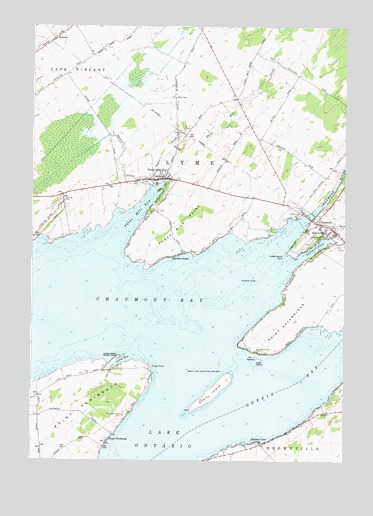
Chaumont, NY USGS Topographic Map
Click on map above to begin viewing in our Map Viewer.

This topographic map contains these locations and features:
Feature Name Type Latitude Longitude GNIS ID View Map
Adams CovePopulated PlaceN44.0064°W76.1585°942165View Map
All Saints ChurchChurchN44.0656°W76.1313°2615516View Map
Barnes Bay CemeteryCemeteryN44.0703°W76.1441°943034View Map
Bay Breeze Golf LinksLocaleN44.0815°W76.1434°2615341View Map
Bourey MarinaLocaleN44.0678°W76.2222°973907View Map
ChaumontPopulated PlaceN44.0670°W76.1302°969990View Map
Chaumont BayBayN44.0372°W76.2071°946456View Map
Chaumont Bay Airport (historical)AirportN44.0417°W76.1283°977955View Map
Chaumont Harbor LightLocaleN44.0587°W76.1458°973909View Map
Chaumont Post OfficePost OfficeN44.0672°W76.1298°2617861View Map
Chaumont RiverStreamN44.0642°W76.1488°946457View Map
Chaumont Volunteer Fire DepartmentBuildingN44.0727°W76.1443°2718533View Map
Cherry IslandIslandN44.0192°W76.1777°946520View Map
Clines PointCapeN44.0267°W76.2016°946883View Map
Crab IslandIslandN44.0289°W76.1585°947622View Map
Cresent MarinaLocaleN44.0637°W76.1355°973905View Map
Cresent Yacht ClubLocaleN44.0631°W76.1355°973910View Map
Croyle IslandIslandN44.0301°W76.1608°950788View Map
Duck BayBayN44.0626°W76.1733°971994View Map
Fir IslandIslandN44.0298°W76.1605°973609View Map
Four Corners School (historical)SchoolN44.0153°W76.2464°2097021View Map
Guffin BayBayN44.0263°W76.1385°951890View Map
Hamilton MarinaLocaleN44.0712°W76.1416°973906View Map
Harder CemeteryCemeteryN44.0946°W76.1907°952200View Map
Harris CemeteryCemeteryN44.1154°W76.1537°952261View Map
Herrick GrovePopulated PlaceN44.0581°W76.1902°952635View Map
Herrick ShoalBarN44.0417°W76.1983°971993View Map
Hickory PointCapeN44.0551°W76.2055°971992View Map
Horse CreekStreamN44.0645°W76.1305°953225View Map
Independence PointCapeN44.0598°W76.1483°953619View Map
Johnson ShoalBarN44.0531°W76.1616°954134View Map
Kittos MarinaLocaleN44.0042°W76.1705°973916View Map
Long BayBayN44.0295°W76.2127°955830View Map
Long Point State ParkParkN44.0301°W76.2149°955899View Map
Lyme Central SchoolSchoolN44.0663°W76.1342°2669060View Map
Lyme Free LibraryBuildingN44.0660°W76.1279°2617338View Map
Middle ShoalBarN44.0501°W76.1880°971991View Map
Point PeninsulaCapeN44.0195°W76.2174°960831View Map
Point PeninsulaPopulated PlaceN44.0059°W76.2191°960832View Map
Point Peninsula CemeteryCemeteryN44.0131°W76.2134°960833View Map
Point SalubriousCapeN44.0384°W76.1505°960840View Map
Point Salubrious CemeteryCemeteryN44.0317°W76.1602°960841View Map
Putman CemeteryCemeteryN44.0746°W76.2371°962000View Map
Putman School (historical)SchoolN44.0761°W76.2381°2097022View Map
RosierePopulated PlaceN44.1214°W76.2416°962928View Map
Salubrious Point Airport (historical)AirportN44.0414°W76.1467°2443105View Map
Sawmill BayBayN44.0609°W76.1369°964524View Map
School Number 8 (historical)SchoolN44.0967°W76.1636°2097023View Map
Shaver CreekStreamN44.0806°W76.2077°964959View Map
Soper CreekStreamN44.0803°W76.2044°965643View Map
Squaw IslandIslandN44.0564°W76.2108°971990View Map
Stumble Inn MarinaLocaleN44.0053°W76.1563°973911View Map
The Last ResortLocaleN44.0359°W76.1444°973912View Map
Three Mile BayBayN44.0709°W76.2066°967454View Map
Three Mile BayPopulated PlaceN44.0814°W76.1983°967455View Map
Three Mile Bay Census Designated PlaceCensusN44.0829°W76.1983°2584295View Map
Three Mile Bay Fire CompanyBuildingN44.0812°W76.2006°2718395View Map
Three Mile Bay Post OfficePost OfficeN44.0813°W76.1984°2618155View Map
Three Mile CreekStreamN44.0812°W76.1955°967456View Map
Three Mile PointCapeN44.0656°W76.1938°967457View Map
Town of LymeCivilN44.0365°W76.2123°979173View Map
Victory Community ChurchChurchN44.0669°W76.1329°2617158View Map
Village of ChaumontCivilN44.0675°W76.1301°2391600View Map
Wells CemeteryCemeteryN44.1046°W76.1929°969043View Map
Wells School (historical)SchoolN44.1022°W76.1933°2097024View Map

Note: Coordinates in the location and feature list above are referenced to NAD83 datum.


Copyright (C) 2008-2024 Ryan Niemi / Sunset Dynamics ... All Rights Reserved