TopoQuest Logo
Do you find TopoQuest useful?
Help keep TopoQuest running and adding new maps/features by donating!
Bitcoin:  19c7KJd3qBynnjoSw5npx9KScwjBe4ifkT
Litecoin:  LXs6TkuXGGXo1vDsWCkWVdjQX94eUKd6ui
Home View Maps Find Maps Find Places Resources & Links


Charity, Missouri Topographic Map

USGS Map Title: Charity, MO
USGS Map MRC: 37093E1
DRG (GeoTIFF) Download: o37093e1.tif


Neighboring USGS Topographic Map Quads:


  Buffalo NW, MO  
37093F2
 

  Buffalo, MO  
37093F1
 

  Windyville, MO  
37092F8
 

  Halfway, MO  
37093E2
 

  Charity, MO  
37093E1
 

  Long Lane, MO  
37092E8
 

  Fair Grove, MO  
37093D2
 

  Elkland, MO  
37093D1
 

  Beach, MO  
37092D8


Map MRC Location:

N38°
W94°
N38°
W93°
H8 H7 H6 H5 H4 H3 H2 H1
G8 G7 G6 G5 G4 G3 G2 G1
F8 F7 F6 F5 F4 F3 F2 F1
E8 E7 E6 E5 E4 E3 E2 E1
D8 D7 D6 D5 D4 D3 D2 D1
C8 C7 C6 C5 C4 C3 C2 C1
B8 B7 B6 B5 B4 B3 B2 B1
A8 A7 A6 A5 A4 A3 A2 A1
N37°
W94°
N37°
W93°

Charity, MO USGS 1:24K Topographic Map Preview:
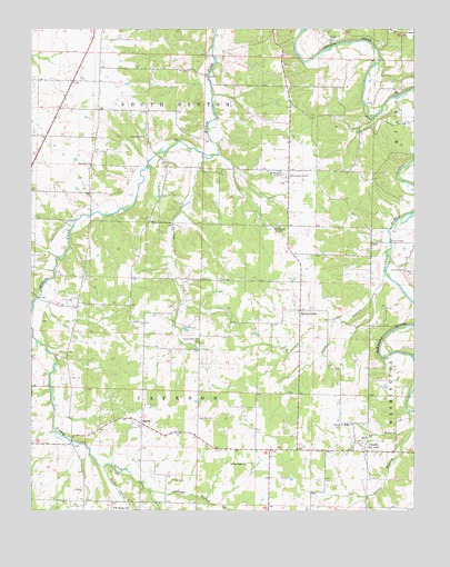
Charity, MO USGS Topographic Map
Click on map above to begin viewing in our Map Viewer.

This topographic map contains these locations and features:
Feature Name Type Latitude Longitude GNIS ID View Map
Bannon CemeteryCemeteryN37.5573°W93.0405°713624View Map
BoydPopulated PlaceN37.5020°W93.0758°755619View Map
Buffalo BranchStreamN37.5534°W93.1246°737896View Map
Buffalo Rural Fire Department Station 2BuildingN37.5160°W93.0370°2621657View Map
Cabbage BranchStreamN37.5000°W93.0599°715170View Map
Center Point ChurchChurchN37.5445°W93.0707°715649View Map
CharityPopulated PlaceN37.5153°W93.0163°715738View Map
Charity Christian Church CemeteryCemeteryN37.5161°W93.0201°2681490View Map
Charity SchoolSchoolN37.5223°W93.0227°715740View Map
Davidson CemeteryCemeteryN37.5239°W93.0707°716692View Map
Flint Ridge School (historical)SchoolN37.5503°W93.0935°735005View Map
Fraker CemeteryCemeteryN37.5661°W93.1246°718155View Map
Gower BranchStreamN37.5259°W93.0018°718639View Map
Hankens BranchStreamN37.5439°W93.1232°737905View Map
Hico (historical)Populated PlaceN37.5695°W93.0052°735007View Map
Hico BridgeBridgeN37.5703°W93.0077°755209View Map
Hog Eye BranchStreamN37.5223°W93.0005°719678View Map
Jones BranchStreamN37.5614°W93.0096°720398View Map
Lauries Landing Airport (historical)AirportN37.5187°W93.0930°758607View Map
Macedonia CemeteryCemeteryN37.5896°W93.1049°2652268View Map
Macedonia ChurchChurchN37.5900°W93.1057°721719View Map
Macedonia ChurchChurchN37.5970°W93.0885°721720View Map
Macedonia School (historical)SchoolN37.5978°W93.0877°735004View Map
MarchPopulated PlaceN37.5225°W93.0894°721861View Map
March School (historical)SchoolN37.5242°W93.0921°735008View Map
McGee ChapelChurchN37.5123°W93.0557°722107View Map
Mount Harmon SchoolSchoolN37.5006°W93.0982°722758View Map
Mount Pleasant Church Number 1ChurchN37.5881°W93.0441°755330View Map
Mount Pleasant Church Number 2ChurchN37.5734°W93.0441°755331View Map
Olive Leaf School (historical)SchoolN37.5842°W93.0416°735006View Map
Opossum CreekStreamN37.5920°W93.0663°723832View Map
Powell CemeteryCemeteryN37.5078°W93.0796°724810View Map
Powell CemeteryCemeteryN37.6217°W93.0274°724811View Map
Spring GrovePopulated PlaceN37.5520°W93.0377°741279View Map
Staten CreekStreamN37.5112°W93.1013°727041View Map
Township of JacksonCivilN37.5315°W93.0973°766566View Map
Township of South BentonCivilN37.6061°W93.0962°766573View Map
Wollard CemeteryCemeteryN37.5625°W93.0032°729083View Map

Note: Coordinates in the location and feature list above are referenced to NAD83 datum.


Copyright (C) 2008-2024 Ryan Niemi / Sunset Dynamics ... All Rights Reserved