TopoQuest Logo
Do you find TopoQuest useful?
Help keep TopoQuest running and adding new maps/features by donating!
Bitcoin:  19c7KJd3qBynnjoSw5npx9KScwjBe4ifkT
Litecoin:  LXs6TkuXGGXo1vDsWCkWVdjQX94eUKd6ui
Home View Maps Find Maps Find Places Resources & Links


Copemish, Michigan Topographic Map

USGS Map Title: Copemish, MI
USGS Map MRC: 44085D8
DRG (GeoTIFF) Download: o44085d8.tif


Neighboring USGS Topographic Map Quads:


  Copemish, MI  
44085D8
 

  Harlan, MI  
44085D7


  Marilla, MI  
44085C8
 

  Yuma, MI  
44085C7


Map MRC Location:

N45°
W86°
N45°
W85°
H8 H7 H6 H5 H4 H3 H2 H1
G8 G7 G6 G5 G4 G3 G2 G1
F8 F7 F6 F5 F4 F3 F2 F1
E8 E7 E6 E5 E4 E3 E2 E1
D8 D7 D6 D5 D4 D3 D2 D1
C8 C7 C6 C5 C4 C3 C2 C1
B8 B7 B6 B5 B4 B3 B2 B1
A8 A7 A6 A5 A4 A3 A2 A1
N44°
W86°
N44°
W85°

Copemish, MI USGS 1:24K Topographic Map Preview:
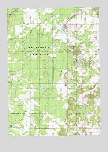
Copemish, MI USGS Topographic Map
Click on map above to begin viewing in our Map Viewer.

This topographic map contains these locations and features:
Feature Name Type Latitude Longitude GNIS ID View Map
Ball PondLakeN44.4569°W85.8758°1619079View Map
Betsie Valley Elementary SchoolSchoolN44.4932°W85.9400°1951783View Map
Cleon Township CemeteryCemeteryN44.4830°W85.8769°2500384View Map
Cleon Township HallBuildingN44.4794°W85.9250°2500344View Map
CopemishPopulated PlaceN44.4817°W85.9226°623800View Map
Copemish - Cleon Township Fire DepartmentBuildingN44.4784°W85.9263°2500345View Map
Copemish Post OfficePost OfficeN44.4819°W85.9239°2500342View Map
Copemish Station (historical)LocaleN44.4811°W85.9250°2500341View Map
Dutchman CreekStreamN44.4581°W85.9795°625035View Map
First CreekStreamN44.4681°W85.9401°626005View Map
Healy Lake CampgroundLocaleN44.4375°W85.9972°2499288View Map
Henry Post Office (historical)Post OfficeN44.4847°W85.9733°2499599View Map
Henry Station (historical)LocaleN44.4847°W85.9733°2499302View Map
Horaks Airport (historical)AirportN44.3875°W85.9501°1623992View Map
Lake SalmaLakeN44.3853°W85.9935°637126View Map
Lemon LakeLakeN44.4213°W85.9536°630304View Map
Lemon Lake Post Office (historical)Post OfficeN44.4264°W85.9389°2499330View Map
Lemon Lake Station (historical)LocaleN44.4264°W85.9389°2499298View Map
Lewis Memorial Kids ParkParkN44.4828°W85.9258°2500117View Map
Marilla CemeteryCemeteryN44.4033°W85.8990°631554View Map
Marilla ChurchChurchN44.3964°W85.8795°631555View Map
Pearl ParkParkN44.4825°W85.9211°2500347View Map
PomonaPopulated PlaceN44.4708°W85.8798°635216View Map
Pomona Bible ChurchChurchN44.4711°W85.8778°2500343View Map
Pomona Post Office (historical)Post OfficeN44.4708°W85.8797°2499322View Map
Pomona Station (historical)LocaleN44.4725°W85.8797°2499295View Map
Saint Raphael ChurchChurchN44.4842°W85.9303°2500346View Map
Second CreekStreamN44.4681°W85.9401°637517View Map
Third CreekStreamN44.4622°W85.9556°1614728View Map
Township of CleonCivilN44.4693°W85.8786°1626096View Map
Township of MarillaCivilN44.3820°W85.8803°1626686View Map
Township of SpringdaleCivilN44.4707°W85.9995°1627107View Map
Village of CopemishCivilN44.4804°W85.9242°2398624View Map

Note: Coordinates in the location and feature list above are referenced to NAD83 datum.


Copyright (C) 2008-2025 Ryan Niemi / Sunset Dynamics ... All Rights Reserved