TopoQuest Logo
Do you find TopoQuest useful?
Help keep TopoQuest running and adding new maps/features by donating!
Bitcoin:  19c7KJd3qBynnjoSw5npx9KScwjBe4ifkT
Litecoin:  LXs6TkuXGGXo1vDsWCkWVdjQX94eUKd6ui
Home View Maps Find Maps Find Places Resources & Links


Coralina Ranch, Texas Topographic Map

USGS Map Title: Coralina Ranch, TX
USGS Map MRC: 30100G2
DRG (GeoTIFF) Download: o30100g2.tif


Neighboring USGS Topographic Map Quads:


  Adams, TX  
30100H3
 

  Fort McKavett NW, TX  
30100H2
 

  Fort McKavett NE, TX  
30100H1
 

  Adams SE, TX  
30100G3
 

  Coralina Ranch, TX  
30100G2
 

  Fort McKavett, TX  
30100G1
 

  Buffalo Well, TX  
30100F3
 

  Coal Kiln Draw, TX  
30100F2
 

  McKegan Draw NE, TX  
30100F1


Map MRC Location:

N31°
W101°
N31°
W100°
H8 H7 H6 H5 H4 H3 H2 H1
G8 G7 G6 G5 G4 G3 G2 G1
F8 F7 F6 F5 F4 F3 F2 F1
E8 E7 E6 E5 E4 E3 E2 E1
D8 D7 D6 D5 D4 D3 D2 D1
C8 C7 C6 C5 C4 C3 C2 C1
B8 B7 B6 B5 B4 B3 B2 B1
A8 A7 A6 A5 A4 A3 A2 A1
N30°
W101°
N30°
W100°

Coralina Ranch, TX USGS 1:24K Topographic Map Preview:
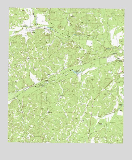
Coralina Ranch, TX USGS Topographic Map
Click on map above to begin viewing in our Map Viewer.

This topographic map contains these locations and features:
Feature Name Type Latitude Longitude GNIS ID View Map
Berrenda DrawValleyN30.7996°W100.2317°1351915View Map
Black Family CemeteryCemeteryN30.8269°W100.1304°1352301View Map
Black WaterholeLakeN30.8074°W100.2001°1352358View Map
Camilla LakeLakeN30.8333°W100.1363°1353602View Map
Colston DrawValleyN30.7822°W100.1302°1354817View Map
Coralina RanchLocaleN30.8141°W100.1751°1354982View Map
Crescent LakeLakeN30.8152°W100.1768°1355347View Map
Derrick RanchLocaleN30.8521°W100.2254°1355934View Map
East Poor HollowValleyN30.8691°W100.2244°1356680View Map
Fourmile WaterholeLakeN30.7858°W100.1269°1357649View Map
Hope PondLakeN30.8029°W100.2128°1359538View Map
Kirkland WaterholeLakeN30.7673°W100.1495°1360701View Map
Limekiln WaterholeLakeN30.8384°W100.1440°1361207View Map
Middle ValleyValleyN30.8327°W100.1251°1362765View Map
Penn Tillery Gas FieldOilfieldN30.8521°W100.1726°1365038View Map
Poor HollowValleyN30.8598°W100.2206°1365582View Map
Powell RanchLocaleN30.8541°W100.2076°1365705View Map
Quemado RanchLocaleN30.7782°W100.2073°1365899View Map
Sevenmile WaterholeLakeN30.8063°W100.2088°1367990View Map
Sixmile WaterholeLakeN30.8563°W100.2060°1368375View Map
Susch RanchLocaleN30.7918°W100.1929°1369436View Map
Willow WaterholeLakeN30.7611°W100.1565°1371691View Map

Note: Coordinates in the location and feature list above are referenced to NAD83 datum.


Copyright (C) 2008-2024 Ryan Niemi / Sunset Dynamics ... All Rights Reserved