TopoQuest Logo
Do you find TopoQuest useful?
Help keep TopoQuest running and adding new maps/features by donating!
Bitcoin:  19c7KJd3qBynnjoSw5npx9KScwjBe4ifkT
Litecoin:  LXs6TkuXGGXo1vDsWCkWVdjQX94eUKd6ui
Home View Maps Find Maps Find Places Resources & Links


Cornishville, Kentucky Topographic Map

USGS Map Title: Cornishville, KY
USGS Map MRC: 37084G8
DRG (GeoTIFF) Download: o37084g8.tif


Neighboring USGS Topographic Map Quads:


  Ashbrook, KY  
37085H1
 

  McBrayer, KY  
37084H8
 

  Salvisa, KY  
37084H7
 

  Cardwell, KY  
37085G1
 

  Cornishville, KY  
37084G8
 

  Harrodsburg, KY  
37084G7
 

  Mackville, KY  
37085F1
 

  Perryville, KY  
37084F8
 

  Danville, KY  
37084F7


Map MRC Location:

N38°
W85°
N38°
W84°
H8 H7 H6 H5 H4 H3 H2 H1
G8 G7 G6 G5 G4 G3 G2 G1
F8 F7 F6 F5 F4 F3 F2 F1
E8 E7 E6 E5 E4 E3 E2 E1
D8 D7 D6 D5 D4 D3 D2 D1
C8 C7 C6 C5 C4 C3 C2 C1
B8 B7 B6 B5 B4 B3 B2 B1
A8 A7 A6 A5 A4 A3 A2 A1
N37°
W85°
N37°
W84°

Cornishville, KY USGS 1:24K Topographic Map Preview:
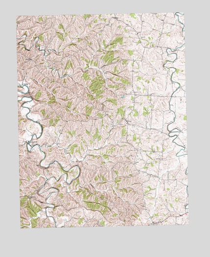
Cornishville, KY USGS Topographic Map
Click on map above to begin viewing in our Map Viewer.

This topographic map contains these locations and features:
Feature Name Type Latitude Longitude GNIS ID View Map
Barney V Brewer Mill (historical)LocaleN37.7764°W84.9810°2566005View Map
Berea CemeteryCemeteryN37.7501°W84.9005°486895View Map
Berea ChurchChurchN37.7504°W84.9011°486899View Map
BohonPopulated PlaceN37.8117°W84.9197°487624View Map
Bohon Post Office (historical)Post OfficeN37.8118°W84.9190°2566011View Map
BushtownPopulated PlaceN37.7681°W84.9927°507628View Map
Calvary ChurchChurchN37.7865°W84.9141°488639View Map
CornishvillePopulated PlaceN37.8003°W84.9936°490127View Map
Cornishville Fire DepartmentBuildingN37.7987°W84.9919°2637089View Map
Cornishville Post Office (historical)Post OfficeN37.7999°W84.9922°2566025View Map
Cornishville School (historical)SchoolN37.8009°W84.9927°2566026View Map
Counter Post Office (historical)Post OfficeN37.7794°W84.9020°2566027View Map
Deep CreekStreamN37.7592°W84.9808°490754View Map
DuncanPopulated PlaceN37.8492°W84.9902°491290View Map
Duncan Post Office (historical)Post OfficeN37.8496°W84.9901°2566036View Map
Grapevine (historical)Populated PlaceN37.8344°W84.9947°2566092View Map
Grapevine CemeteryCemeteryN37.8347°W84.9958°2566093View Map
Grapevine ChurchChurchN37.8342°W84.9958°493128View Map
Grapevine CreekStreamN37.8342°W84.9980°493130View Map
Harrodsburg DivisionCivilN37.7550°W84.9093°1937048View Map
Hayden CreekStreamN37.7959°W84.9836°493903View Map
Hopewell Baptist ChurchChurchN37.8603°W84.9087°494533View Map
Hopewell Church CemeteryCemeteryN37.8599°W84.9082°2566099View Map
Indian CreekStreamN37.8512°W84.9790°494930View Map
Johnsons CreekStreamN37.7769°W84.9654°495430View Map
Liberty (historical)Populated PlaceN37.7651°W84.9704°2566050View Map
Little Indian CreekStreamN37.8557°W84.9827°2566051View Map
MayoPopulated PlaceN37.8717°W84.9250°507313View Map
Mayo Church CemeteryCemeteryN37.8728°W84.9269°2566055View Map
Mayo Post Office (historical)Post OfficeN37.8718°W84.9258°2566056View Map
Mercer County Fire Protection District Station 3 Cornishville StorageBuildingN37.7989°W84.9917°2637400View Map
Mount Pleasant CemeteryCemeteryN37.7890°W84.8936°498826View Map
Oakland (historical)Populated PlaceN37.7608°W84.9074°2566068View Map
Oakland CemeteryCemeteryN37.7612°W84.9072°499735View Map
Oakland Methodist Church (historical)ChurchN37.7615°W84.9073°2566069View Map
Salem Church (historical)ChurchN37.8338°W84.9666°2566075View Map
Trace BranchStreamN37.7782°W84.9789°2566085View Map

Note: Coordinates in the location and feature list above are referenced to NAD83 datum.


Copyright (C) 2008-2024 Ryan Niemi / Sunset Dynamics ... All Rights Reserved