TopoQuest Logo
Do you find TopoQuest useful?
Help keep TopoQuest running and adding new maps/features by donating!
Bitcoin:  19c7KJd3qBynnjoSw5npx9KScwjBe4ifkT
Litecoin:  LXs6TkuXGGXo1vDsWCkWVdjQX94eUKd6ui
Home View Maps Find Maps Find Places Resources & Links


Cornucopia Ridge, Nevada Topographic Map

USGS Map Title: Cornucopia Ridge, NV
USGS Map MRC: 41116E3
DRG (GeoTIFF) Download: o41116e3.tif


Neighboring USGS Topographic Map Quads:


  Fourmile Butte, NV  
41116F4
 

  Wilson Reservoir, NV  
41116F3
 

  Bull Run Reservoir, NV  
41116F2
 

  I L Ranch, NV  
41116E4
 

  Cornucopia Ridge, NV  
41116E3
 

  Deep Creek, NV  
41116E2
 

  Red Cow Creek, NV  
41116D4
 

  Big Cottonwood Canyon, NV  
41116D3
 

  Cottonwood Peak, NV  
41116D2


Map MRC Location:

N42°
W117°
N42°
W116°
H8 H7 H6 H5 H4 H3 H2 H1
G8 G7 G6 G5 G4 G3 G2 G1
F8 F7 F6 F5 F4 F3 F2 F1
E8 E7 E6 E5 E4 E3 E2 E1
D8 D7 D6 D5 D4 D3 D2 D1
C8 C7 C6 C5 C4 C3 C2 C1
B8 B7 B6 B5 B4 B3 B2 B1
A8 A7 A6 A5 A4 A3 A2 A1
N41°
W117°
N41°
W116°

Cornucopia Ridge, NV USGS 1:24K Topographic Map Preview:
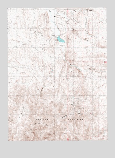
Cornucopia Ridge, NV USGS Topographic Map
Click on map above to begin viewing in our Map Viewer.

This topographic map contains these locations and features:
Feature Name Type Latitude Longitude GNIS ID View Map
Allen SpringSpringN41.5266°W116.2882°852024View Map
Cornucopia (historical)Populated PlaceN41.5349°W116.2923°852155View Map
Cornucopia MineMineN41.5335°W116.2937°839693View Map
Cornucopia Mining DistrictCivilN41.5341°W116.3182°855919View Map
Cornucopia Post Office (historical)Post OfficeN41.5349°W116.2923°864359View Map
Cornucopia RidgeRidgeN41.5230°W116.3026°839694View Map
Deep Creek DamDamN41.5899°W116.3109°863405View Map
Deep Creek ReservoirReservoirN41.5899°W116.3109°857957View Map
Granite CreekStreamN41.5924°W116.3112°840746View Map
Hussey MineMineN41.5335°W116.2937°855596View Map
Leopard MineMineN41.5332°W116.2926°852824View Map
Mill Town (historical)LocaleN41.5652°W116.2773°852196View Map
Panther MineMineN41.5332°W116.2926°852825View Map
Republic MineMineN41.5335°W116.2937°855597View Map
Silver PeakSummitN41.5252°W116.2854°843710View Map
South Leopard MineMineN41.5335°W116.2937°855595View Map
Sulphur CreekStreamN41.6191°W116.3095°844069View Map
Sulphur SpringSpringN41.5924°W116.3004°852154View Map
VN RanchLocaleN41.6177°W116.3151°845994View Map
Wild Horse BasinBasinN41.5285°W116.3582°844847View Map

Note: Coordinates in the location and feature list above are referenced to NAD83 datum.


Copyright (C) 2008-2024 Ryan Niemi / Sunset Dynamics ... All Rights Reserved