TopoQuest Logo
Do you find TopoQuest useful?
Help keep TopoQuest running and adding new maps/features by donating!
Bitcoin:  19c7KJd3qBynnjoSw5npx9KScwjBe4ifkT
Litecoin:  LXs6TkuXGGXo1vDsWCkWVdjQX94eUKd6ui
Home View Maps Find Maps Find Places Resources & Links


Corral Canyon, Washington Topographic Map

USGS Map Title: Corral Canyon, WA
USGS Map MRC: 46119C5
DRG (GeoTIFF) Download: o46119c5.tif


Neighboring USGS Topographic Map Quads:


  Snively Basin, WA  
46119D6
 

  Iowa Flats, WA  
46119D5
 

  Horn Rapids Dam, WA  
46119D4
 

  Snipes Creek, WA  
46119C6
 

  Corral Canyon, WA  
46119C5
 

  Benton City, WA  
46119C4
 

  Whitstran, WA  
46119B6
 

  Whitstran NE, WA  
46119B5
 

  Webber Canyon, WA  
46119B4


Map MRC Location:

N47°
W120°
N47°
W119°
H8 H7 H6 H5 H4 H3 H2 H1
G8 G7 G6 G5 G4 G3 G2 G1
F8 F7 F6 F5 F4 F3 F2 F1
E8 E7 E6 E5 E4 E3 E2 E1
D8 D7 D6 D5 D4 D3 D2 D1
C8 C7 C6 C5 C4 C3 C2 C1
B8 B7 B6 B5 B4 B3 B2 B1
A8 A7 A6 A5 A4 A3 A2 A1
N46°
W120°
N46°
W119°

Corral Canyon, WA USGS 1:24K Topographic Map Preview:
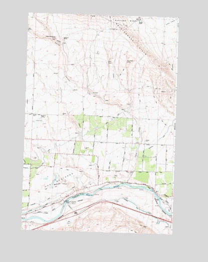
Corral Canyon, WA USGS Topographic Map
Click on map above to begin viewing in our Map Viewer.

This topographic map contains these locations and features:
Feature Name Type Latitude Longitude GNIS ID View Map
Badlands LakesLakeN46.2771°W119.5928°1503116View Map
Benton City DivisionCivilN46.3258°W119.5835°1939450View Map
Benton County Fire District 2 Station 220BuildingN46.2854°W119.5324°2643406View Map
ChaffeePopulated PlaceN46.2601°W119.6067°1510869View Map
ChandlerLocaleN46.2654°W119.5845°1534123View Map
Chandler Power and Pumping PlantLocaleN46.2671°W119.5897°1533092View Map
Corral CanyonValleyN46.3146°W119.5314°1504149View Map
Corral CreekStreamN46.2779°W119.5381°1504151View Map
Hodges RanchLocaleN46.3729°W119.5320°1505536View Map
Katie Fleck SpringSpringN46.3490°W119.5411°1505913View Map
Kiona CanalCanalN46.2782°W119.5303°1505995View Map
Lonesome SpringSpringN46.3609°W119.5951°1506273View Map
Mc Whorter Ranch AirportAirportN46.3151°W119.6109°1533902View Map
McWhorter RanchLocaleN46.3160°W119.6114°1506592View Map
Orcutt WellWellN46.3301°W119.5686°1510724View Map
Rattlesnake Slope State Wildlife Recreation AreaParkN46.3599°W119.5178°1513766View Map
The BadlandsLocaleN46.2790°W119.6000°1508961View Map
Virgil O McWhorter SpringSpringN46.3612°W119.6006°1509234View Map

Note: Coordinates in the location and feature list above are referenced to NAD83 datum.


Copyright (C) 2008-2025 Ryan Niemi / Sunset Dynamics ... All Rights Reserved