TopoQuest Logo
Do you find TopoQuest useful?
Help keep TopoQuest running and adding new maps/features by donating!
Bitcoin:  19c7KJd3qBynnjoSw5npx9KScwjBe4ifkT
Litecoin:  LXs6TkuXGGXo1vDsWCkWVdjQX94eUKd6ui
Home View Maps Find Maps Find Places Resources & Links


Cortez, Nevada Topographic Map

USGS Map Title: Cortez, NV
USGS Map MRC: 40116B5
DRG (GeoTIFF) Download: o40116b5.tif


Neighboring USGS Topographic Map Quads:


  Tenabo, NV  
40116C6
 

  East of Tenabo, NV  
40116C5
 

  Hand-me-down Creek, NV  
40116C4
 

  Cortez Canyon, NV  
40116B6
 

  Cortez, NV  
40116B5
 

  Buckhorn Mine, NV  
40116B4
 

  Wenban Spring, NV  
40116A6
 

  Dugout Spring, NV  
40116A5
 

  Rocky Hills, NV  
40116A4


Map MRC Location:

N41°
W117°
N41°
W116°
H8 H7 H6 H5 H4 H3 H2 H1
G8 G7 G6 G5 G4 G3 G2 G1
F8 F7 F6 F5 F4 F3 F2 F1
E8 E7 E6 E5 E4 E3 E2 E1
D8 D7 D6 D5 D4 D3 D2 D1
C8 C7 C6 C5 C4 C3 C2 C1
B8 B7 B6 B5 B4 B3 B2 B1
A8 A7 A6 A5 A4 A3 A2 A1
N40°
W117°
N40°
W116°

Cortez, NV USGS 1:24K Topographic Map Preview:
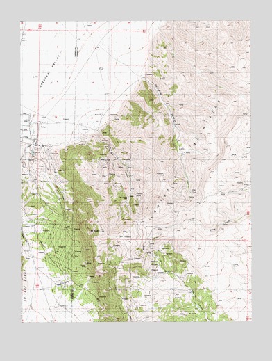
Cortez, NV USGS Topographic Map
Click on map above to begin viewing in our Map Viewer.

This topographic map contains these locations and features:
Feature Name Type Latitude Longitude GNIS ID View Map
Artic MineMineN40.1727°W116.6065°853650View Map
Benjamin Harrison MineMineN40.1858°W116.5734°853701View Map
Berlin MineMineN40.1971°W116.5762°853697View Map
Big Field Number OneFlatN40.1419°W116.5473°846550View Map
Big Field Number TwoFlatN40.1385°W116.5426°846552View Map
Buckhorn SpringSpringN40.1783°W116.5174°846629View Map
Bullion Hill MineMineN40.1796°W116.5720°853700View Map
Caledonia MineMineN40.2033°W116.5815°853703View Map
Cherry Tree SpringSpringN40.1772°W116.5633°846546View Map
CortezPopulated PlaceN40.1410°W116.6034°839715View Map
Cortez Gold MineMineN40.1930°W116.6145°853749View Map
Cortez MineMineN40.1499°W116.5929°839717View Map
Cortez Post Office (historical)Post OfficeN40.1410°W116.6034°864658View Map
Cortez-Mill Canyon Mining DistrictCivilN40.1727°W116.6065°858353View Map
Dean Spring Number OneSpringN40.1916°W116.5257°846630View Map
Dean Spring Number ThreeSpringN40.2069°W116.5423°846631View Map
Dean Spring Number TwoSpringN40.1765°W116.5347°846592View Map
Empire State MineMineN40.1896°W116.5790°853699View Map
Falconer MineMineN40.1919°W116.5798°853698View Map
Fitzgerald MineMineN40.1727°W116.6065°853651View Map
Fourmile CanyonValleyN40.2285°W116.5640°840543View Map
Goyeneche Spring Number FourSpringN40.1800°W116.5001°846633View Map
Goyeneche Spring Number SixSpringN40.1669°W116.5740°846553View Map
Lewis Canyon MinesMineN40.1894°W116.5729°853702View Map
Mill CanyonValleyN40.2052°W116.5873°842115View Map
Mill Canyon (historical)LocaleN40.2046°W116.5848°848205View Map
Mill Canyon MineMineN40.1791°W116.5748°842119View Map
Mill Canyon School (historical)SchoolN40.1927°W116.5734°858095View Map
Mill CreekStreamN40.2185°W116.5965°846528View Map
Mount TenaboSummitN40.1630°W116.5848°854643View Map
Mount Tenabo MineMineN40.1727°W116.6065°853653View Map
Mule Canyon SpringSpringN40.2415°W116.5052°846632View Map
New York MineMineN40.1983°W116.5787°853696View Map
Rimrock SpringSpringN40.1541°W116.5026°846549View Map
Rimrock SpringsSpringN40.1480°W116.5270°846551View Map
Rock HouseLocaleN40.1658°W116.5934°843281View Map
Saint Louis MineMineN40.1727°W116.6065°853652View Map
Sidehill Blue SpringSpringN40.1533°W116.5585°846554View Map
Tub SpringSpringN40.1640°W116.5517°846548View Map
West Fork Mill CreekStreamN40.1788°W116.5662°846542View Map
Willow SpringSpringN40.1671°W116.5323°846547View Map

Note: Coordinates in the location and feature list above are referenced to NAD83 datum.


Copyright (C) 2008-2024 Ryan Niemi / Sunset Dynamics ... All Rights Reserved