TopoQuest Logo
Do you find TopoQuest useful?
Help keep TopoQuest running and adding new maps/features by donating!
Bitcoin:  19c7KJd3qBynnjoSw5npx9KScwjBe4ifkT
Litecoin:  LXs6TkuXGGXo1vDsWCkWVdjQX94eUKd6ui
Home View Maps Find Maps Find Places Resources & Links


Angel Draw, New Mexico Topographic Map

USGS Map Title: Angel Draw, NM
USGS Map MRC: 32104E2
DRG (GeoTIFF) Download: o32104e2.tif


Neighboring USGS Topographic Map Quads:


  Lake McMillan North, NM  
32104F3
 

  Illinois Camp, NM  
32104F2
 

  Illinois Camp NE, NM  
32104F1
 

  Lake McMillan South, NM  
32104E3
 

  Angel Draw, NM  
32104E2
 

  Illinois Camp SE, NM  
32104E1
 

  Carlsbad West, NM  
32104D3
 

  Carlsbad East, NM  
32104D2
 

  Indian Flats, NM  
32104D1


Map MRC Location:

N33°
W105°
N33°
W104°
H8 H7 H6 H5 H4 H3 H2 H1
G8 G7 G6 G5 G4 G3 G2 G1
F8 F7 F6 F5 F4 F3 F2 F1
E8 E7 E6 E5 E4 E3 E2 E1
D8 D7 D6 D5 D4 D3 D2 D1
C8 C7 C6 C5 C4 C3 C2 C1
B8 B7 B6 B5 B4 B3 B2 B1
A8 A7 A6 A5 A4 A3 A2 A1
N32°
W105°
N32°
W104°

Angel Draw, NM USGS 1:24K Topographic Map Preview:
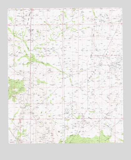
Angel Draw, NM USGS Topographic Map
Click on map above to begin viewing in our Map Viewer.

This topographic map contains these locations and features:
Feature Name Type Latitude Longitude GNIS ID View Map
00817 Water WellWellN32.5062°W104.2075°931998View Map
06434 Water WellWellN32.5979°W104.1452°931951View Map
06435 Water WellWellN32.5873°W104.1958°931950View Map
06436 Water WellWellN32.5868°W104.1952°931949View Map
06437 Water WellWellN32.5748°W104.1366°932002View Map
06438 Water WellWellN32.5798°W104.1494°932003View Map
06439 Water WellWellN32.5532°W104.1800°932000View Map
06440 Water WellWellN32.5532°W104.1800°932001View Map
06441 Water WellWellN32.5482°W104.1591°931999View Map
06442 Water WellWellN32.5296°W104.1833°931957View Map
06443 Water WellWellN32.5332°W104.1336°931958View Map
06703 Water WellWellN32.5062°W104.1394°931997View Map
06704 Water WellWellN32.5060°W104.1399°931996View Map
06705 Water WellWellN32.5082°W104.1780°931954View Map
06706 Water WellWellN32.5118°W104.1991°931955View Map
06707 Water WellWellN32.5032°W104.2108°931995View Map
06708 Water WellWellN32.5296°W104.1833°931956View Map
12178 Water WellWellN32.6235°W104.1780°931953View Map
12179 Water WellWellN32.6126°W104.1283°931952View Map
Alkali LakeLakeN32.5109°W104.1925°885684View Map
Angel DrawValleyN32.5623°W104.1858°885753View Map
Angel RanchLocaleN32.5868°W104.1966°885754View Map
Bates RanchLocaleN32.5471°W104.1602°886109View Map
Burton FlatFlatN32.5754°W104.1513°886970View Map
Indian HillSummitN32.6048°W104.2261°900935View Map
Murray RanchLocaleN32.5118°W104.1388°892351View Map
Murray West WellWellN32.5076°W104.1780°892355View Map
Saladar FlatFlatN32.5137°W104.1788°894300View Map
Scanlon DrawValleyN32.5243°W104.1491°894623View Map

Note: Coordinates in the location and feature list above are referenced to NAD83 datum.


Copyright (C) 2008-2024 Ryan Niemi / Sunset Dynamics ... All Rights Reserved