TopoQuest Logo
Do you find TopoQuest useful?
Help keep TopoQuest running and adding new maps/features by donating!
Bitcoin:  19c7KJd3qBynnjoSw5npx9KScwjBe4ifkT
Litecoin:  LXs6TkuXGGXo1vDsWCkWVdjQX94eUKd6ui
Home View Maps Find Maps Find Places Resources & Links


Cougar Reservoir, Oregon Topographic Map

USGS Map Title: Cougar Reservoir, OR
USGS Map MRC: 44122A2
DRG (GeoTIFF) Download: o44122a2.tif


Neighboring USGS Topographic Map Quads:


  Blue River, OR  
44122B3
 

  McKenzie Bridge, OR  
44122B2
 

  Belknap Springs, OR  
44122B1
 

  Harvey Mountain, OR  
44122A3
 

  Cougar Reservoir, OR  
44122A2
 

  French Mountain, OR  
44122A1
 

  Sardine Butte, OR  
43122H3
 

  Grasshopper Mountain, OR  
43122H2
 

  Chucksney Mountain, OR  
43122H1


Map MRC Location:

N45°
W123°
N45°
W122°
H8 H7 H6 H5 H4 H3 H2 H1
G8 G7 G6 G5 G4 G3 G2 G1
F8 F7 F6 F5 F4 F3 F2 F1
E8 E7 E6 E5 E4 E3 E2 E1
D8 D7 D6 D5 D4 D3 D2 D1
C8 C7 C6 C5 C4 C3 C2 C1
B8 B7 B6 B5 B4 B3 B2 B1
A8 A7 A6 A5 A4 A3 A2 A1
N44°
W123°
N44°
W122°

Cougar Reservoir, OR USGS 1:24K Topographic Map Preview:
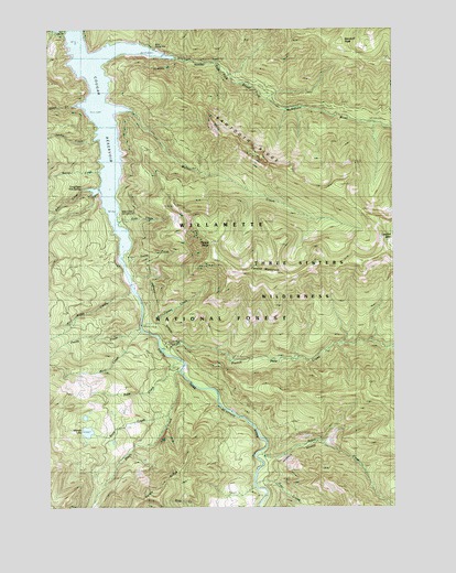
Cougar Reservoir, OR USGS Topographic Map
Click on map above to begin viewing in our Map Viewer.

This topographic map contains these locations and features:
Feature Name Type Latitude Longitude GNIS ID View Map
Annie CreekStreamN44.0962°W122.2345°1158676View Map
Balm CreekStreamN44.0343°W122.2056°1117215View Map
Basalt CreekStreamN44.1054°W122.2359°1130681View Map
Boone CreekStreamN44.0873°W122.2289°1138436View Map
Buoy CreekStreamN44.0218°W122.2092°1118319View Map
Cougar CossingLocaleN44.0589°W122.2210°2668332View Map
Cougar Crossing Recreation SiteLocaleN44.0573°W122.2195°1926264View Map
Cougar ReservoirReservoirN44.1027°W122.2308°1158911View Map
East Fork South Fork McKenzie RiverStreamN44.1154°W122.2378°1120327View Map
East Fork/Echo Recreation SiteLocaleN44.1185°W122.2053°1133771View Map
Echo / East Fork Boat RampLocaleN44.1193°W122.2113°2668572View Map
French Pete CreekStreamN44.0412°W122.2075°1142473View Map
French Pete Recreation SiteLocaleN44.0415°W122.2087°1159209View Map
Hard Rock Recreation SiteLocaleN44.0373°W122.2034°1926268View Map
Hardy CreekStreamN44.0354°W122.2028°1143302View Map
Hardy RidgeRidgeN44.0023°W122.2153°1143303View Map
Hidden LakeLakeN44.0197°W122.2374°1121789View Map
Horn CreekStreamN44.0360°W122.2206°1130682View Map
Lowder MountainSummitN44.0715°W122.1255°1123545View Map
McKenzie River DivisionCivilN44.1004°W122.1935°1938049View Map
McLennan MountainSummitN44.1223°W122.1444°1161741View Map
Penny CreekStreamN44.0471°W122.2178°1125290View Map
Rebel CreekStreamN44.0121°W122.1737°1148264View Map
Red Diamond Recreation SiteLocaleN44.0146°W122.1737°1926273View Map
Rider CreekStreamN44.0835°W122.2306°1125994View Map
Ridge CreekStreamN44.0568°W122.2203°1125996View Map
Sawtooth RidgeRidgeN44.0937°W122.1781°1126623View Map
Slide CreekStreamN44.0726°W122.2234°1127076View Map
Slide Creek Boat RampLocaleN44.0768°W122.2261°2668374View Map
Slide Creek Recreation SiteLocaleN44.0748°W122.2248°1133772View Map
Smith CreekStreamN44.0662°W122.2245°1127109View Map
Sunnyside Recreation SiteLocaleN44.0587°W122.2206°1926276View Map
Terwilliger Hot SpringSpringN44.0835°W122.2392°1156955View Map
Terwilliger Hot Springs Recreation SiteLocaleN44.0837°W122.2331°1926278View Map
Tipsoo ButteSummitN44.0689°W122.1915°1128127View Map
Tipsoo CreekStreamN44.0479°W122.2173°1128128View Map
Tipsoo TrailTrailN44.0765°W122.1975°1128130View Map
Trail CreekStreamN44.0065°W122.1764°1156977View Map
Walker CreekStreamN44.1021°W122.2317°1128589View Map
Willamette National ForestForestN44.1094°W122.1835°1132117View Map
Yankee CreekStreamN44.0457°W122.2137°1130683View Map
Yankee MountainSummitN44.0612°W122.1750°1136928View Map

Note: Coordinates in the location and feature list above are referenced to NAD83 datum.


Copyright (C) 2008-2025 Ryan Niemi / Sunset Dynamics ... All Rights Reserved