TopoQuest Logo
Do you find TopoQuest useful?
Help keep TopoQuest running and adding new maps/features by donating!
Bitcoin:  19c7KJd3qBynnjoSw5npx9KScwjBe4ifkT
Litecoin:  LXs6TkuXGGXo1vDsWCkWVdjQX94eUKd6ui
Home View Maps Find Maps Find Places Resources & Links


Cowhorn Mountain, Oregon Topographic Map

USGS Map Title: Cowhorn Mountain, OR
USGS Map MRC: 43122D1
DRG (GeoTIFF) Download: o43122d1.tif


Neighboring USGS Topographic Map Quads:


  Diamond Peak, OR  
43122E2
 

  Willamette Pass, OR  
43122E1
 

  Odell Lake, OR  
43121E8
 

  Emigrant Butte, OR  
43122D2
 

  Cowhorn Mountain, OR  
43122D1
 

  Crescent Lake, OR  
43121D8
 

  Lemolo Lake, OR  
43122C2
 

  Tolo Mountain, OR  
43122C1
 

  Burn Butte, OR  
43121C8


Map MRC Location:

N44°
W123°
N44°
W122°
H8 H7 H6 H5 H4 H3 H2 H1
G8 G7 G6 G5 G4 G3 G2 G1
F8 F7 F6 F5 F4 F3 F2 F1
E8 E7 E6 E5 E4 E3 E2 E1
D8 D7 D6 D5 D4 D3 D2 D1
C8 C7 C6 C5 C4 C3 C2 C1
B8 B7 B6 B5 B4 B3 B2 B1
A8 A7 A6 A5 A4 A3 A2 A1
N43°
W123°
N43°
W122°

Cowhorn Mountain, OR USGS 1:24K Topographic Map Preview:
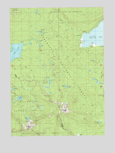
Cowhorn Mountain, OR USGS Topographic Map
Click on map above to begin viewing in our Map Viewer.

This topographic map contains these locations and features:
Feature Name Type Latitude Longitude GNIS ID View Map
Amos LakeLakeN43.4026°W122.0895°1155489View Map
Andy LakeLakeN43.4037°W122.0861°1137187View Map
Bingham LakesLakeN43.4266°W122.0107°1138135View Map
Bingham MeadowFlatN43.4229°W122.0067°1134047View Map
Contorta PointCapeN43.4651°W122.0150°1134049View Map
Contorta Point Recreation SiteLocaleN43.4623°W122.0095°1162324View Map
Cornett LakeLakeN43.4777°W122.0851°1158912View Map
Cowhorn CreekStreamN43.4615°W122.0286°1140296View Map
Cowhorn MountainSummitN43.3996°W122.0536°1140297View Map
Crater ButteSummitN43.4957°W122.1178°1140387View Map
Crescent Lake Recreation SiteLocaleN43.4596°W122.0295°1140437View Map
Darlene LakeLakeN43.4229°W122.0497°1154113View Map
Effie LakeLakeN43.4953°W122.0908°1134048View Map
Farrell LakeLakeN43.4752°W122.0822°1142026View Map
Greenwood PointCapeN43.4804°W122.0081°1154111View Map
Indigo LakeLakeN43.3923°W122.1037°1144089View Map
Indigo Lake Recreation SiteLocaleN43.3948°W122.1061°1155850View Map
Meek LakeLakeN43.4633°W122.0860°1146079View Map
Mountain CreekStreamN43.4985°W122.0639°1146538View Map
Nip and Tuck LakesLakeN43.3883°W122.0080°1146846View Map
Opal LakeLakeN43.4211°W122.1227°1147247View Map
Opal Lake Recreation SiteLocaleN43.4229°W122.1234°1154095View Map
Pinewan LakeLakeN43.4476°W122.0133°1147738View Map
Sawtooth MountainSummitN43.3840°W122.1016°1149100View Map
Snell LakeLakeN43.4764°W122.0870°1149796View Map
Spring Campground Boat RampLocaleN43.4632°W122.0162°2698974View Map
Spring Forest CampLocaleN43.4610°W122.0198°1150185View Map
Summit CreekStreamN43.4673°W122.0275°1150609View Map
Summit LakeLakeN43.4565°W122.1224°1150624View Map
Suzanne LakeLakeN43.4233°W122.0539°1154114View Map
Tandy BayBayN43.4630°W122.0282°1154110View Map
Tandy Bay Recreation SiteLocaleN43.4665°W122.0289°1156752View Map
Timpanogas LakeLakeN43.4120°W122.1138°1151258View Map
Timpanogas Recreation SiteLocaleN43.4096°W122.1142°1155849View Map
Tranquil CoveBayN43.4715°W122.0266°1154109View Map
Tranquil Cove Recreation SiteLocaleN43.4693°W122.0317°1158862View Map
Whitefish CreekStreamN43.4773°W122.0417°1152256View Map
Whitefish Horse CampLocaleN43.4721°W122.0317°1159319View Map
Windy Group CampLocaleN43.4610°W122.0317°1926228View Map
Windy LakesLakeN43.4271°W122.0751°1152512View Map
Windy Lakes TrailTrailN43.4429°W122.0520°1152513View Map
Windy Pass WayTrailN43.3904°W122.0867°1152515View Map

Note: Coordinates in the location and feature list above are referenced to NAD83 datum.


Copyright (C) 2008-2024 Ryan Niemi / Sunset Dynamics ... All Rights Reserved