TopoQuest Logo
Do you find TopoQuest useful?
Help keep TopoQuest running and adding new maps/features by donating!
Bitcoin:  19c7KJd3qBynnjoSw5npx9KScwjBe4ifkT
Litecoin:  LXs6TkuXGGXo1vDsWCkWVdjQX94eUKd6ui
Home View Maps Find Maps Find Places Resources & Links


Coyote Springs, Wyoming Topographic Map

USGS Map Title: Coyote Springs, WY
USGS Map MRC: 42107F6
DRG (GeoTIFF) Download: o42107f6.tif


Neighboring USGS Topographic Map Quads:


  Rongis Reservoir SE, WY  
42107G7
 

  Puddle Springs, WY  
42107G6
 

  Gas Hills, WY  
42107G5
 

  Muskrat Basin, WY  
42107F7
 

  Coyote Springs, WY  
42107F6
 

  McIntosh Meadows, WY  
42107F5
 

  Stampede Meadow, WY  
42107E7
 

  Black Rock Gap, WY  
42107E6
 

  Lankin Dome, WY  
42107E5


Map MRC Location:

N43°
W108°
N43°
W107°
H8 H7 H6 H5 H4 H3 H2 H1
G8 G7 G6 G5 G4 G3 G2 G1
F8 F7 F6 F5 F4 F3 F2 F1
E8 E7 E6 E5 E4 E3 E2 E1
D8 D7 D6 D5 D4 D3 D2 D1
C8 C7 C6 C5 C4 C3 C2 C1
B8 B7 B6 B5 B4 B3 B2 B1
A8 A7 A6 A5 A4 A3 A2 A1
N42°
W108°
N42°
W107°

Coyote Springs, WY USGS 1:24K Topographic Map Preview:
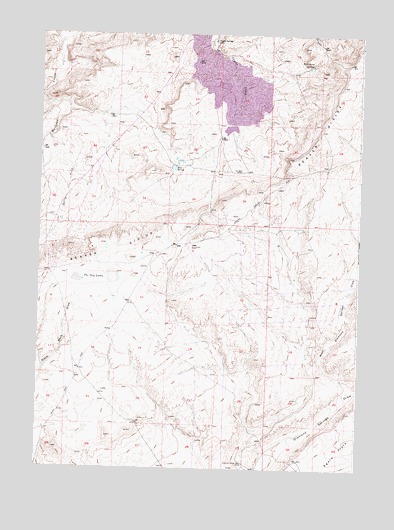
Coyote Springs, WY USGS Topographic Map
Click on map above to begin viewing in our Map Viewer.

This topographic map contains these locations and features:
Feature Name Type Latitude Longitude GNIS ID View Map
B. T. W. Number Eighteen MineMineN42.7169°W107.7101°1746593View Map
Bum Steer Number One MineMineN42.7325°W107.7301°1746594View Map
Clyde Bret MineMineN42.7369°W107.6776°1746603View Map
Clyde MineMineN42.7352°W107.7259°1746611View Map
Clyde MinesMineN42.7313°W107.6904°1746597View Map
Clyde Number Five MineMineN42.7313°W107.6901°1746596View Map
Clyde Number Three MineMineN42.7313°W107.6901°1746595View Map
Clyde, A, B, A-1, A2C MineMineN42.7314°W107.6700°1747095View Map
Coco Underground Number One MineMineN42.7313°W107.6904°1746601View Map
Coyote SpringsSpringN42.7480°W107.6829°1587166View Map
Day MineMineN42.7366°W107.6792°1746598View Map
Day Number Twenty-six MineMineN42.7275°W107.6673°1746599View Map
Day Ore Pad DamDamN42.7333°W107.6640°1607796View Map
Day Ore Pad ReservoirReservoirN42.7333°W107.6640°1607797View Map
Day South DamDamN42.7200°W107.6590°1607798View Map
Day South ReservoirReservoirN42.7200°W107.6590°1607799View Map
Diamond Springs WellWellN42.6269°W107.6695°1587598View Map
East DamDamN42.7233°W107.6640°1607800View Map
East ReservoirReservoirN42.7233°W107.6640°1607801View Map
Federal American Open PitMineN42.7392°W107.6753°1746610View Map
Keeno Number One MineMineN42.7458°W107.6695°1746600View Map
Loco Bret A2C, C-2 Number One MineMineN42.7314°W107.6894°1747096View Map
Loco C MineMineN42.7375°W107.6784°1746602View Map
Loco D MineMineN42.7394°W107.6895°1746604View Map
Loco M, L, K MineMineN42.7411°W107.6842°1747098View Map
Loco N-1, N-2 MineMineN42.7444°W107.6900°1747099View Map
Loma Mine GroupMineN42.7311°W107.6715°1746592View Map
Loma-Day ClaimsMineN42.7367°W107.6786°1746605View Map
Mud SpringsSpringN42.7111°W107.6984°1591857View Map
Nels Number Eight MineMineN42.7458°W107.6709°1746606View Map
Nels Number Twenty MineMineN42.7486°W107.6345°1746607View Map
Reno Number One MineMineN42.7458°W107.6709°1746608View Map
RMCC Number Eight MineMineN42.7458°W107.6909°1746609View Map
Spring CreekStreamN42.7183°W107.7459°1594835View Map
The Dry LakesLakeN42.6808°W107.7284°1595417View Map
West Diamond Springs DrawValleyN42.6477°W107.6287°1596170View Map
Wild Horse SpringsSpringN42.7416°W107.6442°1596379View Map

Note: Coordinates in the location and feature list above are referenced to NAD83 datum.


Copyright (C) 2008-2025 Ryan Niemi / Sunset Dynamics ... All Rights Reserved