TopoQuest Logo
Do you find TopoQuest useful?
Help keep TopoQuest running and adding new maps/features by donating!
Bitcoin:  19c7KJd3qBynnjoSw5npx9KScwjBe4ifkT
Litecoin:  LXs6TkuXGGXo1vDsWCkWVdjQX94eUKd6ui
Home View Maps Find Maps Find Places Resources & Links


Crab Spring Butte, Idaho Topographic Map

USGS Map Title: Crab Spring Butte, ID
USGS Map MRC: 42116E3
DRG (GeoTIFF) Download: o42116e3.tif


Neighboring USGS Topographic Map Quads:


  Clover Mountain, ID  
42116F4
 

  Snow Creek, ID  
42116F3
 

  O X Lake, ID  
42116F2
 

  Big Springs Ranch, ID  
42116E4
 

  Crab Spring Butte, ID  
42116E3
 

  Sugarloaf, ID  
42116E2
 

  Frying Pan Basin, ID  
42116D4
 

  Lost Valley, ID  
42116D3
 

  Turner Table, ID  
42116D2


Map MRC Location:

N43°
W117°
N43°
W116°
H8 H7 H6 H5 H4 H3 H2 H1
G8 G7 G6 G5 G4 G3 G2 G1
F8 F7 F6 F5 F4 F3 F2 F1
E8 E7 E6 E5 E4 E3 E2 E1
D8 D7 D6 D5 D4 D3 D2 D1
C8 C7 C6 C5 C4 C3 C2 C1
B8 B7 B6 B5 B4 B3 B2 B1
A8 A7 A6 A5 A4 A3 A2 A1
N42°
W117°
N42°
W116°

Crab Spring Butte, ID USGS 1:24K Topographic Map Preview:
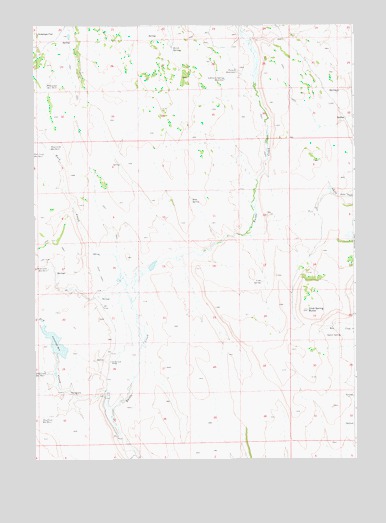
Crab Spring Butte, ID USGS Topographic Map
Click on map above to begin viewing in our Map Viewer.

This topographic map contains these locations and features:
Feature Name Type Latitude Longitude GNIS ID View Map
Battle Creek RanchLocaleN42.5288°W116.3459°371387View Map
Crab SpringSpringN42.5510°W116.2869°372230View Map
Crab Spring ButteSummitN42.5429°W116.2690°372231View Map
Dry CreekStreamN42.5152°W116.3454°372470View Map
Dry Creek ReservoirReservoirN42.5338°W116.3670°398833View Map
Dry Creek Reservoir Number EightReservoirN42.5896°W116.3687°397651View Map
Dry Creek Reservoir Number ThreeReservoirN42.5114°W116.3727°397646View Map
Dry Creek Reservoir Number TwoReservoirN42.5549°W116.3698°397645View Map
Hutch SpringsSpringN42.6185°W116.3209°373189View Map
Lahtinen Spring ReservoirReservoirN42.6095°W116.3005°373439View Map
Pole Creek Reservoir Number FiveReservoirN42.6077°W116.3700°398006View Map
Rock CreekStreamN42.5502°W116.3396°374717View Map
Rock SpringSpringN42.5742°W116.3141°374739View Map
Scrappy Creek DamDamN42.5310°W116.3662°398832View Map
Squaw SpringSpringN42.5355°W116.2557°375240View Map
Turner ReservoirReservoirN42.6118°W116.2958°375606View Map

Note: Coordinates in the location and feature list above are referenced to NAD83 datum.


Copyright (C) 2008-2025 Ryan Niemi / Sunset Dynamics ... All Rights Reserved