TopoQuest Logo
Do you find TopoQuest useful?
Help keep TopoQuest running and adding new maps/features by donating!
Bitcoin:  19c7KJd3qBynnjoSw5npx9KScwjBe4ifkT
Litecoin:  LXs6TkuXGGXo1vDsWCkWVdjQX94eUKd6ui
Home View Maps Find Maps Find Places Resources & Links


Craig, Nebraska Topographic Map

USGS Map Title: Craig, NE
USGS Map MRC: 41096G3
DRG (GeoTIFF) Download: o41096g3.tif


Neighboring USGS Topographic Map Quads:


  Lyons, NE  
41096H4
 

  Bertha, NE  
41096H3
 

  Tekamah NW, NE  
41096H2
 

  Oakland, NE  
41096G4
 

  Craig, NE  
41096G3
 

  Tekamah, NE  
41096G2
 

  Nickerson NW, NE  
41096F4
 

  Nickerson NE, NE  
41096F3
 

  Herman, NE  
41096F2


Map MRC Location:

N42°
W97°
N42°
W96°
H8 H7 H6 H5 H4 H3 H2 H1
G8 G7 G6 G5 G4 G3 G2 G1
F8 F7 F6 F5 F4 F3 F2 F1
E8 E7 E6 E5 E4 E3 E2 E1
D8 D7 D6 D5 D4 D3 D2 D1
C8 C7 C6 C5 C4 C3 C2 C1
B8 B7 B6 B5 B4 B3 B2 B1
A8 A7 A6 A5 A4 A3 A2 A1
N41°
W97°
N41°
W96°

Craig, NE USGS 1:24K Topographic Map Preview:
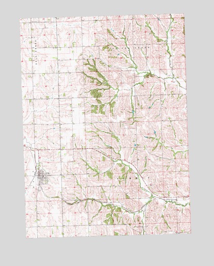
Craig, NE USGS Topographic Map
Click on map above to begin viewing in our Map Viewer.

This topographic map contains these locations and features:
Feature Name Type Latitude Longitude GNIS ID View Map
Agland Co-op ElevatorLocaleN41.7855°W96.3639°1893045View Map
Burt CountyCivilN41.8516°W96.3286°835832View Map
CraigPopulated PlaceN41.7855°W96.3639°828437View Map
Craig (historical)LocaleN41.7861°W96.3656°1893049View Map
Craig CemeteryCemeteryN41.7772°W96.3658°828438View Map
Craig Fire and Rescue AssociationBuildingN41.7829°W96.3637°1893044View Map
Craig Post OfficePost OfficeN41.7858°W96.3638°1893048View Map
Craig Public LibraryBuildingN41.7855°W96.3639°1893043View Map
Grace CemeteryCemeteryN41.8730°W96.3661°829603View Map
Methodist ChurchChurchN41.7855°W96.3639°1893047View Map
Presbyterian ChurchChurchN41.7855°W96.3639°1893046View Map
Silver Creek CemeteryCemeteryN41.8400°W96.2889°833446View Map
Summit LakeReservoirN41.7610°W96.2886°1893042View Map
Summit Lake TrailTrailN41.7597°W96.2920°1893040View Map
Summit Reservoir State Recreation AreaParkN41.7597°W96.2920°1893041View Map
Tekamah Creek Dam 6-1DamN41.7796°W96.3337°1769872View Map
Tekamah Creek Reservoir 6-1LakeN41.7806°W96.3348°1769873View Map
Tekamah-Mud Creek Dam 5-ADamN41.7662°W96.2844°1769996View Map
Tekamah-Mud Creek Reservoir 5-AReservoirN41.7650°W96.2853°1769997View Map
Township of Silver CreekCivilN41.8726°W96.2894°838253View Map
Township of SummitCivilN41.7561°W96.2898°838275View Map
Village of CraigCivilN41.7853°W96.3624°2398642View Map

Note: Coordinates in the location and feature list above are referenced to NAD83 datum.


Copyright (C) 2008-2025 Ryan Niemi / Sunset Dynamics ... All Rights Reserved